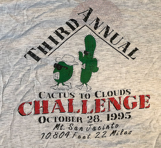
|
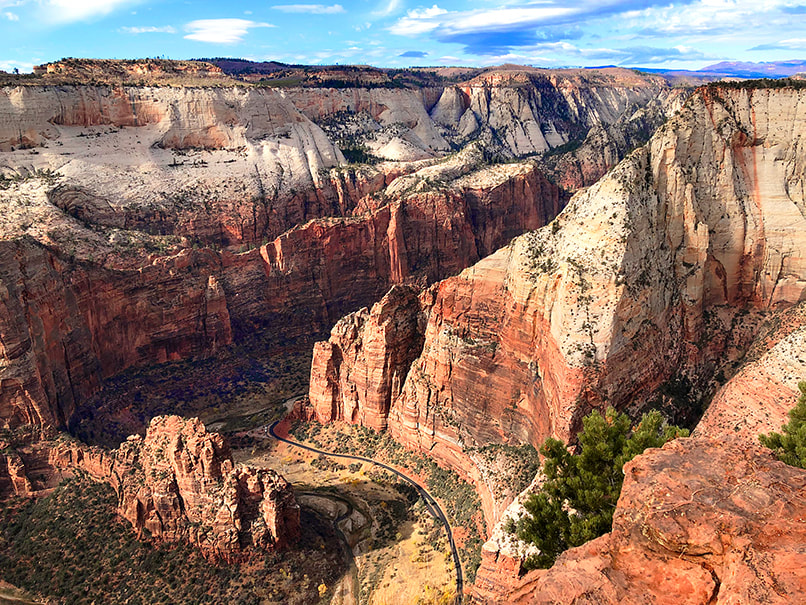
Getting creative with hikes in Southwestern Utah to prepare for the Grand Canyon. Grand Canyon North Rim to South Rim Hike Facts:
Standard route (North Kaibab Trail and Bright Angel Trail). Distances/Elevation gain/loss: North Kaibab Trail = 14 miles/5,600 feet loss. Bright Angel Trail = 9.4 miles/4,500 feet gain. Note: I've seen various estimates of "net elevation gain" that are higher. Since there is not any major regaining of lost elevation, I am estimating gain by difference between Colorado River and south rim. Elevations: north rim = 8,000 feet, south rim = 6,800', Colorado river = 2,400'. Geology: Oldest rocks are Vishnu Schist, an early Paleoproterozoic basement rock (2 billion years ago) at bottom of Grand Canyon. Youngest rock is the Kaibab Limestone on the top of the rim, a cream and white sandy limestone. Related Posts
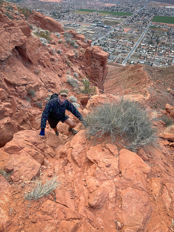
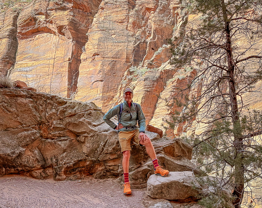
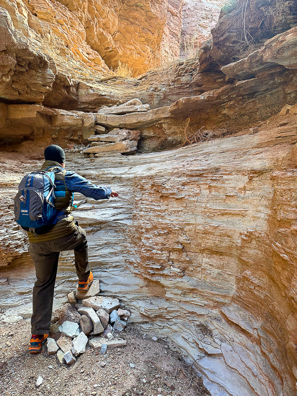
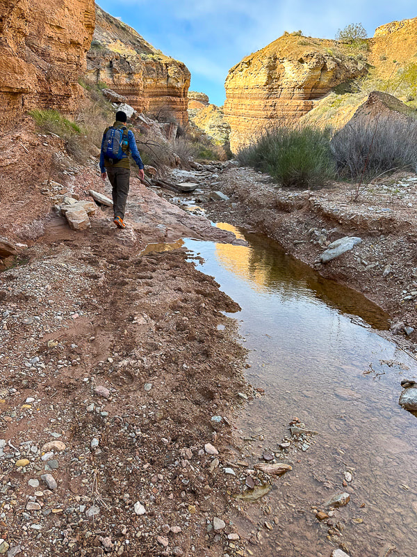
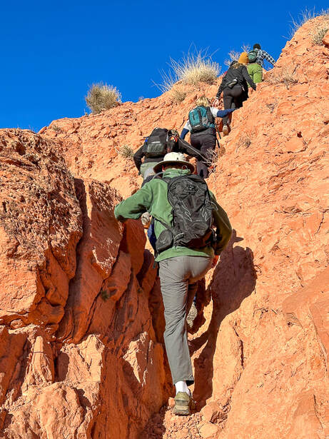
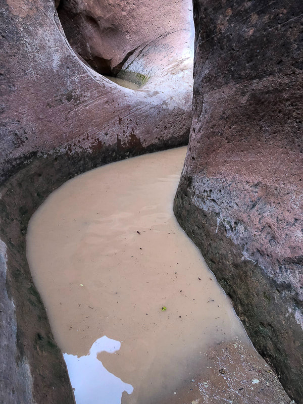
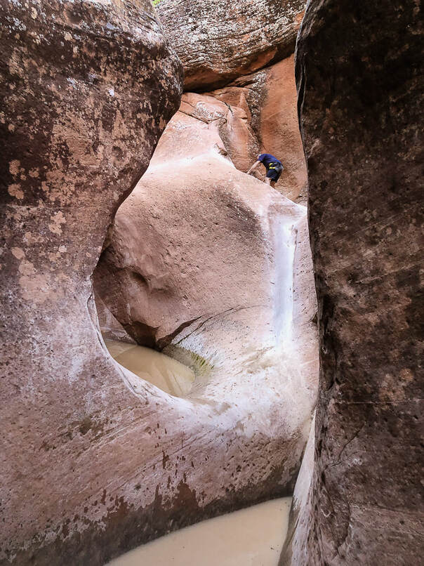
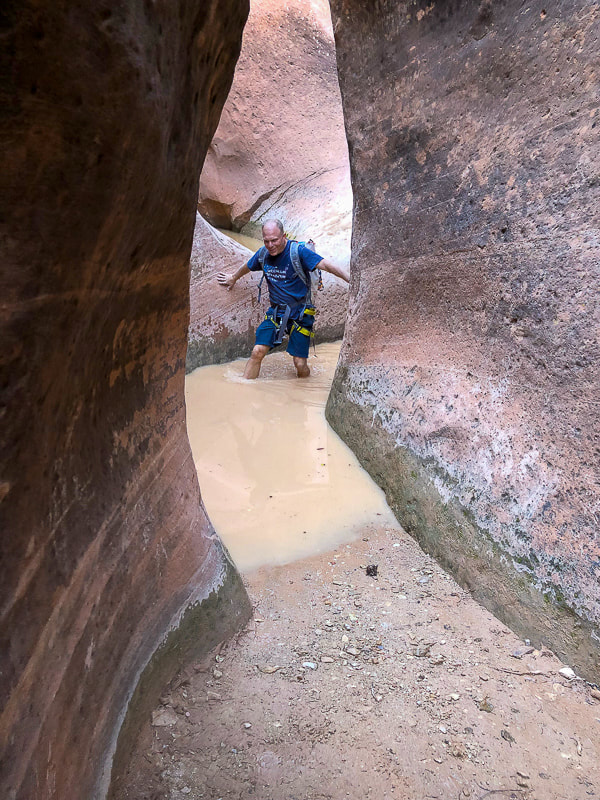
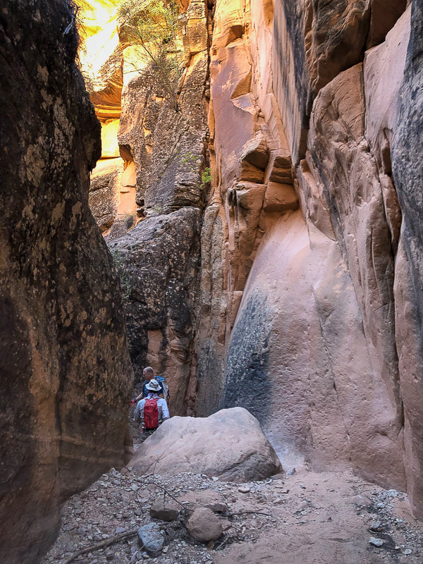
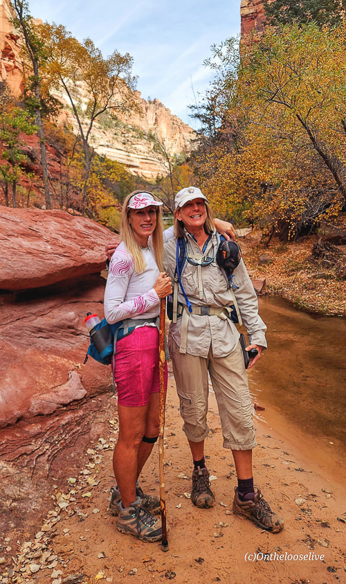
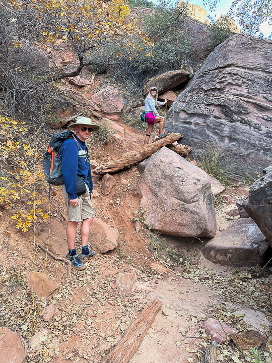
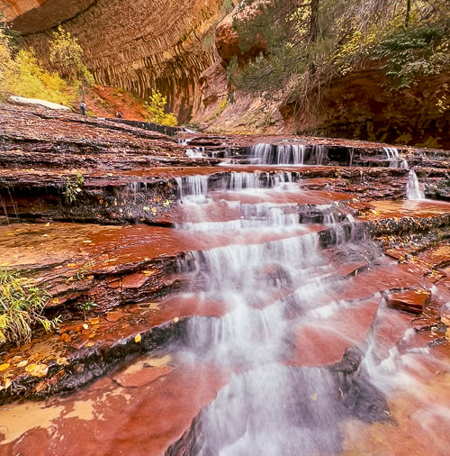
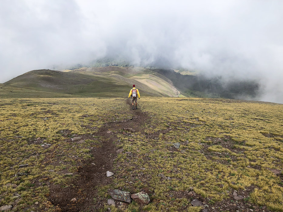
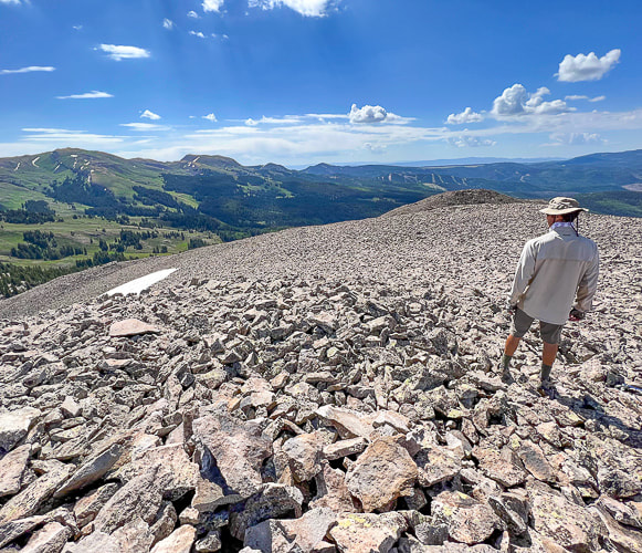
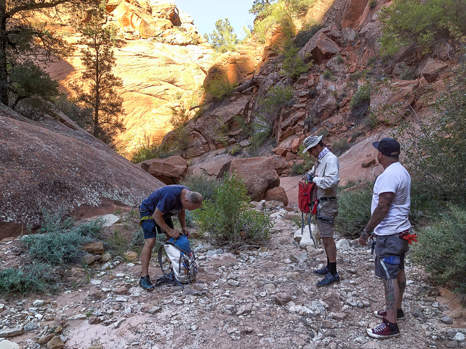
On May 23, we will be walking Grand Canyon from its north rim to its south rim in one day - again. Fred and I first hiked this 23 years ago, to celebrate birthday #40 for both of us. We hiked it on our 50th. We talked about doing it for our 60th, but it wasn't until our friend Robin asked us to go that we got our motivation to train for rim to rim #3. Jeff will do it too, and Lindy will train with us but when it comes to the big day, she has generously offered to drop us off at the north rim and drive all the way around to the south rim to pick us up. Since January, Fred, Jeff, Lindy, Robin and I have been hiking the most challenging trails near St. George, Utah and in Zion National park. Creative planning like linking trails together ensures optimal distance and elevation training. We need to be able to cover 23 miles and a 4,500' gain for rim to rim. Just when your legs are tired from descending 14 miles on North Kaibab Trail, you face the biggest challenge: climbing up Bright Angel Trail for another 9.4 miles. And temperatures on the climb out can be hot, which was the case when we did this hike 23 years ago. We ended up soaking our hats in streams on the way up to cool off. Fred drank 9 liters of water! The next day, we hiked back to the north rim. Some of Our Training Hikes
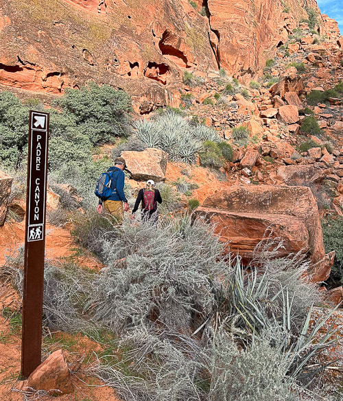
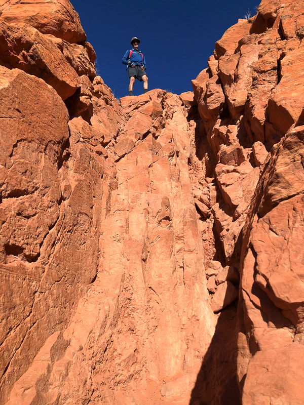
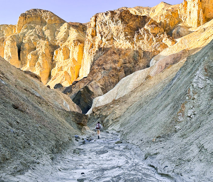
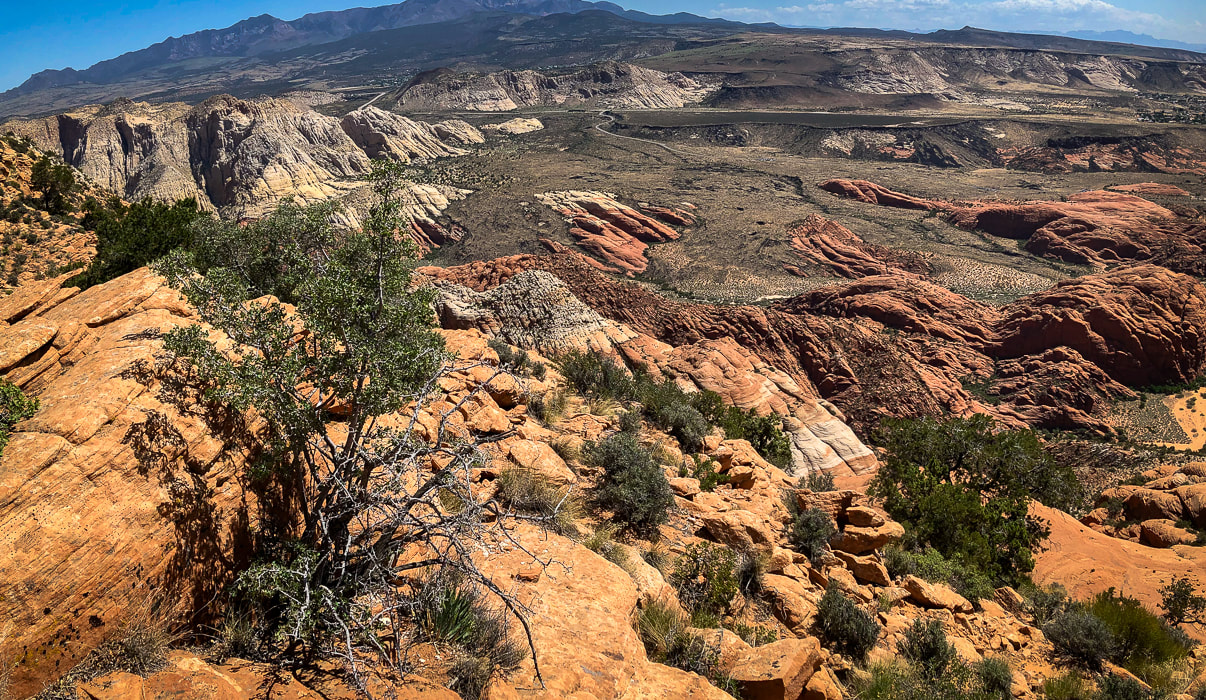
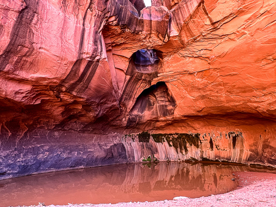
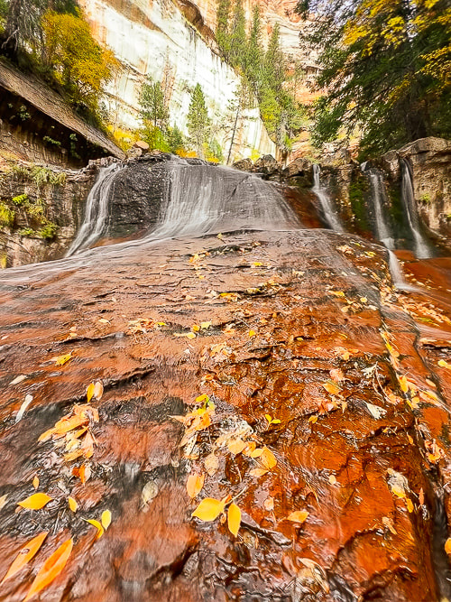
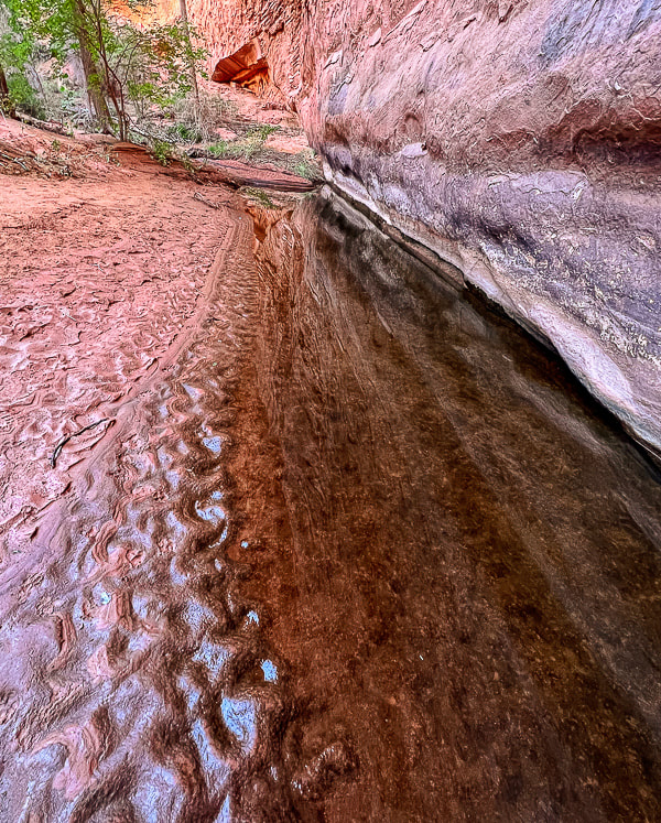
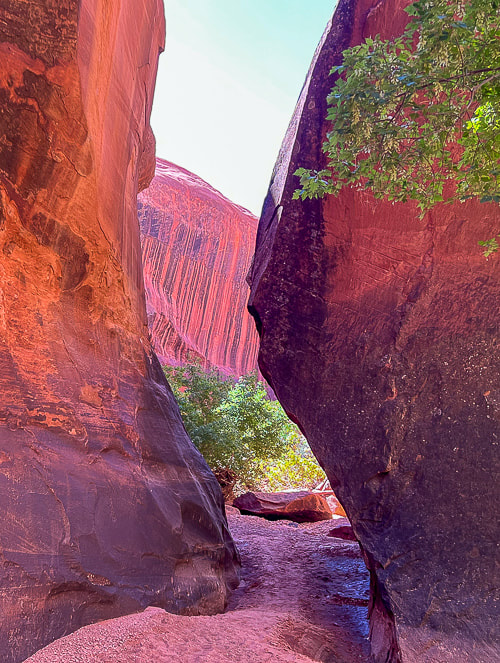
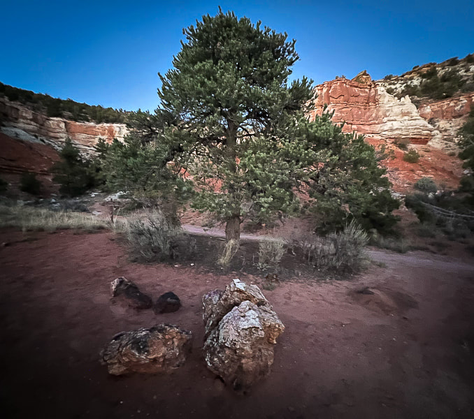
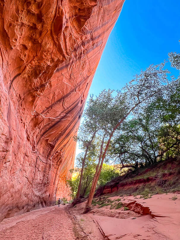
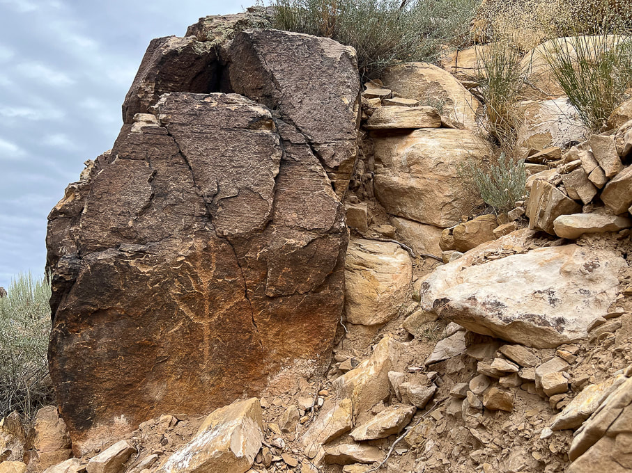
Strengthening for Hill Climbing - Walking Lunge with Overhead Weight Climbing out of the Grand Canyon requires strong glutes! The most important function of your gluteus medius during hiking is to stabilize your pelvis to keep it level while standing on one leg (stance phase of walking). The stronger they are, the better protection for your knees, and the more efficiently they work, the less energy you waste. Walking lunges challenge your glute and core strength. Holding a weight over your head adds more challenge to your core musculature including abdominals and back extensors, as well as your shoulder girdle stabilizers (rhomboids, trapezius, serratus). Good training for scrambling hikes where you have to use hands to propel up rocks. Action: Hold dumbell or kettlebell overhead with elbow straight, next to your ear. Or, you could hold the weight in a "goblet" position next to your chest. Take a large step forward, that knee should not go ahead of your foot. Opposite knee taps the ground. Squeeze glute on stance leg to raise to lunge with opposite leg. Here's some scenes from three of our training hikes: Snow Canyon from Bottom to Top and Then Some: Berm Trail to Joan's Bones (12 miles RT, ~1600' net gain) Berm Trail → Padre' Canyon Trail → Red Sands Trail → West Rim Trail → Lava Flow Trail → Whiterocks Trail →Joan's Bones → car at Whiterocks Trailhead. Living near Utah's Snow Canyon State Park sure has its advantages. Each time I hike in this Navajo Sandstone paradise, I love it more. We started near where we live, caught the berm trail and walked to the Whiterocks Trail on the north side of the park, then walked east to almost the top of Joan's Bones. This route features gorgeous pools in cross bedded sandstone, soaring orange and red towers, petrified sand dunes, and pristine white sandstone slickrock strewn with black basalt boulders. Joan's Bones hike is on AllTrails (misspelled as "Jones Bones"). 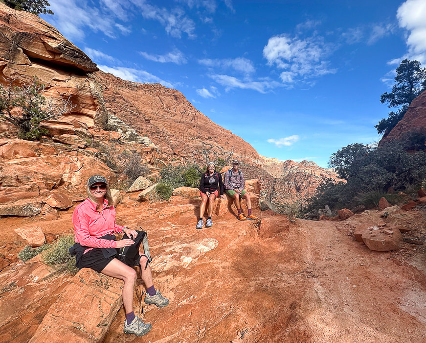 Snow Canyon training! Robin, Lindy and Jeff at top of Padre' Canyon. Scenes from Snow Canyon State Park, except upper right photo is from Joan's Bones Trail to the east. 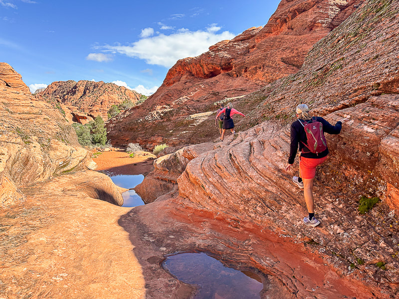 Jeff, Robin and Lindy on the Padre' Canyon Trail.
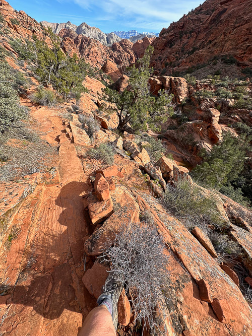
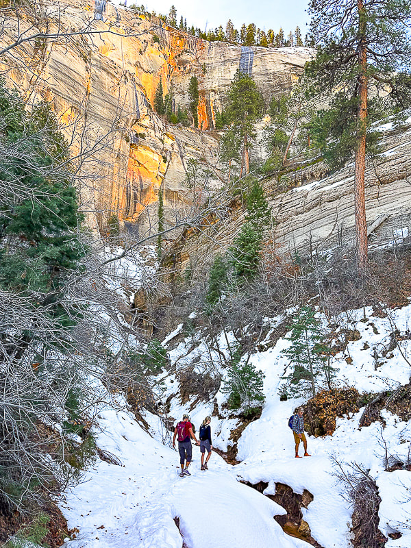
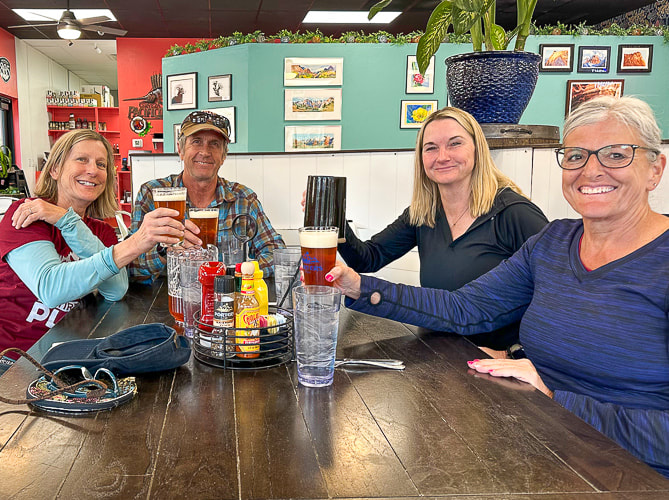
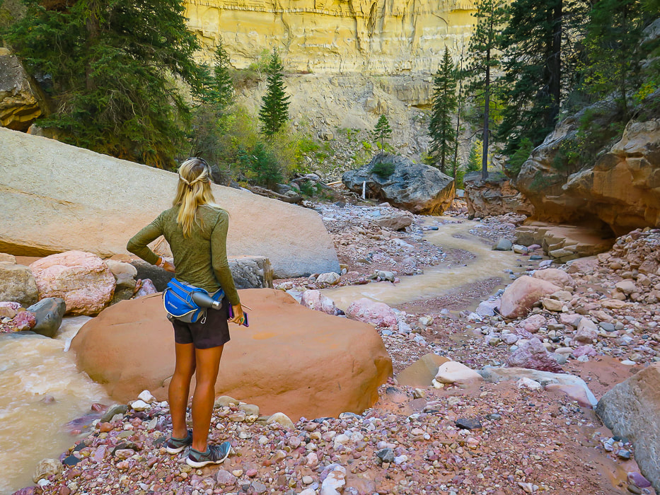
Fred climbing up cliff band on Red Mountain Trail, backside of Padre' Canyon. 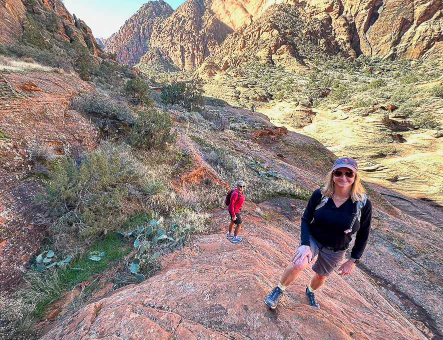 Exploring off the Padre' Canyon Trail. 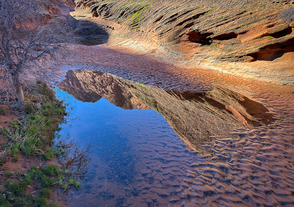 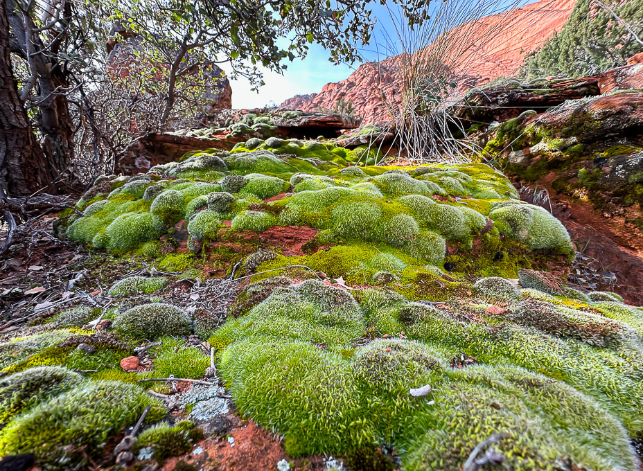 Moss after a rain near Padre' Canyon. 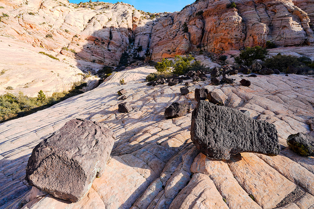 Hiking up toward Joan's Bones - basalt and sandstone. 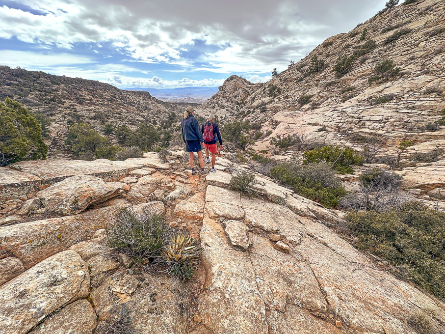 Descending Joan's Bones Trail. 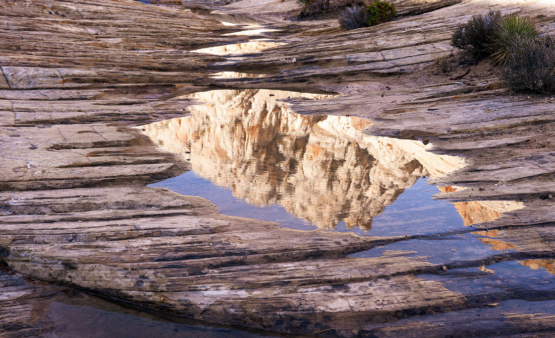 Reflection at Whiterocks Amphitheater 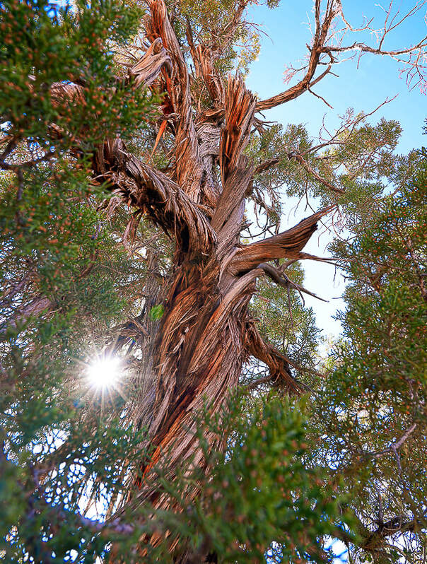 Old juniper on Butterfly Trail in Snow Canyon State Park, Utah 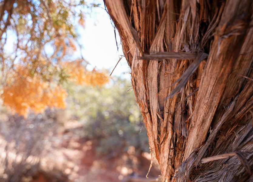 Old juniper image shot with my new Sony mirrorless, full frame sensor camera!!  Zion National Park - West Rim Trail to Horse Pasture Plateau (10 miles, 3,000' gain). Right after the shuttle service opened in early March, Lindy, Robin, Jeff and I headed to Zion to get some elevation training in. Starting at the Grotto Trailhead, 4,300' elevation, we hiked up West Rim Trail, past Angels Landing to the entrance into Horse Pasture Plateau at 6,713', at the intersection with Telephone Canyon Trail. After regaining ~ 300' of elevation loss to and from, I calculated our gain to be ~3,000 feet. We hiked on some icy snow. Down in the canyon and at the plateau, temperatures were a bit chilly. Zion was not especially busy with visitors that day. We celebrated afterwards in Springdale with beer and burgers at Porter's restaurant. 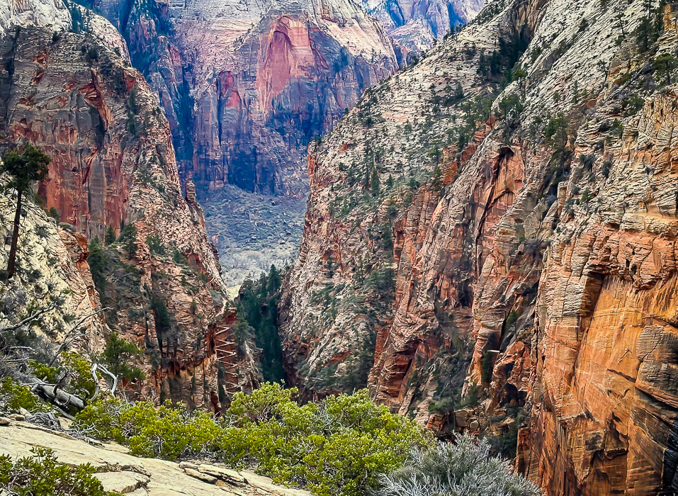 A view of Walter's Wiggles, tight switchbacks up through Refrigerator Canyon on the way to Angels Landing. Named after Walter Ruesch, Zion National Park's first superintendent who helped construct the trail in 1926.
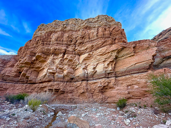
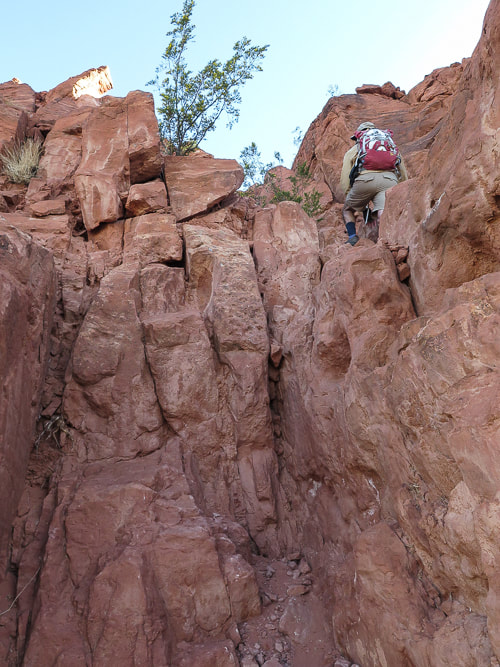
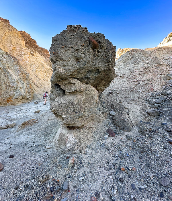
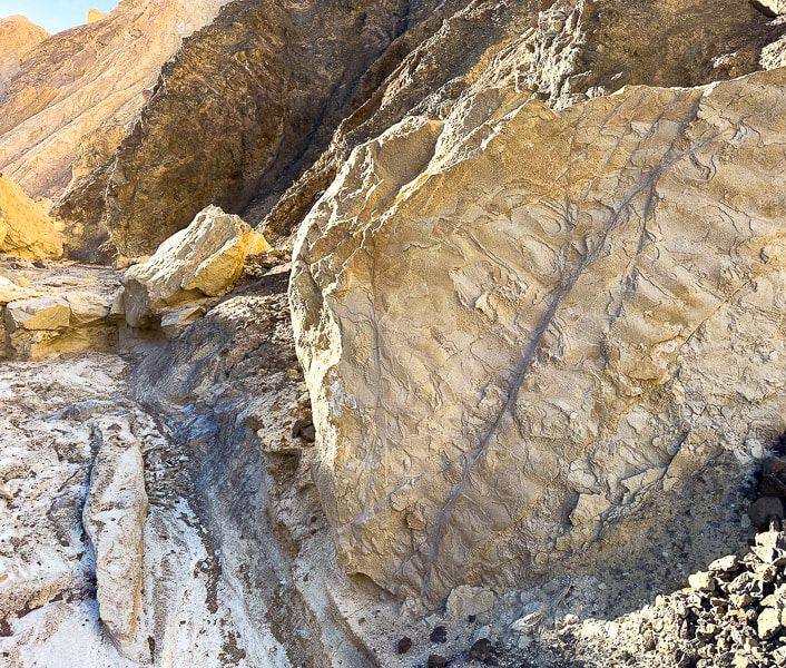
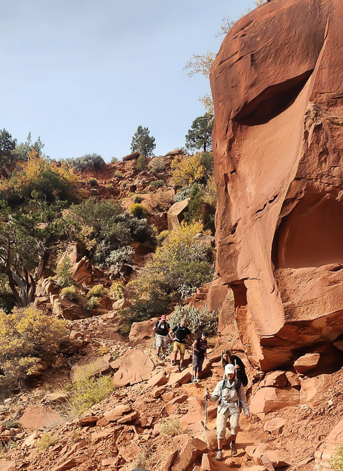
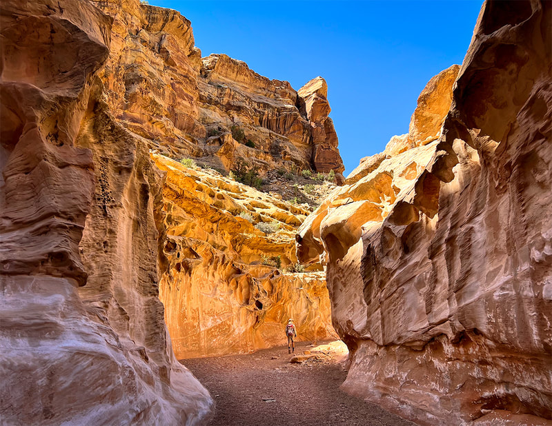
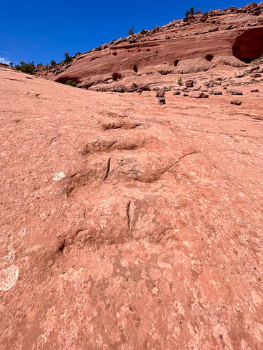
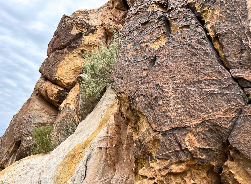
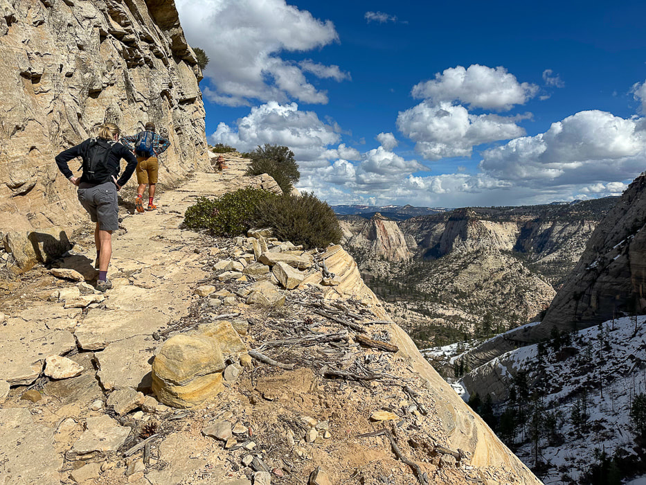 One of the last switchbacks up to intersection of West Rim Trail and Telephone Canyon Trail on Horse Pasture Plateau. 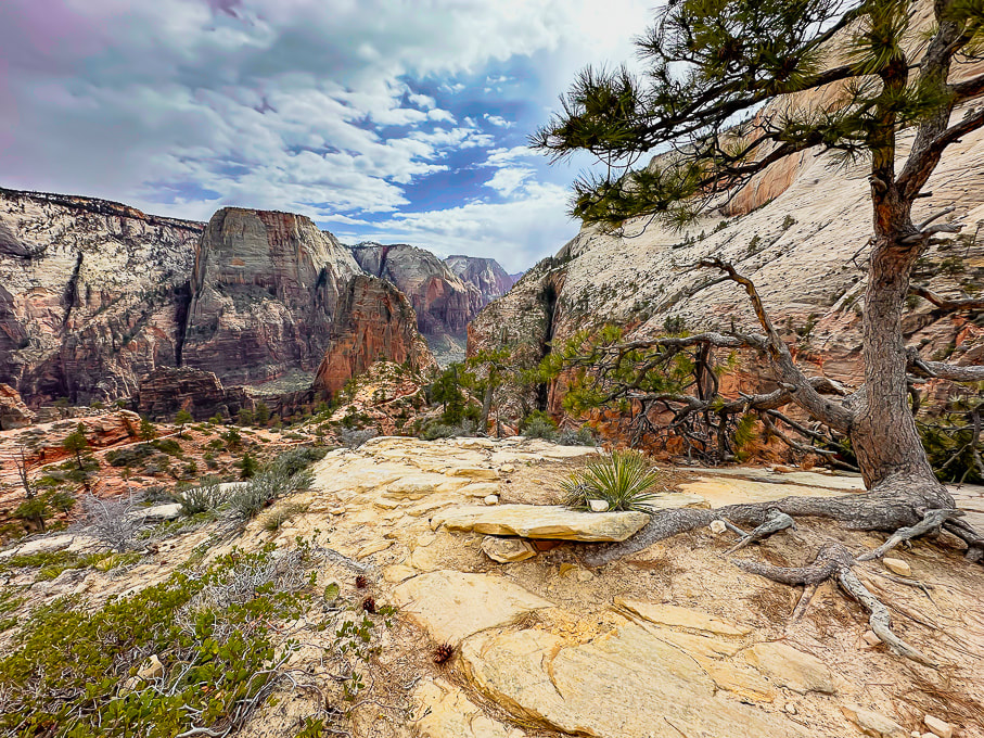 Looking at Zion's West Rim Trail and Angels Landing (orange fin beneath Great White Throne). Aprés hike brew and burgers! More scenes from Zion, and Jeff on Walter's Wiggles on the way to Angels Landing. 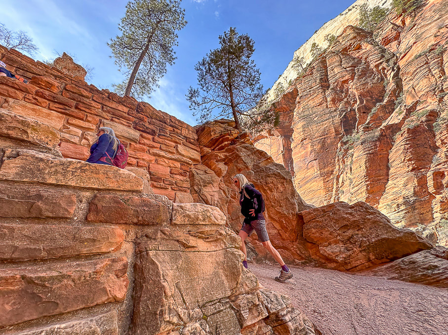 Ascending Walter's Wiggles, Refrigerator Canyon to the right. Ivins and Santa Clara, Utah: Suicidal Tendencies Trail and the "Badlands." The "badlands" is my nickname for the landscape west of Land Hill in Ivins, and east of the Beaver Dam Mountains because it reminds me of South Dakota's badlands. A spectacular view of this formidable-looking red and white striped land cracked by crooked canyons and washes and plateaus with well-established biological soils can be savored from the top of Land Hill. We hiked Wittwer Canyon, a major tributary that washes into Santa Clara River. Fred and I put together a 10-mile hike that linked the petroglyph trails on Land Hill to cross the Santa Clara River, to wander through the "badlands" to find a way to link to the Barrel Roll Trail in the Cove Wash Trails. In just one hike, Fred and I saw all the "cool stuff on this trail," (see photos below) and then some. A conglomerate boulder hanging on the steep wall under Land Hill looks like it has embedded dinosaur tracks. I called the local paleontologist; stay tuned!
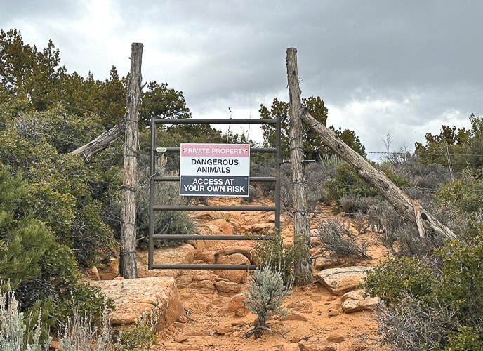
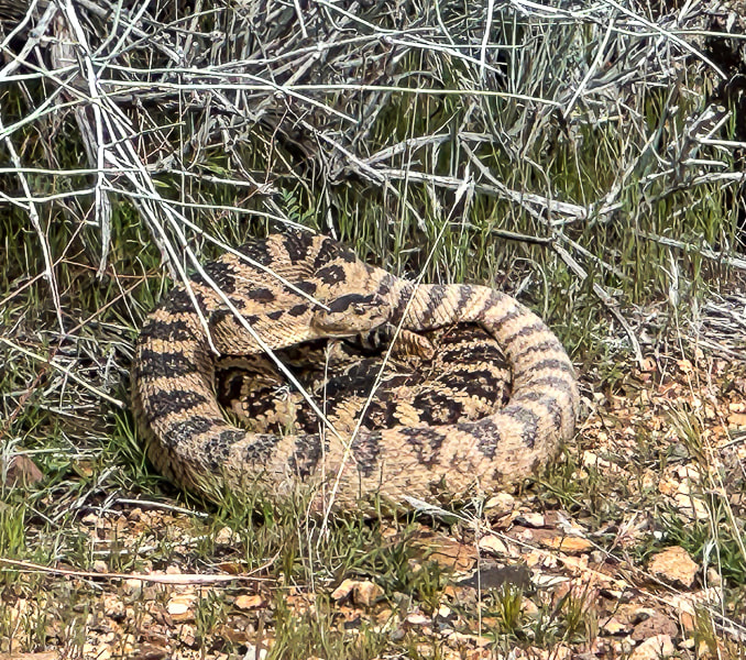
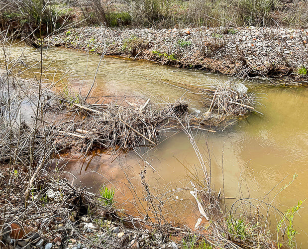
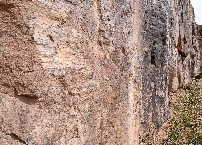
We're fortunate to have Colorado Plateau hiking to the east of us and Mojave Desert hiking to the west. One day we hiked the 11-mile Suicidal Tendencies, a popular mountain bike trail with scary drop-offs. The more we hike this part of Utah, the more we find to explore. Not only are the views magnificent - black lava flows blend with red and orange cliffs, signs of past cultures and geological events adds a lot character to this part of southern Utah. My next post (rim to rim training, part 2) will highlight another Zion hike and Red Mountain Traverse. Getting Ready for the Big Day! Keep On Exploring!!! Cool Stuff on the Trail One angry rattler, Santa Clara petroglyphs, preserved ripples, beaver dam on the Santa Clara River, dinosaur tracks(?) in Shinarump Conglomerate, a well-developed biological soil crust in the "badlands." 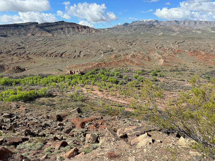 The "badlands" west of Ivins, Utah. Top of Suicidal Tendencies is on the left butte. Fred and I descended down to the cottonwood trees below and crossed the Santa Clara River, found a path through the badlands to the left and looped back using Cove Wash trails.
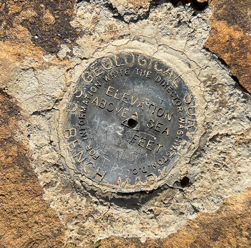
Jeff climbing a dry waterfall in Wittwer Canyon, finding our way up-canyon. 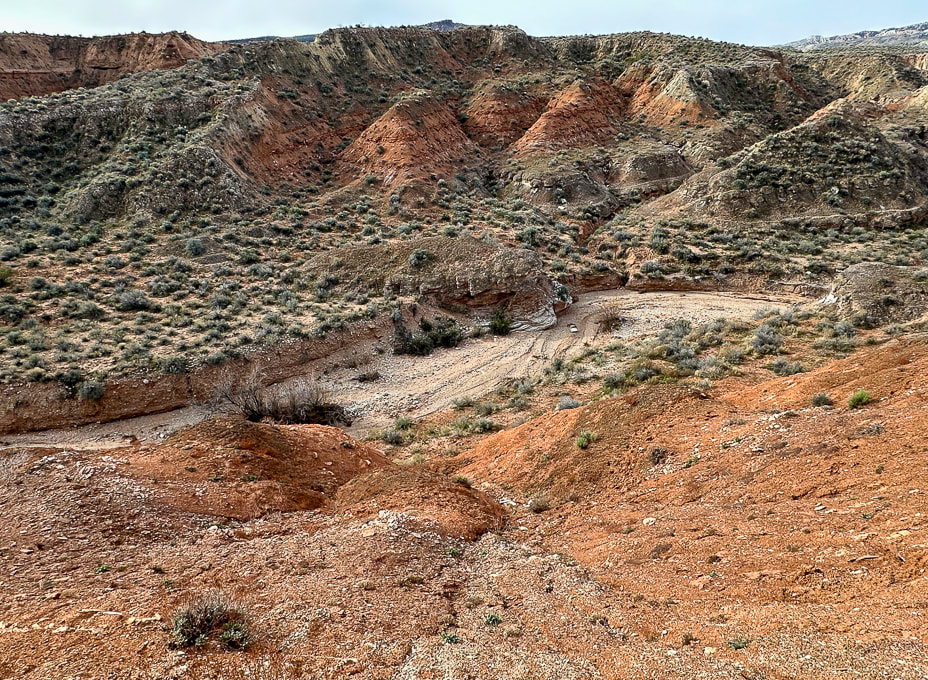 Wittwer Canyon: upper part is located in the Shivwits Band of Paiutes Land. 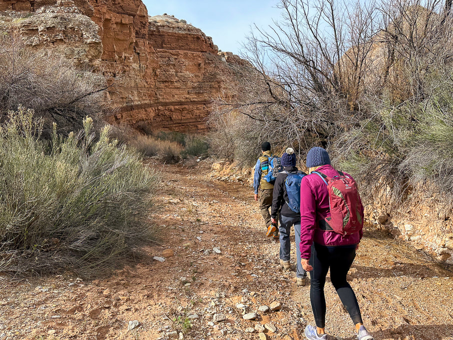 Wittwer Canyon - Santa Clara River Reserve on a cold and windy day. 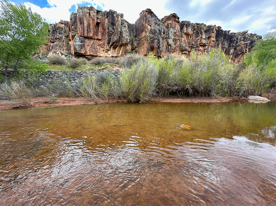 Western cliffs along the Santa Clara River - the rattlesnake is up there! 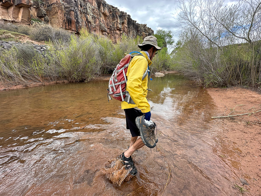 Fred and I found a shallow crossing on the Santa Clara. 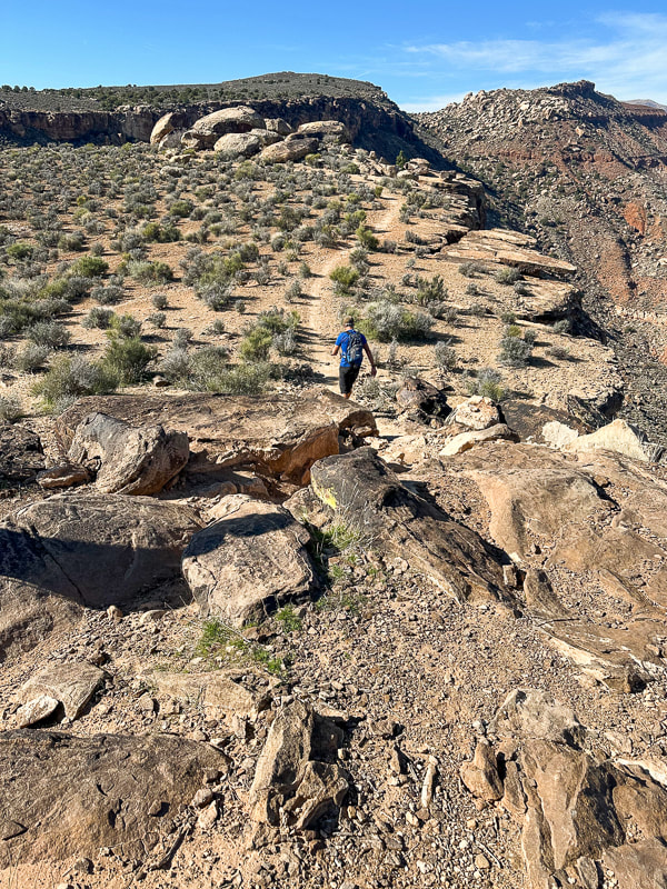 Jeff walking toward top of Suicidal Tendencies Trail (green plateau). 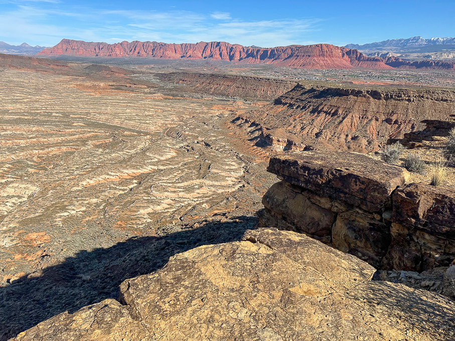 From Suicidal Tendencies Trail looking north across "badlands" to Red Mountain and Ivins, Utah. Snow-covered Pine Valley Mountains on the right horizon. On the top of Suicidal Tendencies - a survey marker that has "Santa Clara" and "1954" stamped onto it.
4 Comments
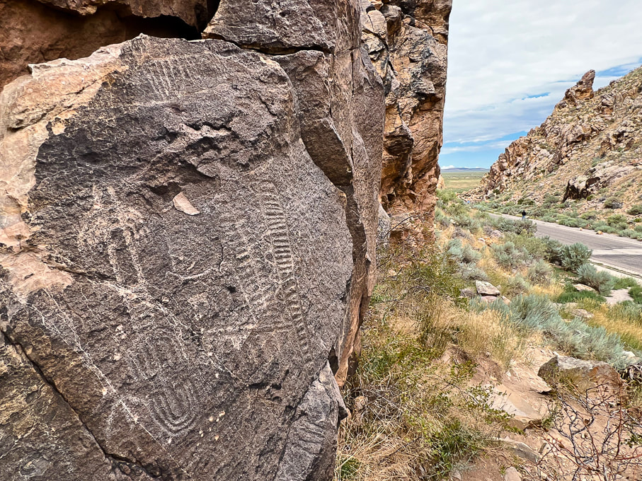
Unravelling the mysteries of two unique, older petroglyph sites that I found along the Santa Clara River in Utah. 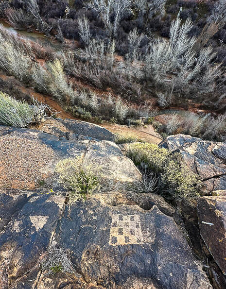
Abstract petroglyph overlooking the Santa Clara River in the Santa Clara River Reserve.
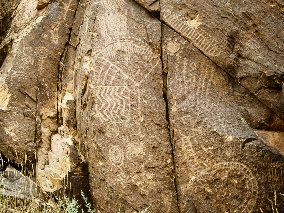
This design closely resembles an Ancestral Puebloan (formerly Anasazi) petroglyph found in Arizona. Checkerboard designs are associated with Glen Canyon Style 5 made before 1050 A.D. by Ancestral Puebloans including Basketmaker cuture. Related Posts:
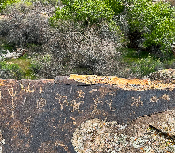
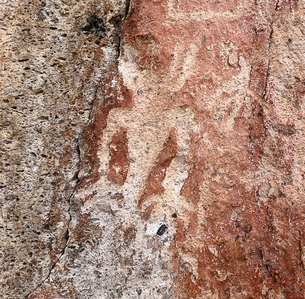
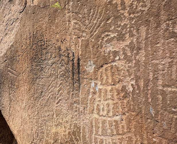
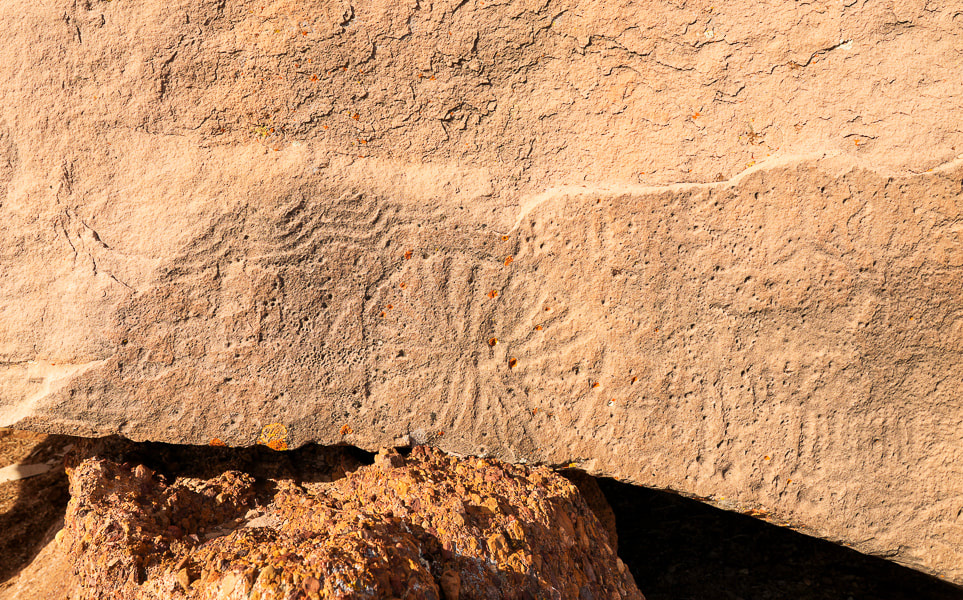
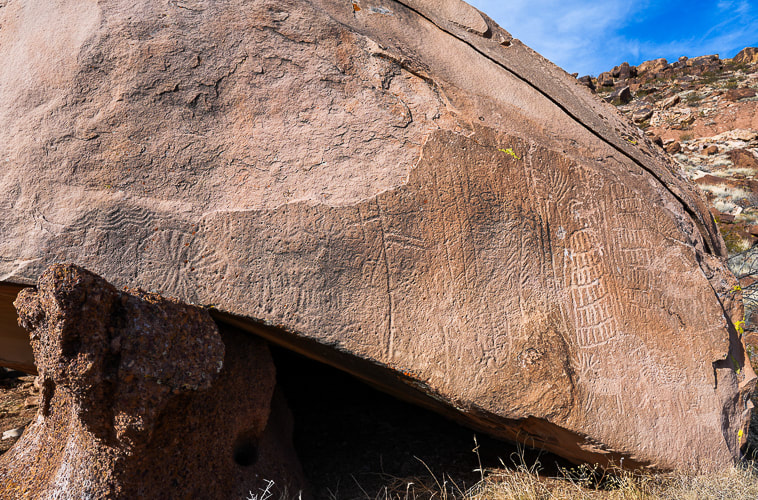
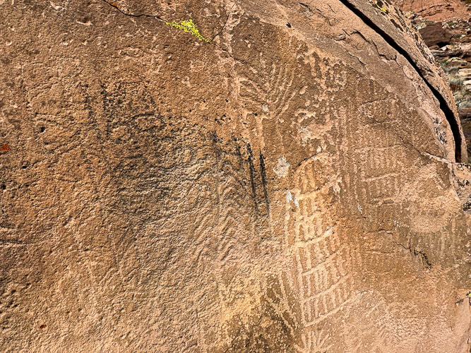
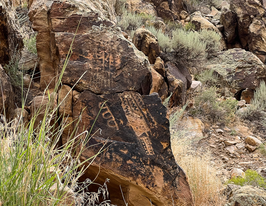
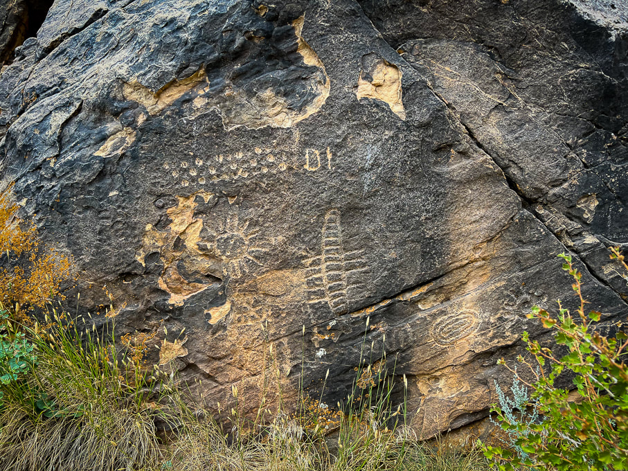
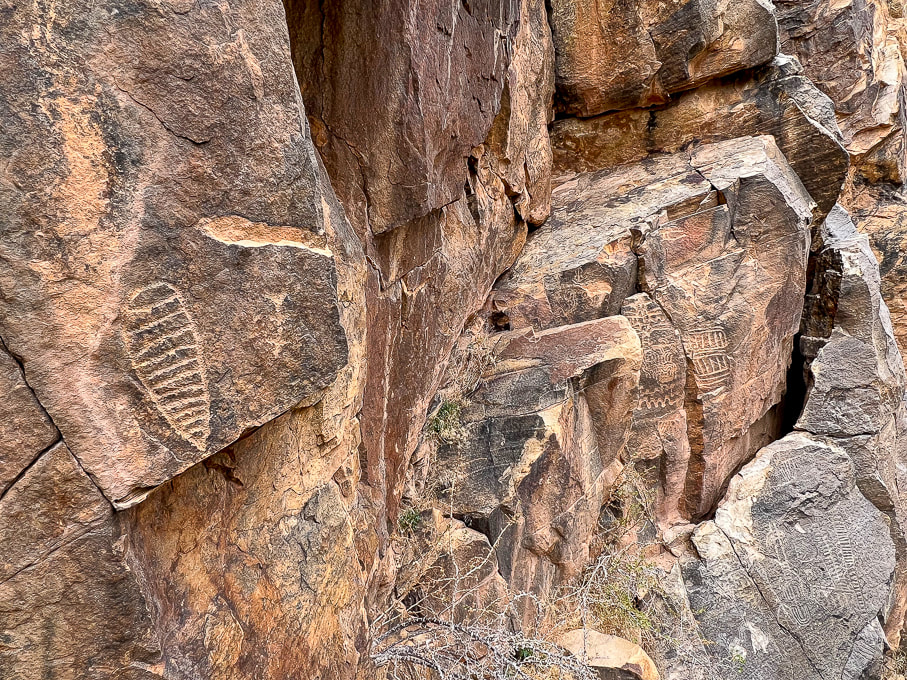
Trip Stats Location: Santa Clara River Reserve near Ivins and Santa Clara, Utah - Land Hill. Trailheads: Anasazi Valley Trailhead (north) and Tukupetsi Trailhead (south). Distance: The distance that includes all of the petroglyphs described here is ~ 5+ miles (top of Land Hill and along the Santa Clara River). Some interesting books: A Field Guide to Rock Art Symbols of the Greater Southwest by Alex Patterson. Early Rock Art of the American West: The Geometric Enigma by Ekkehart Malotki and Ellen Dissanayake. The Rock Art of Utah by Polly Schaafsma Links: Santa Clara River Reserve Map Santa Clara/Land Hill is designated as an Area of Critical Environmental Concern (ACEC). Geology: Petroglyphs are located in the oldest rocks of the Santa Clara Quadrangle Geologic Map: - Shinarump Member Upper Sandstone unit and Shinarump Conglomerate Member of the Chinle Formation: Upper Triassic (~ 200 million years ago). Petroglyphs in sandstone and dinosaur tracks in conglomerate. -Cliffs below Land Hill along the Santa Clara River: Upper Red Member of the Moenkopi Formation: Lower Triassic (~ 250 million years ago). The fascinating rock art on the Tempi'po'op Trail (Anasazi Valley Trail) in Ivins, Utah, made by the Virgin Ancestral Puebloan and Southern Paiute cultures thousands of years ago can be discovered for more than two miles along the cliffs of Land Hill, overlooking the Santa Clara River. Additionally, many more petroglyphs are pecked into huge boulders and sheer walls beneath Land Hill, next to the river. Each time I explore this part of the Santa Clara River Reserve, I find new petroglyphs. On a recent wander, I discovered two intriguing petroglyph sites that I had previously passed by.
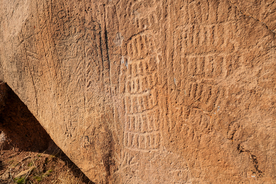
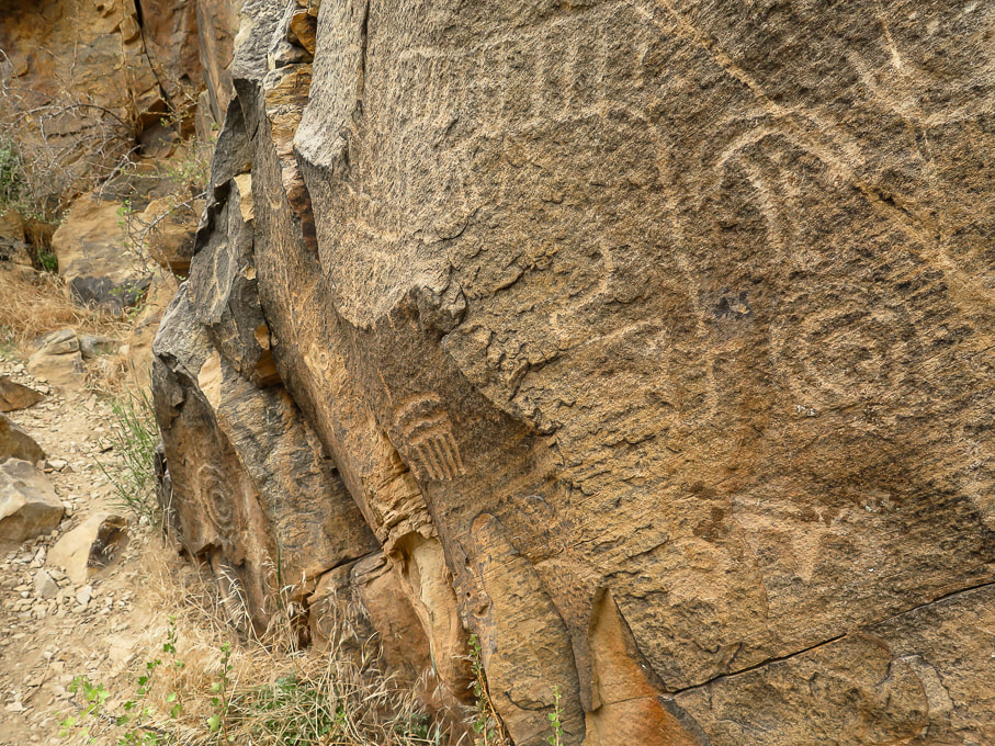
Five bighorn sheep on the right side of the boulder along with two large columns made with parallel vertical lines bisected incrementally with horizontal lines are pecked next to the older-appearing, lichen-filled and more highly eroded geometric glyphs. Who made these abstract/geometric petroglyphs and what do they "mean"? Various theories include shamanistic visions, recording of phosphenes, and communication of vital information like water sources. The Paiute word for them, Tumpituxwinap, translates roughly as "storied rocks."
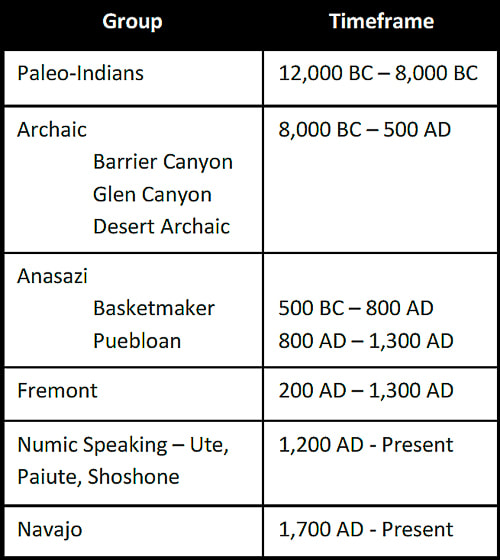
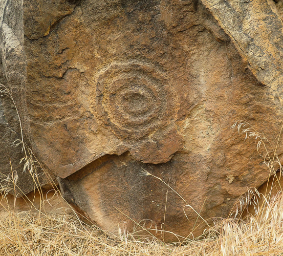
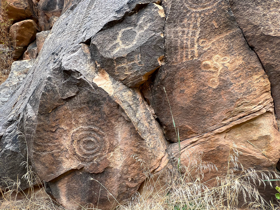
Huge boulder on flat area near Santa Clara River predominated by abstract/geometric petroglyphs, possibly of the Great Basin Curvilinear and Rectilinear style. 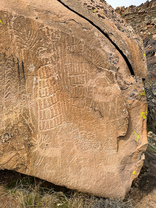 The right side of the boulder; these deer and sheep petroglyphs seem to be younger than those on the left side because they are not as eroded. The plant-like image (upper left) looks like a corn tassle to me. 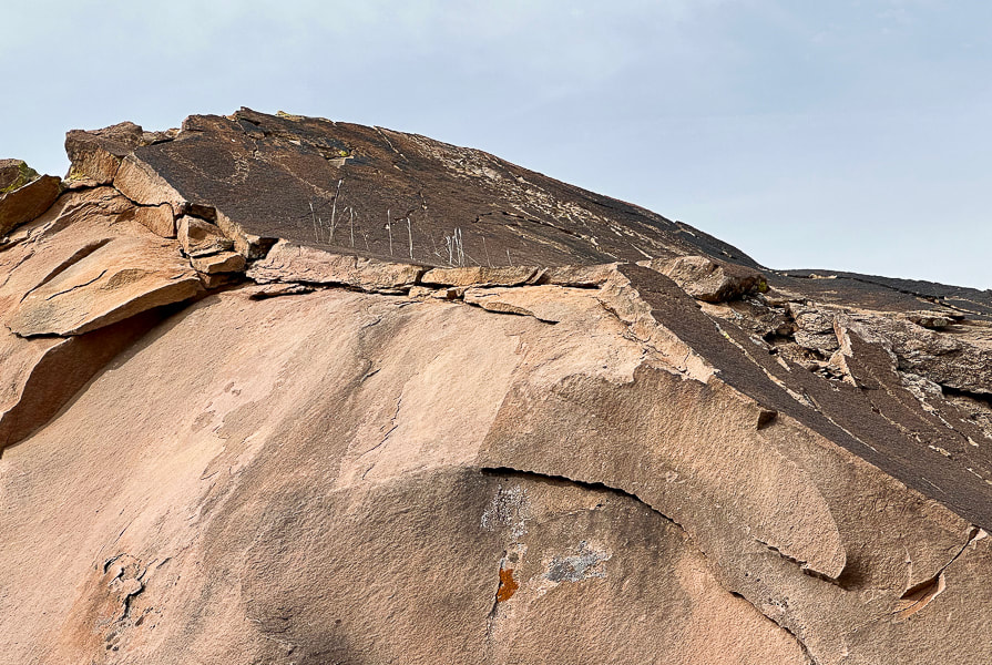 Petroglyph on top of boulder (left). It reminds me of a necklace: it's similar to those that are pecked into a boulder nearby. It looks like a chain of circles, which might indicate the Great Basin Curvilinear style. In Search of the Rattlesnake Petroglyph.  Back of boulder with what I could find as the easiest route to the top.
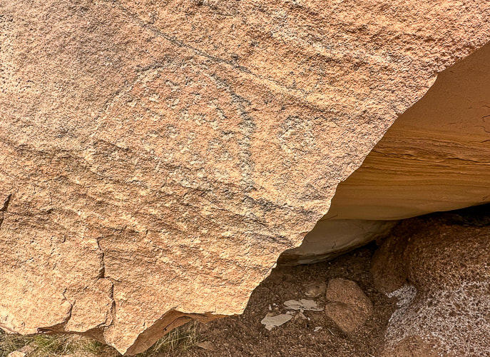
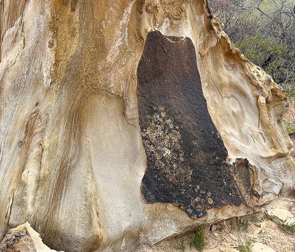
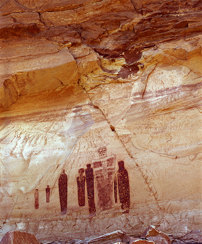
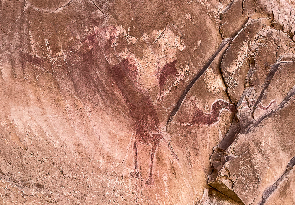
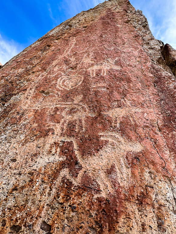
Phosphenes are lately being proposed by scientists as the catalyst for the creation of abstract designs. All humans experience phosphenes that occur during hyperventilation, migraine headaches, meditation, use of hallucinatory drugs, fatigue and hunger and pressure put on a closed eye. The idea is that geometric petroglyphs and pictographs depict an innate visual grammar (Engel in Fein, 1993) that we all share, ingrained in the biology of our brains. My earlier post Corn Springs Petroglyphs: Vision Quests, Steamboats, and Ringing Rocks explains a few theories for the creation of the Western Archaic Tradition rock art. The Santa Clara Boulder and the "Abstract Enigma" I found two photos of petroglyphs very similar to that of the spoked circle design on the large boulder by the river. One illustrates the Western Virgin Kayenta style and the other illustrates Great Basin Carved Abstract petroglyphs. This spoked circle seems less prevalent than the spiral petroglyphs that appear frequently on the cliffs above the river. Great Basin Abstract tradition rock art spans the Archaic and the Late Prehistoric (8,000-150 years ago). The Great Basin Carved Abstract style occurs in St. George, Utah area. It's characterized by purely geometric petroglyphs that fill boulders so that little unmarked space is left. Art includes various circle configurations, grooves, grids, lattices, herringbone shapes, ladder-like shapes, chevron, hatchmarks and dots. This boulder along the Santa Clara River contains some of these elements. Since this style is found not only in Nevada's Great Basin, but throughout the American West, some scientists call it "Carved Abstract". The rows of vertical lines cut with horizontal lines, surrounded by a line are similar to "gridiron" petroglyphs seen in New Mexico. The parallel wavy lines above the spoked circle are considered Great Basin Curvilinear, which I read is another way to say Great Basin Carved Abstract. The grids and cross-hatchings, and perpendicular form is known as "rectilinear." These styles are associated with the Archaic style and also occur in styles associated with Puebloan and Fremont groups. Two authors state that the Great Basin Abstract petroglyphs appear to be made as a part of "magic hunting ritual and were related to subsistence practices..." (Heizer and Baumhoff). Abstract designs predominate this style, with a limited depiction of animals. The most common animal portrayed is the bighorn sheep. I also noticed what appeared to be cupules (pit and groove style) on the back side of the boulder. Or are these holes just natural weathering? Or both? One pit placed on the side of the boulder looks too symmetrical to be made by weathering. Theories for their creation include fertility enhancement and the use of powder produced from making them. 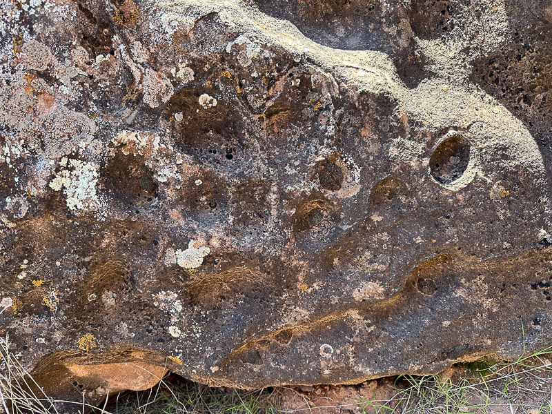 Cupules or natural weathering? Cupules are associated with very early Carved Abstract Style. It's assumed that cupule sites identify places of significance. 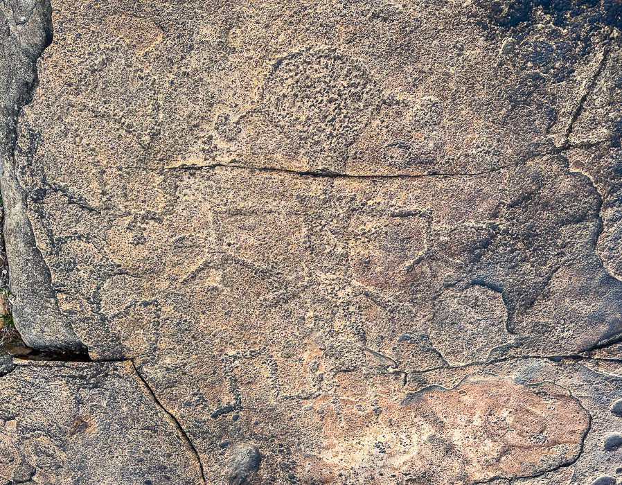 Anthropomorphic (Human-like) petroglyph on a flat boulder near the Een'oog Trail and the cliffs overlooking the Santa Clara River. Size is ~ 14 inches tall. Is a Snake Biting the Figure with the Drooping Hands? The second amazing petroglyph I found is on top of Land Hill along the Een'oog Trail, on the cliffs above the Santa Clara River. It's totally repatinated, blends into the rock, so it's easily missed (see above). Its drooping arms, termed "pendant" by scientists, round head, hair bobs, long rectangular or slightly trapezoidal (wider at the shoulders), and feet and hands pointing down match the description I found of the Anasazi Basketmaker culture - 500 BC - 800 AD. The term "Anasazi" has now been replaced by "Ancestral Puebloan." A serpentine-like line winds its way from the left side of the figure to the figure's leg. These “representational” styles are typically associated with Fremont and Western Puebloan cultures (ca. 2,000-750 years ago) in southeastern Nevada, Utah, and the Colorado Plateau. These semi-horticultural groups made rock art that featured human-like forms portrayed by trapezoidal, rectangular, or triangular body shapes. These were often portrayed with bodily decoration such as headgear, jewelry, or decorated clothing. In my research, I found the Classic Vernal-Style (a sub-set of Fremont Style) Anthropomorph has large heads and trapezoidal torsos with well-defined extremities. The Fremont style tends to have round earbobs and arms and hands held down, commonly with splayed fingers. In western Utah, there is an intermix of Great Basin Curvilinear and Fremont styles. Ancestral Puebloan farmers lived in the Land Hill area in permanent settlements ~ 1,000 years ago. The Santa Clara River gave them a good water supply to irrigate their crops. During A.D. 700 - 1100, population on Land Hill thrived, but then around 1200 A.D., population decreased possibly due to changing climatic conditions. I found an old corn cob in a grassy area beneath the cliffs next to the river (see photo below). Every kernel had been removed. It couldn't have survived hundreds of years! Or could it have been exhumed after the record-setting rains of 2022-2023 that caused a major landslide at an area close to it? A Land Rich in Culture, Stories, and Mystery Dinosaur tracks have been documented on Land Hill. At first glance, you wouldn't imagine that the Santa Clara River Reserve holds so many stories among its cliffs, plateaus, and rock art. If you look closely, you will see abstract and representational communication made by different cultures during different times. In my quest to figure out who made these fascinating petroglyphs and why, I realize that if anything, they still remain an enigma. I'll let you know if I find the dinosaur tracks and more corn cobs! Keep Exploring! 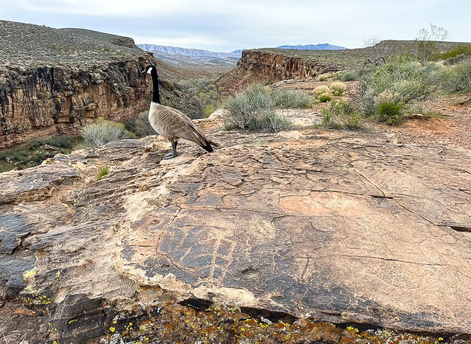 When I went to look at the figure with the round head and the ear bobs again (lower right), I shared the petroglyph rock with a goose.  Petroglyphs (walls on right) overlooking the Santa Clara River.  Land Hill on the right and a path that runs along the Santa Clara River. Beaver Dam Mountains in the distance. Petroglyphs are found on the flat surface rocks, in the steep cliffs of Land Hill, and on boulders along the river. 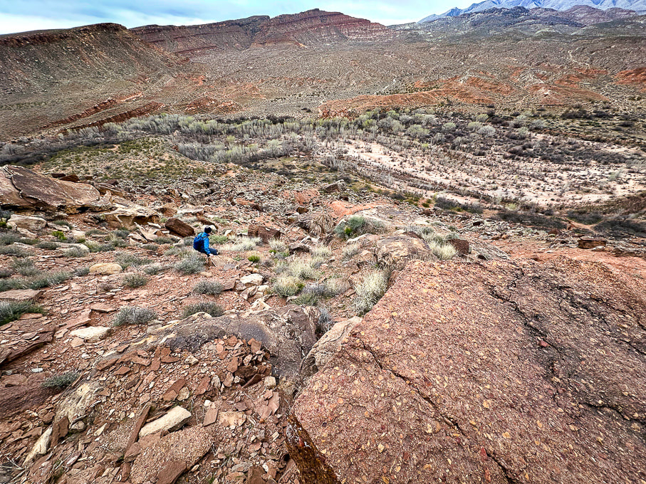 Finding a route down from the top of Land Hill with my friend Laura. We are headed to the Santa Clara River below. Notice the Shinarump conglomerate rock in the right foreground. 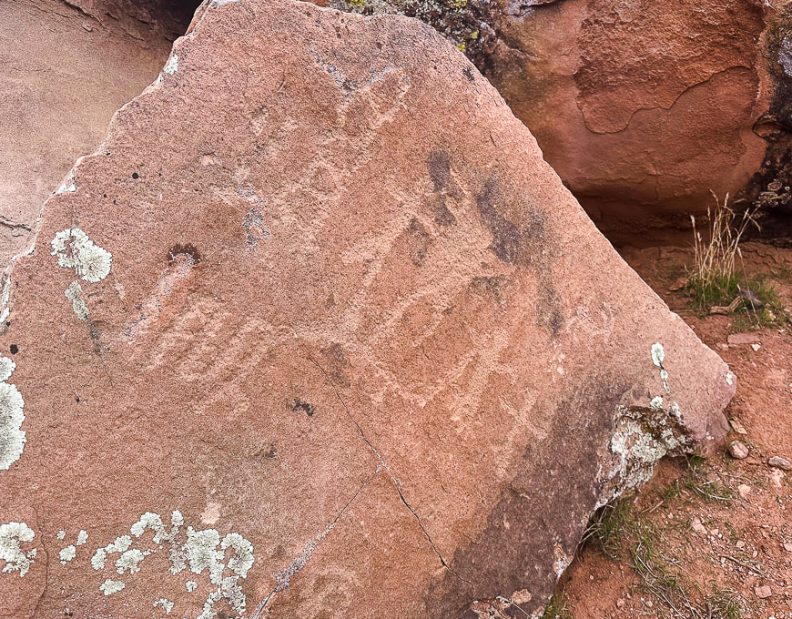 When we got near the river, we found this boulder with what looks like Great Basin Curvilinear style and a family of anthropomorphs (human-like) figures. 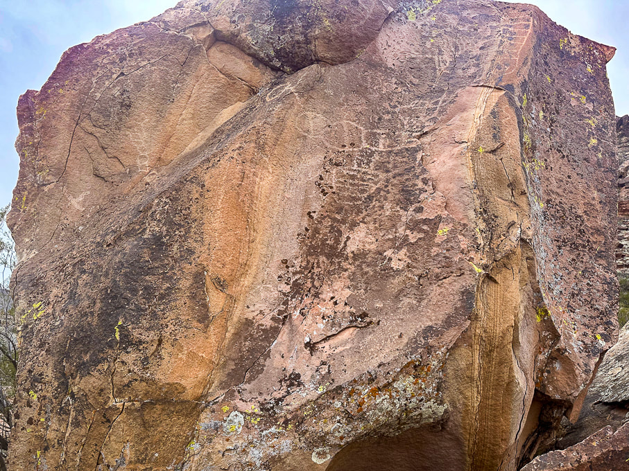 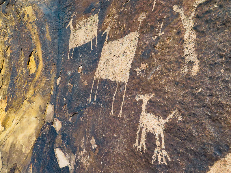 Petroglyphs on the Anasazi Valley Trail in Ivins, Utah. The Glen Canyon Style 5 (Ethnic groups are Early Puebloan and Basketmaker). Bighorn sheep have large rectangular bodies disproportionately large compared to their small heads, tail and legs.
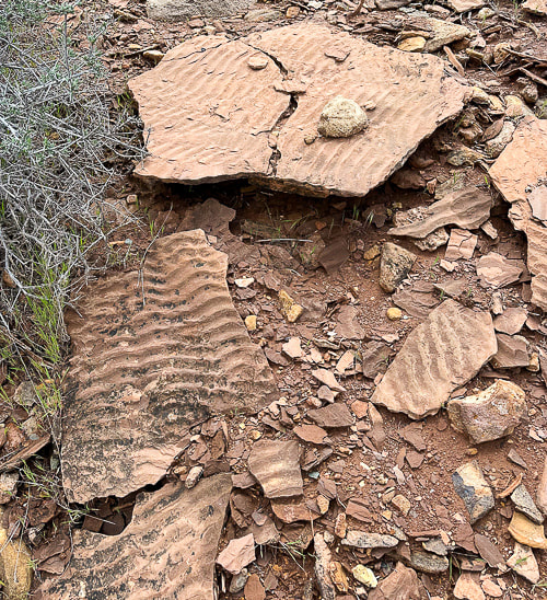
Laura and some really cool sandstone boulders along the Santa Clara River. Some Cool Stuff on the Trail Clockwise from upper left: slickensides created from scraping against other rocks in a fault, bivalve fossil near the Een'oog Trail, a corn cob, a desert-varnished panel on an eroded sandstone boulder.  Sandstone boulder detail. References Bureau of Land Management. Land Hill Heritage Site. Malotki, Ekkehart. The Rock Art of Arizona: Art for LIfe's Sake. From website: Bradshaw Foundation. Mangum, M.E. 2018. Lithics and Mobility at Land Hill and Hidden Hills: A Study of the Stone Tools and Debitage at Sites in the Santa Clara River Basin and on the Shivwits Plateau. Brigham Young University ProQuest Dissertations Publishing, 2018. 28107515. National Park Service. Reading Rock Markings. Schaafsma, P. 1971. The Rock Art of Utah. Scotter, T. Bowen , N. 2017. The Rock Art of Utah. The Nevada Rock Art Foundation - Styles and Themes Willis, J.C., Hayden, J.M. 2015. Geologic Map of the Santa Clara Quadrangle, Washington County, Utah. A New Year's Day 2024 journey through pinyon-juniper woodland on top of Red Mountain near St. George, Utah to a spectacular Snow Canyon overlook. 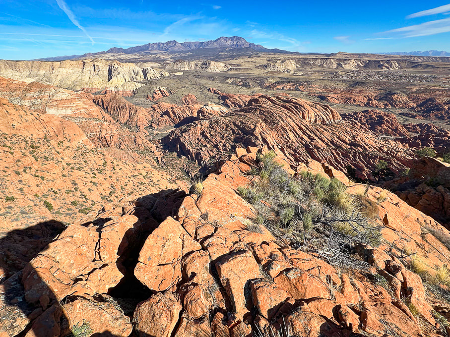 Looking north over Snow Canyon State Park from "On Top of the World" on Red Mountain. Pine Valley Mountains on the horizon. 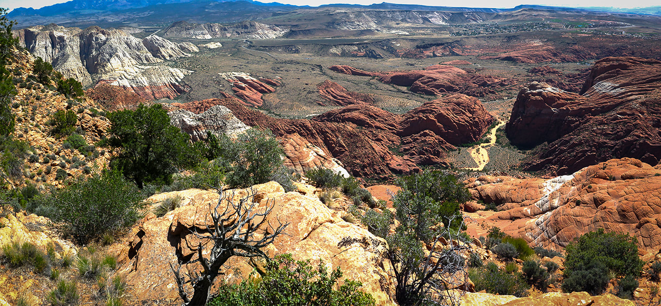 View of Red Sands Trail (right) in Snow Canyon SP from a previous hike - Red Mountain Primitive Trail. Trip Stats - Ivins Trailhead
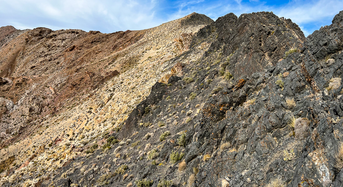
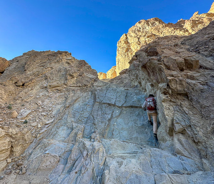
Overview/Location: This quiet, cross-country excursion through the gorgeous Red Mountain juniper woodland biome brings you to an expansive view of southern Utah's Snow Canyon State Park. A remote island of solitude in the Red Mountain Wilderness elevated above the cities of Ivins and St. George. Distance/Elevation gain: 5 miles out and back/1,575'. Coordinates/Elevation: Red Mountain Trailhead = 37.17519, -113.67755 (3,190'). Southern Red Mountain Primitive Trail out of Ivins. Top-off at 0.8 miles = 37.18375, -113.67849 (4,556'). Snow Canyon Overlook (On Top of the World) = 37.20116, -113.66671 (4,765'). Maps/Apps: Topo Maps U.S. app, Garmin GPS, BLM Utah Red Mountain Wilderness (Avenza app). Maps at end of this post. Difficulty/Trail: strenuous Class 1-3 climb up Red Mountain (mild exposure) for the first 0.8 mile, moderate cross-country Class 2 over slick rock and deep sand. Date Hiked: 1/1/2024. Geology: Red Mountain's lower slopes are the Kayenta Formation, the oldest rock in Snow Canyon State Park (190 million years). The horizontal sediment layers are made from rivers depositing mudstone, siltstone and sandstone. The upper slopes, cliffs and top of Red Mountain are a great block of Navajo Sandstone that is younger (180 million years), also seen as a major rock unit of Zion National Park. This Navajo Sandstone exhibits large, sweeping cross-bed features - horizontal and dipping layers of ancient sand dunes deposited in a vast eolian (wind carried) dune field. Red Mountain is bounded by the Gunlock Fault on its west side. It merges with an extensive field of 2.4 million - 2,000 year old basalt flows to the northeast. The Gunlock Fault is a normal fault with the down-drop on its west side (See references below). Considerations: The first mile from the Ivins trailhead is Class 1-2 with two short Class 3 maneuvers. Once the trail tops out, there is no marked trail. Experience with navigation and route-finding using a compass/GPS and topo maps is advised after top of Red Mountain is reached to avoid getting lost. A sign at this trailhead reads, "Hazardous, unmaintained route with steep exposed slopes: your safety is your responsibility." Recommend taking a GPS waypoint at critical points on the trail such as point where you enter the plateau from the cliffs. Search and rescue operations for lost hikers have occurred. Be prepared if you have to spend the night! Research this route thoroughly! 2/5/23: Three rescues in Washington County on the same Day (St. George News). Related Posts Our New Year's Day Hike Fred and I have a tradition of hiking on New Years Day. For 2024, we took friends to the top of Red Mountain and across its beautiful plateau to a high point dubbed "On Top of the World" by our friend Dan. From here, you stand 1,400 feet over an outstanding view of Snow Canyon's petrified yellow sand dunes and orange ridges, black basalt flows from northern volcanoes near Veyo. It's worth the orange sand trudge on the top to get there. This short, five-mile hike packs in a good variety of terrain. The first mile climbs steeply through a cliff band requiring some fun Class 3 (un-roped using hands to climb) maneuvers, gaining 1,300 feet. The next 1.5 miles initially descends through a beautiful juniper woodland bowl where Gunsight Pass can be reached to the southeast. You will trek through sand, washes, over slick rock then climb to a sandy saddle where our "On Top of the World" high point can finally be seen. Then it's a matter of making a ~0.5-mile beeline to it across relatively level terrain, traversing minor washes, dodging cacti and prickly shrubs. When you top-off onto Red Mountain's plateau, you initially follow the north/south Red Mountain Primitive Trail for ~1.2 miles, then a short jaunt off of it to the northeast to reach On Top of the World, elevation 4,765'. Red Mountain Primitive Trail's northern trailhead is located just north of Diamond Cinder Cone on Utah Highway 18. It's a fun little scramble to the cairned top, using your hands a few times to climb easy rocks, overlooking Padre Canyon and Tuacahn Center for the Arts to the southeast. Once you summit, the rugged terrain drops steeply below with a breathtaking view of Snow Canyon, with a few smooth slick rock benches above it that look interesting to explore or camp in. Can't think of a better way to celebrate the New Year: friends and the reward of finding our own way to a seldom-visited summit in one of the most beautiful places in the southwest. Great "medicine" for the soul, body and mind. Explore More in 2024!! 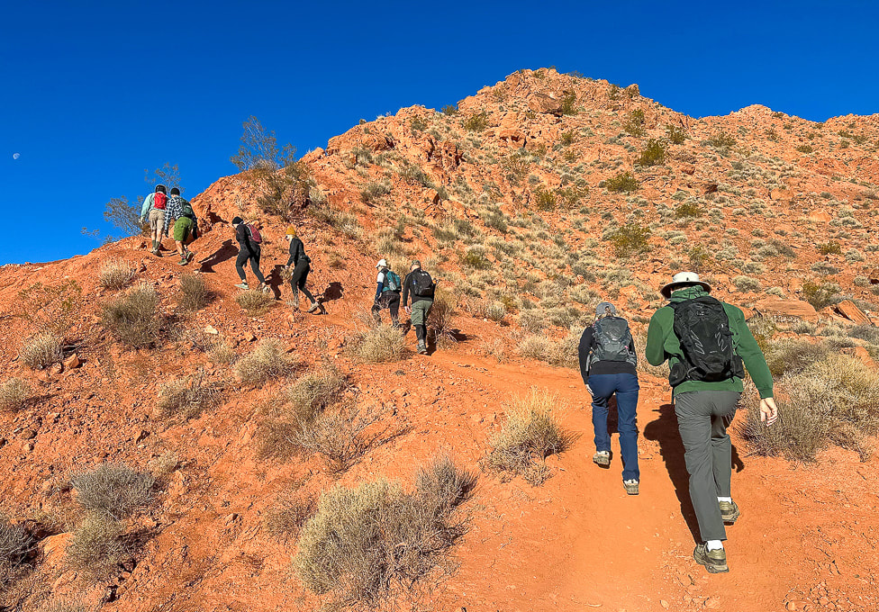 Southern Red Mountain trailhead in Ivins. The trail starts out steep! 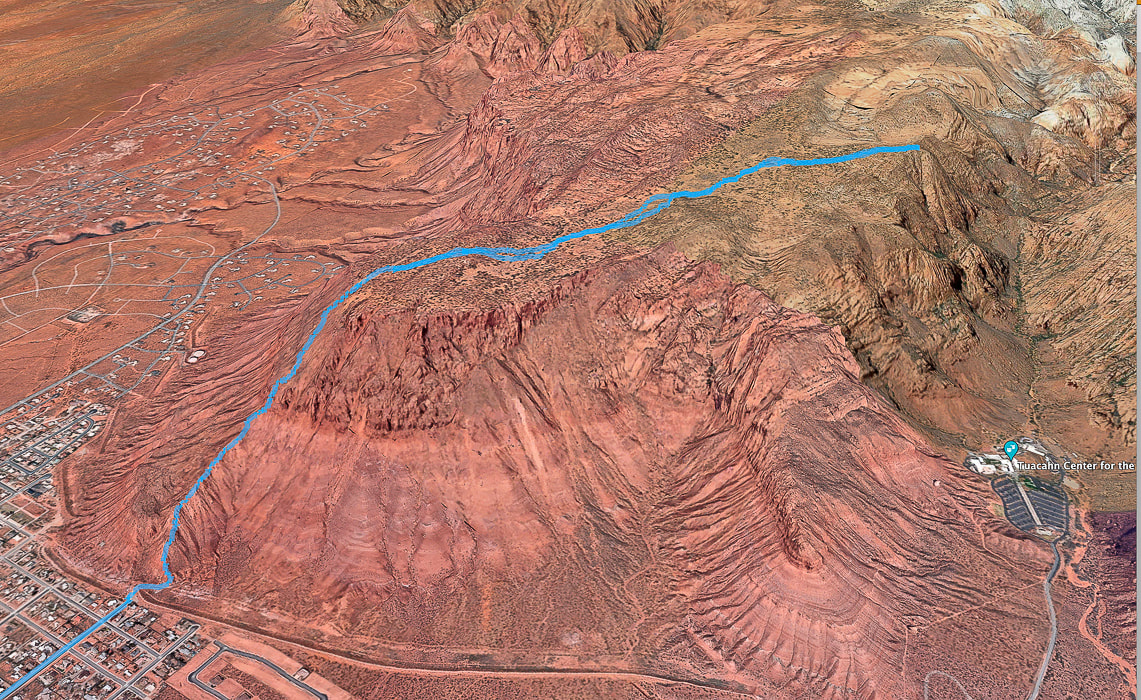 Google Earth view of our GPS tracks beginning at the Red Mountain Primitive Trail's southern trailhead in Ivins (lower left), going through the cliff-band about halfway up, getting onto Red Mountain, and traversing across plateau to "On Top of the World" overlooking Snow Canyon, Padre Canyon, and Tuacahn Center for the Arts. See more maps at the end of this post.
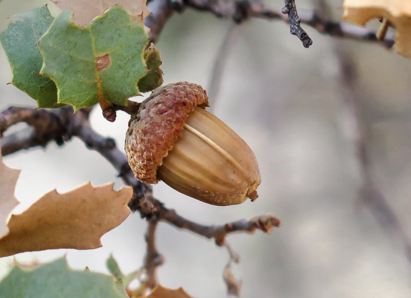
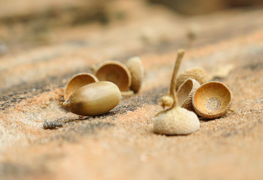
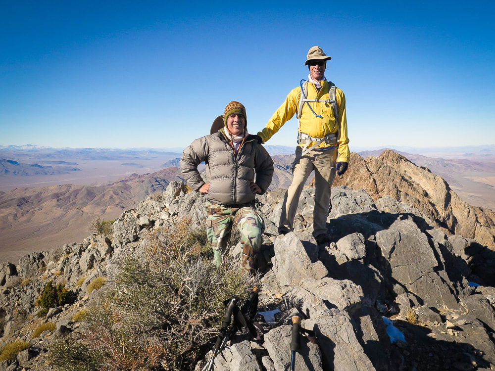
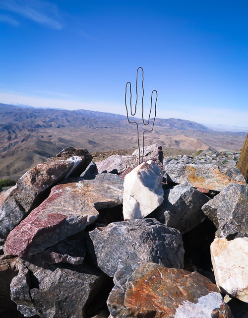
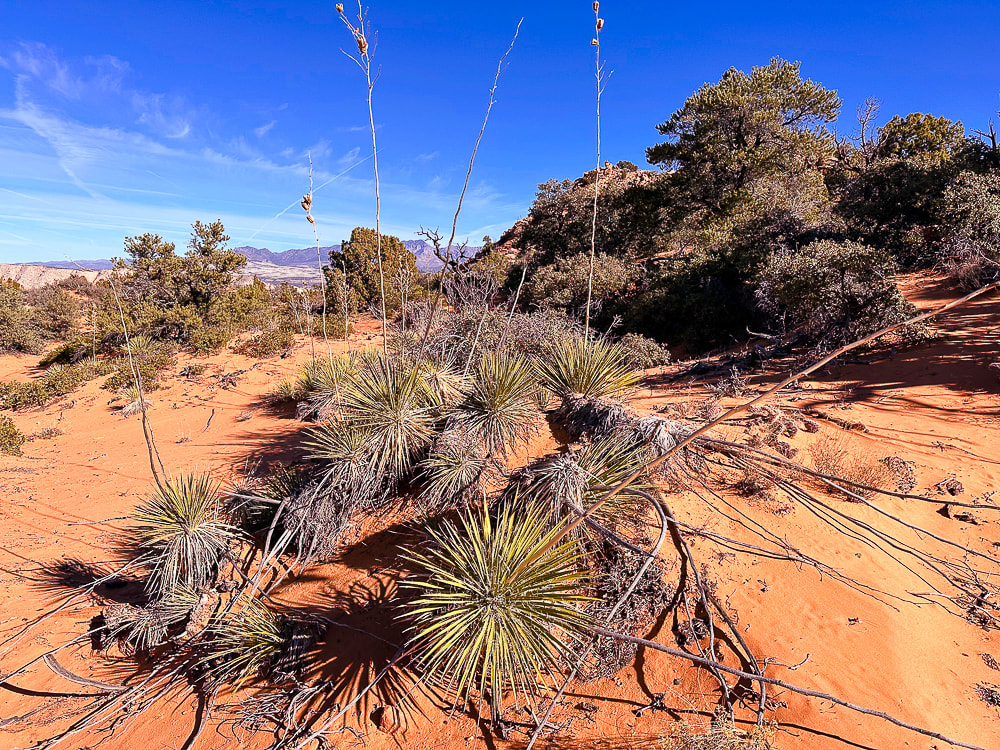 Utah yucca and pinyon pines, shrub live oak (Quercus turbinella) on Red Mountain's plateau. The name turbinella, meaning "like a little top", refers to the acorn, this plant's fruit which appears in summer. The reference to "turbinella" in the photo above prompted me to add these photos of the shrub live oak acorns. They're so cute! 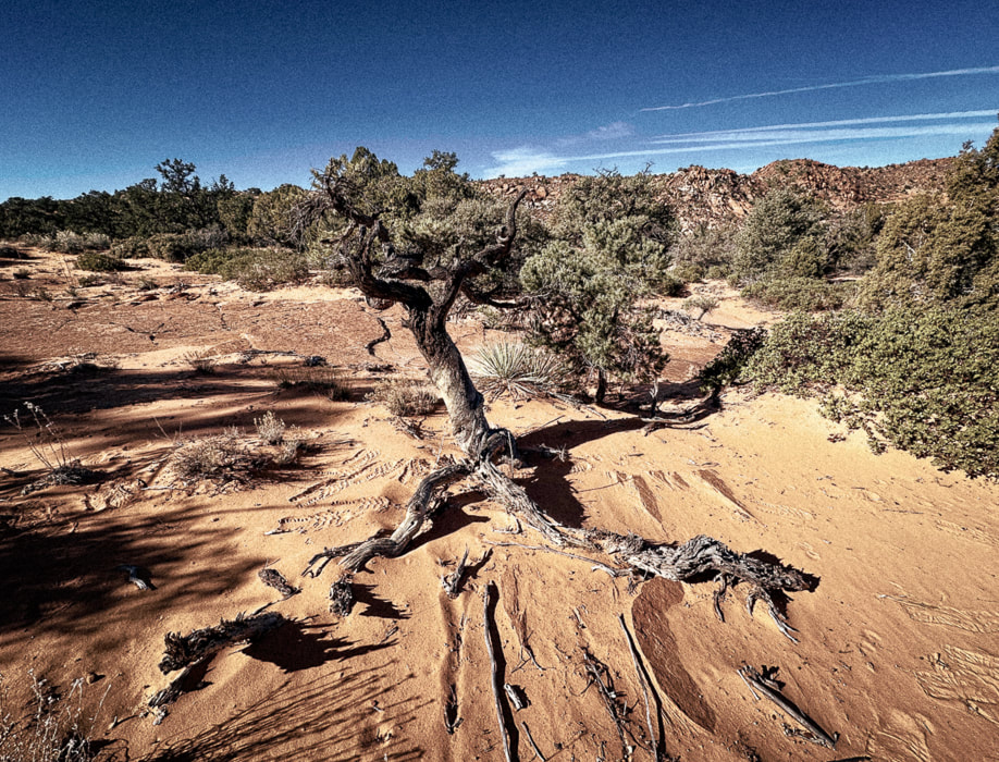 Life and death on the Colorado Plateau: beauty and grace in a dead juniper.  On top of Red Mountain: lots of sand and shrubs to negotiate. 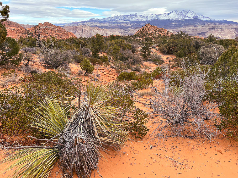 The first view of "On Top of the World" highpoint (red cone to the right). Snow-covered Pine Valley Mountains on the horizon. This photo was taken last winter when we had record snowfalls in southwestern Utah. 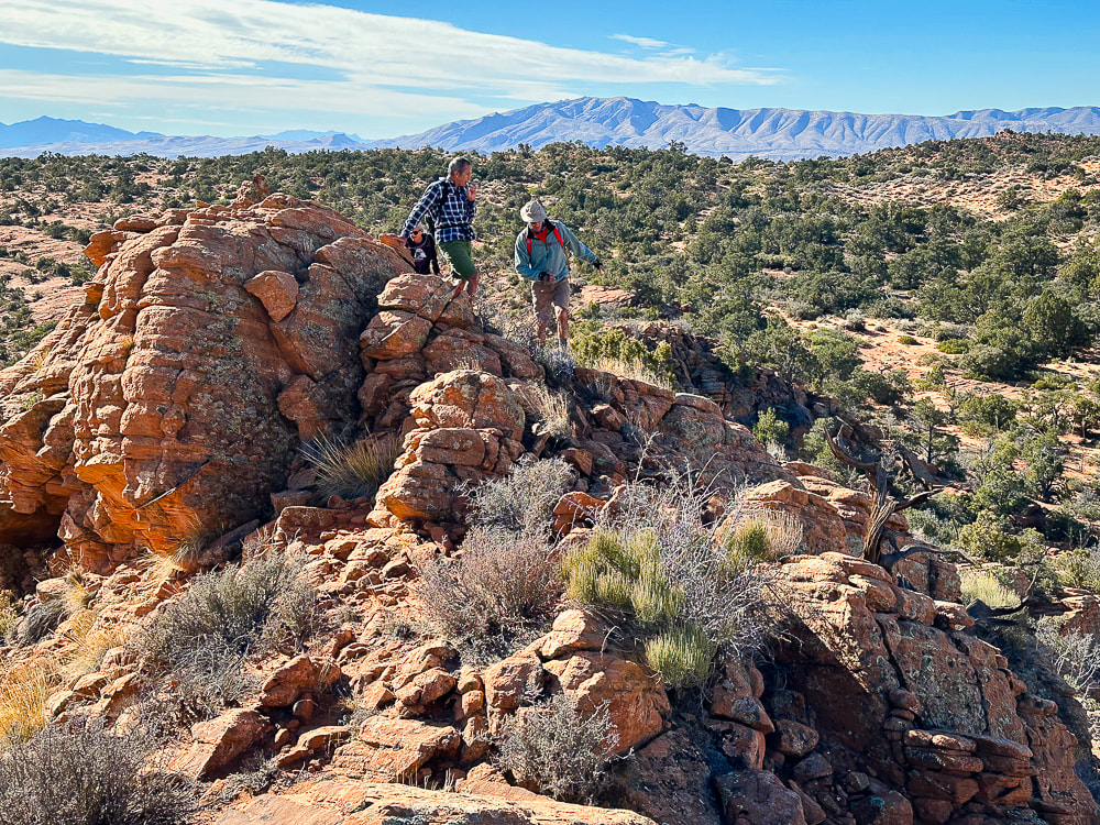 We have just walked across the pinyon/juniper scrub land behind Fred and Jeff and are starting up the ridge to our summit. Beaver Dam Mountains on the horizon to the west. 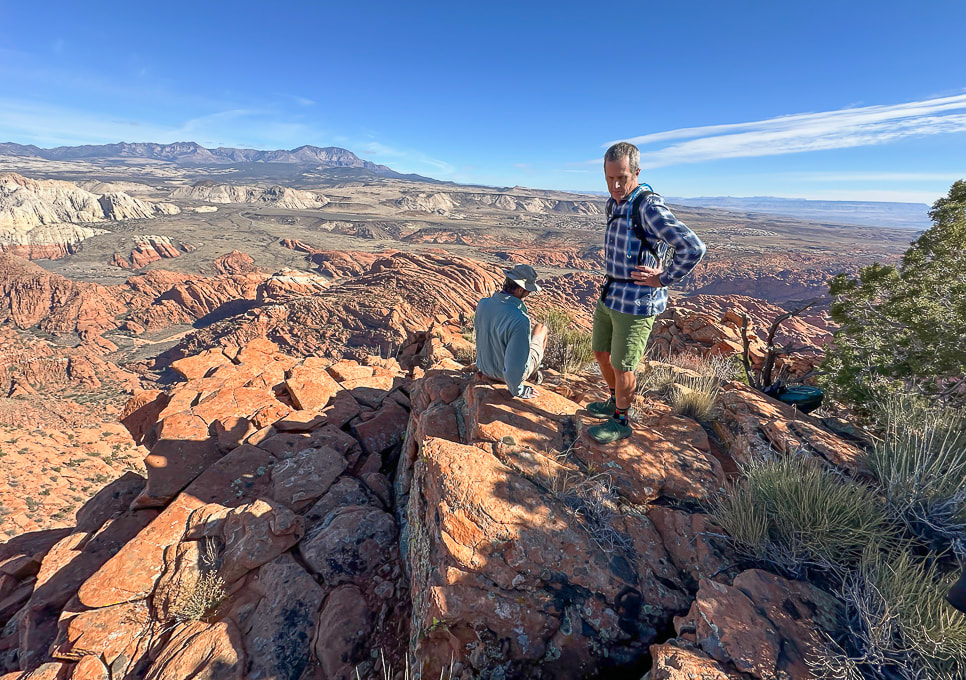 "On Top of the World!" 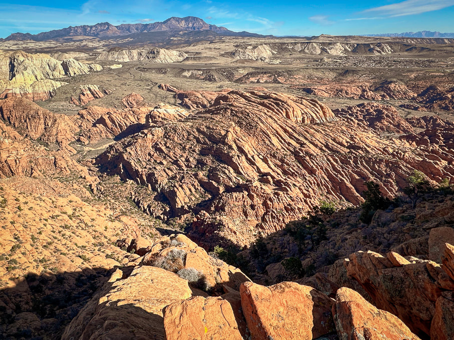 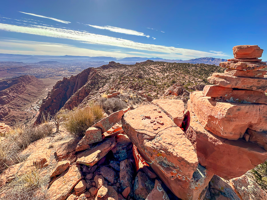 A cairn marking our summit and a view of Tuacahn Center for the Arts lower left. View is looking south at Ivins and St. George, Utah and toward Arizona on the horizon. 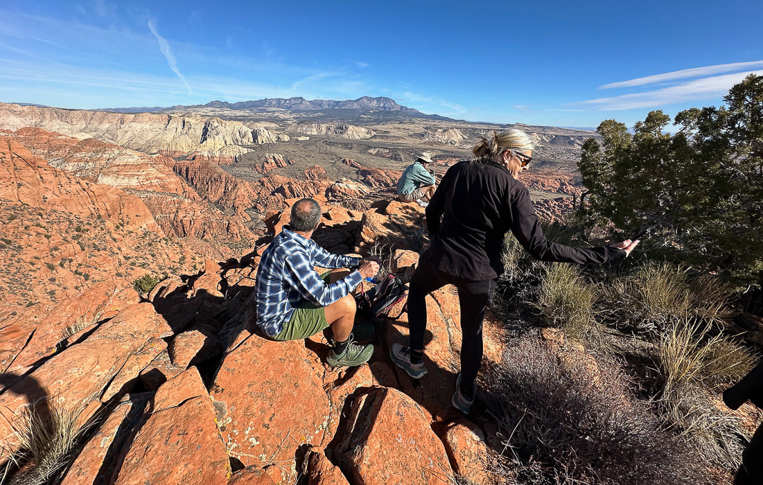 Jeff and Lindy - Happy New Years!  Dan (who named this summit "On Top of the World") in a photo from last winter.  The road in the valley is the drive through Snow Canyon State Park. Note the black shrub-covered basalt flows mid/upper in photo, covering the Navajo Sandstone. 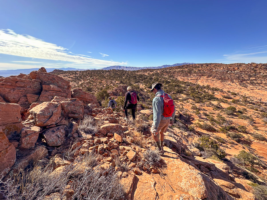 Heading back. As soon as you get over the saddle in the foreground, you drop into sand dunes and washes, then a brief climb up a sandstone ridge to find your entry point onto the plateau. Navigation experience on unmarked terrain is essential so you don't get lost. I recommend taking a GPS point when you finish the 0.8 mile climb from the trailhead to the plateau entry. 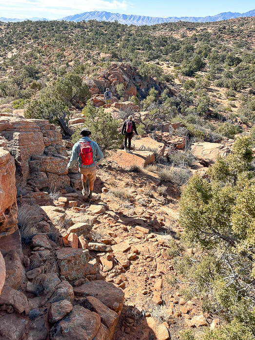 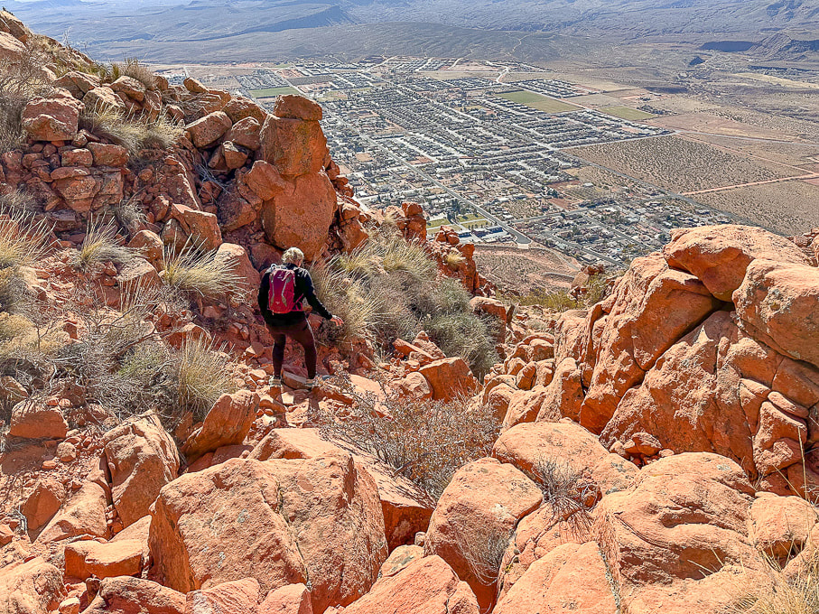 Heading down off the plateau of Red Mountain on Red Mountain Trail. Overlooking the city of Ivins. 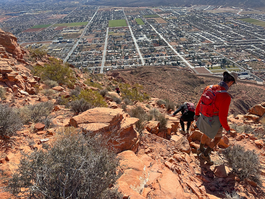 City of Ivins below. 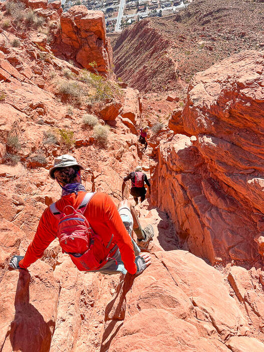 Descending through Class 2+/3 cliff band. Below us is the trail on top of the ridge. 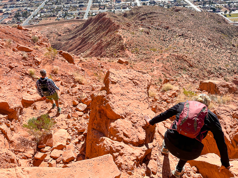 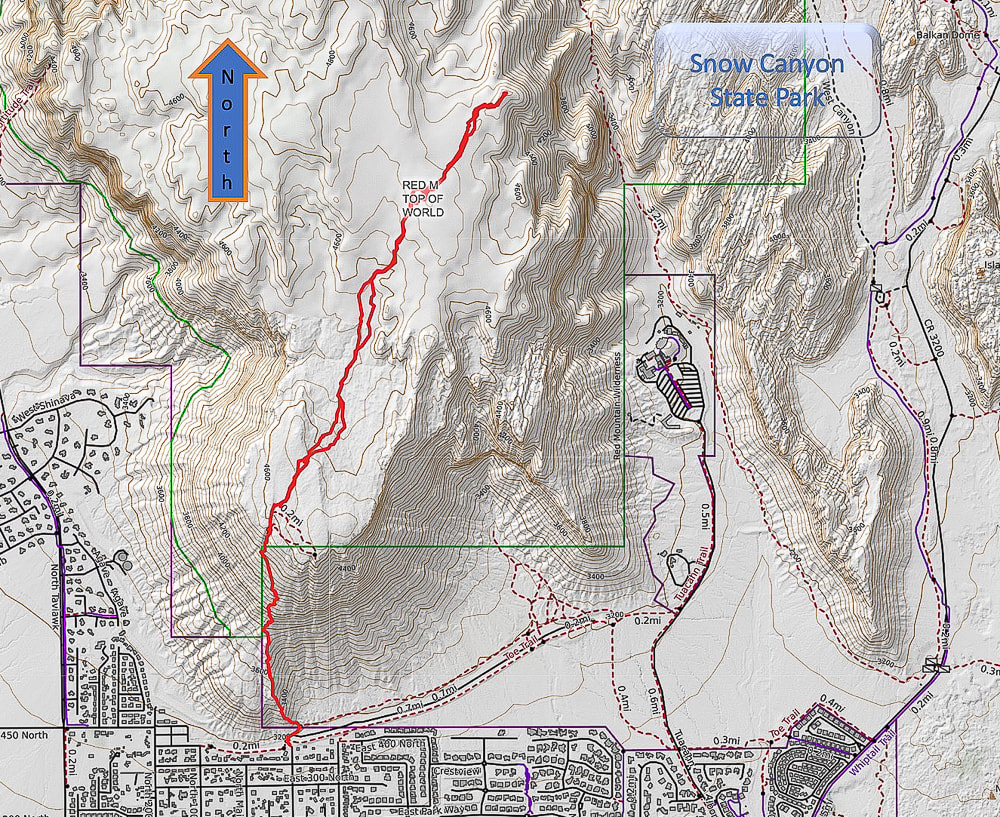 Caltopo Map of our GPS tracks. 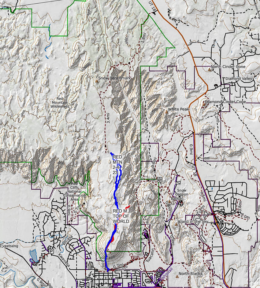 Caltopo map illustrating our hikes on the Red Mountain Primitive Trail. Red tracks = "On Top of the World" hike. Blue tracks = our hike on 2/4/23. Dashed line = continuation of Red Mountain Primitive Trail past Snow Benchmark, to intersection with Snow Canyon Overlook, then ending at its upper trailhead. References
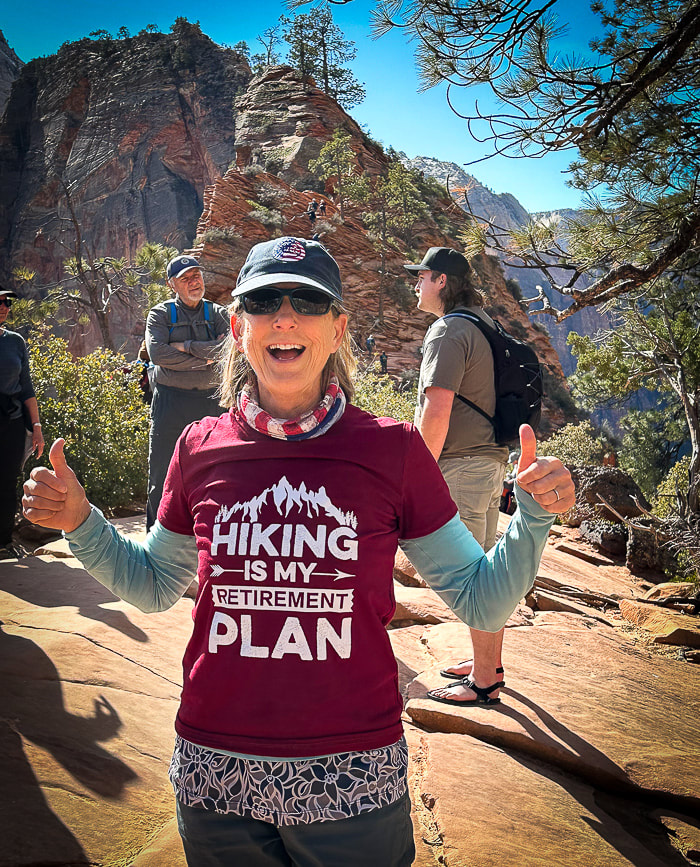
Bugden, M. Geology of Snow Canyon State Park Cryptobiotic Soils: Jayne Belnap. Holding the Place in Place - USGS: Impacts of Climate Change on Life and Ecosystems. Red Mountain Wilderness Maps - Wilderness Connect Ecoregions of Utah - usgs.gov Geologic Map of the St. George and East Part of the Clover Mountains 30' x 60' quadrangles, Washington and Iron Counties, Utah. Biek, R.F., and others. USGS publications. Miller, R. Our Geological Wonderland: Snow Canyon State Park A rare chance to walk in water in Badwater Basin, attempts to climb Artist Palette Peak and Sheephead Mountain, and a wrap-up of 2023 hikes. 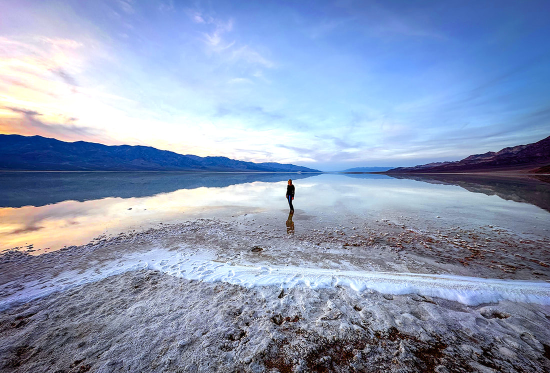 Sunset on Badwater Basin, Death Valley National Park, 12/23. photo by Fred Birnbaum Trip Stats
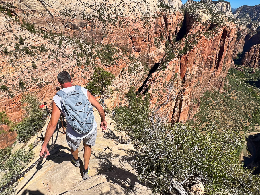
Peaks Attempted: Artist's Palette Peak, east Death Valley National Park, and Sheephead Mountain, Ibex Wilderness (southern Death Valley). Dates hiked: December 15 and 16, 2023. Maps and Apps: Trails Illustrated Death Valley National Park #221. Used Stavislost.com for Artist's Palette Peak and Sheephead Mountain routes. Lodging: Shoshone Inn at Shoshone Village, southwest of Death Valley NP. Geology: Tectonic processes relatively young; rocks are old Precambrian - 1.8 billion years ago. Schists and gneisses that have been uplifted and exposed, located in the Panamint Mountains to the west of Death Valley and Badwater Basin. Paleozoic - 550 million years ago. Limestone and dolomite in warm shallow seas. Late Paleozoic/Mesozoic - 225-65 million years ago. Pacific plate subducted under North American plate, causing melting ---> magma and volcanism. Jurassic and Cretaceous - magma chamber production ---> cooled intrusions that formed the Sierra Nevada mountains ---> some of these plutons spread eastward to Death Valley. Compression caused thrust faults (older rock thrust over younger rock). Cenozoic - 66 million years ago - present. Extension (spreading) caused volcanism Related Posts 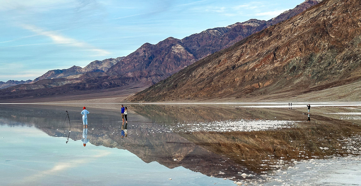 One of the photographers at Badwater Basin's lake. Our Trip - Badwater Basin, Artist's Palette Peak, Sheephead Mountain On August 20, 2023, Tropical Storm Hilary dumped a year's worth of rainfall on Death Valley National Park, transforming famous Badwater Basin into a spectacular sight: a huge turquoise-colored, salt-rimmed lake reflecting massive mountains on both sides. This rare occurrence is reminiscent of Pleistocene Lake Manly, a deep ice-age body of water that once filled this basin and dried up about 10,000 years ago. Although not as deep and extensive as its predecessor, it was still an amazing sight to see, especially at sunset. Badwater Basin, the lowest point in North America, is normally a salt flat cut into hexagons, and freeze/thaw hummocks - soft yet crunchy to walk on. Fred and I had hurried from Shoshone Village, a 45-minute drive to the southeast, to get there by sunset. There were a few other photographers, their mirror-images appearing unbroken in the still, shallow, and salty water. It was so quiet and remote that we could hear their conversations. For the past three years, we have stayed and hiked in the Death Valley National Park area during the Christmas holiday. In 2021, we hiked Pahrump Point out of Chicago Valley in the Nopah mountains with our friend Scott. In 2022, Fred and I hiked the awesome Pyramid Peak in the Funeral Mountains, and in 2023 we got to experience the magic of Badwater Basin's reflections and also hike Artists Palette Peak and Sheephead Mountain in the Ibex Wilderness. Hikes are challenging in Death Valley, a rough and rocky place - remote, stoic and mysterious. That's why we love it. A land that has experienced a lot of turmoil, yet stands defiant. 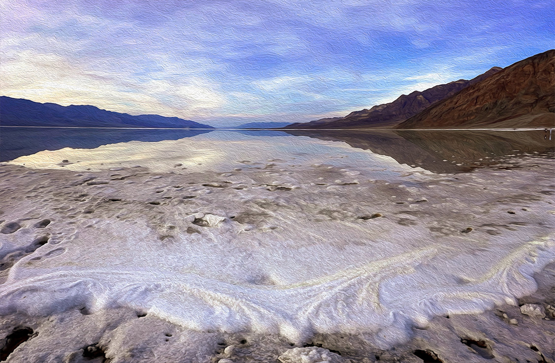 How Long will Badwater Basin's Lake Last? The depth of the lake was about four inches where I stood after walking through thick (and sharp!) salt deposits at the lake margins. The evaporation rate in Death Valley is 120-150 inches per year. I read one source that stated the depth was two feet right after the storm. The evaporation rate is the highest in the U.S., so get out and see it soon! The Landsat images below show relative evaporation in 10.5 weeks (images 2 and 3). Note that the northern, smaller body of water appears to have mostly dried up already. 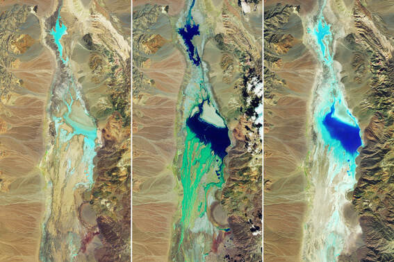 National Aeronautics and Space Administration (NASA) Landsat Images of Badwater Basin in Death Valley National Park. Water appears in shades of blue. Image #1 taken 7/5/23 shows little moisture. Image #2 taken 8/22/23, two days after Tropical Storm Hilary's record rainfall. Image #3 taken on 11/2/23, 10.5 weeks after the flooding, shows some evaporation. NASA Earth Observatory images by Wanmei Liang, using Landsat data from the U.S. Geological Survey. 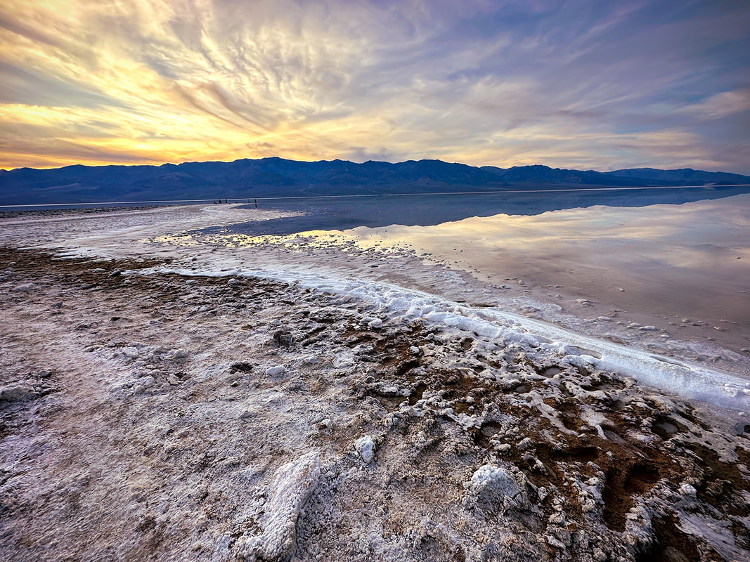 Sodium chloride (table salt) crystals accumulated around the perimeter of this year's lake that filled in part of Badwater Basin, a rare event. This lake has the greatest evaporation rate in the U.S. 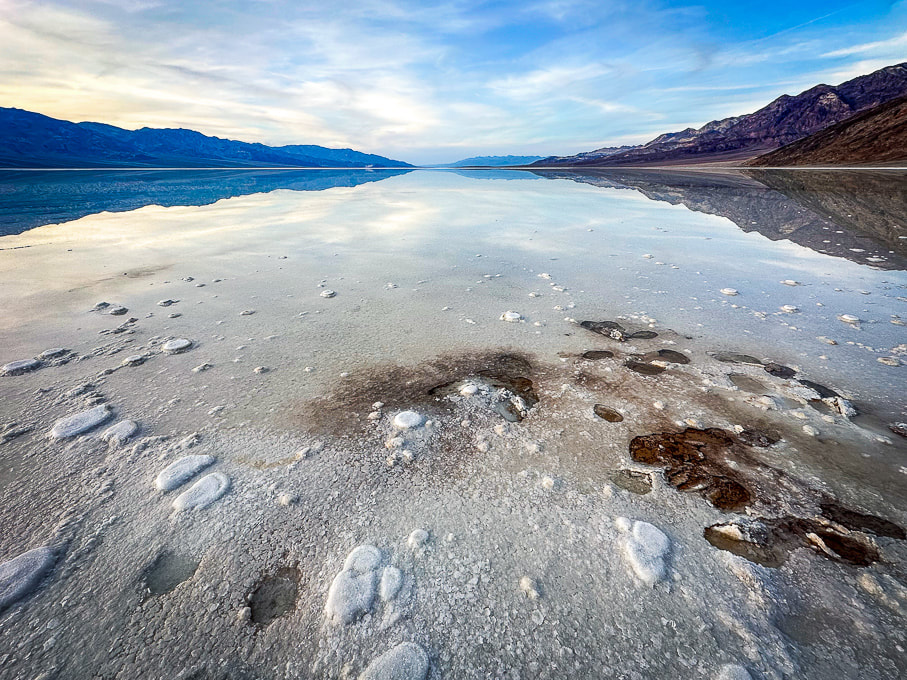 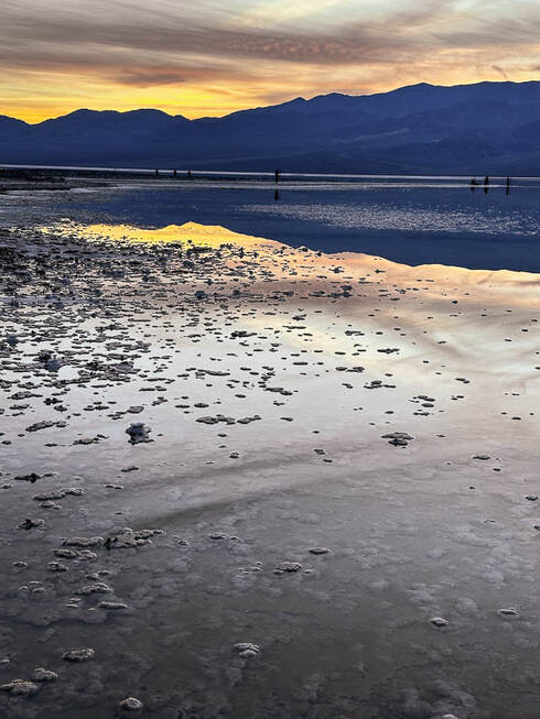 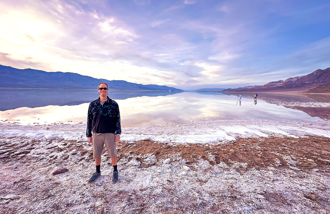 Fred at the salty Badwater Basin, the lowest point in North America - a sublime setting. 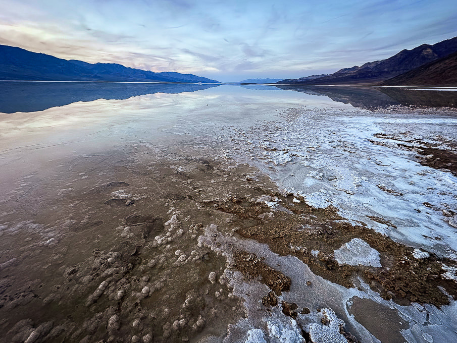 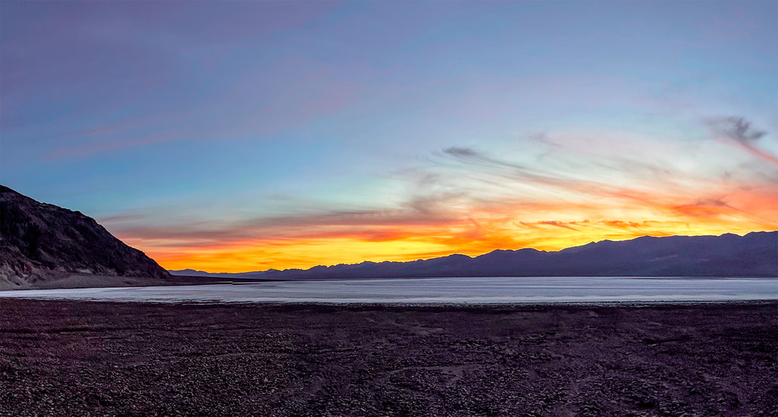 Artist's Palette Peak and Sheephead Mountain Our experience with gnarly-looking loose, slippery scree slopes (Idaho's Leatherman Peak is one) and Class 3 boulder obstacles made us turn back once we got closer to these summits. Both of these hikes involve Class 2 and 3+ route-finding, as there are no trails or markers. I frequently go to stavislost website to plan summits, and study topo maps to understand the terrain. Maybe we are, in our 60's, getting too old for these treacherous scrambles - or we just don't want to put ourselves through the frustration! Seems like we've had more "grudge peaks" than usual this year. 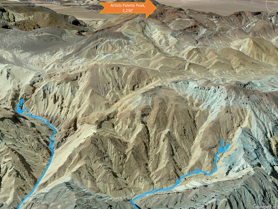 Tough Terrain to Artists Palette Peak, top of image (looking south). Another Grudge Peak! Our GPS tracks in blue. Twenty Team Mule Canyon to the left, we ran into Class 3+. Steep and loose talus slope out of canyon to the right. We began ascending Artist's Palette Peak via Twenty Mule Team Canyon heading mostly south, after parking on 20 Mule Team Road, accessed from Highway 190. Evidence of a recent heavy wash-out with a freshly-carved stream (maybe from Tropical Storm Hilary?) coursed through the canyon floor. Huge boulders had been dropped into the canyon. We scaled a small waterfall and had no difficulty until we reached a Class 3+ boulder obstacle, blocking our progress. Shortly before this, we were able to hoist ourselves over a huge tilted boulder by standing on unstable rocks piled up against it to make a platform (glad I had Fred to help me place my feet in the right spot on these tippy rocks on the way down!). Hoping we were golden but discovering we were not after the next canyon turn, we tried a few ways to get past the next boulder array but decided to descend and try a different canyon. It would have meant climbing a very steep and loose slope of gravel, where I was slipping more than I was ascending. 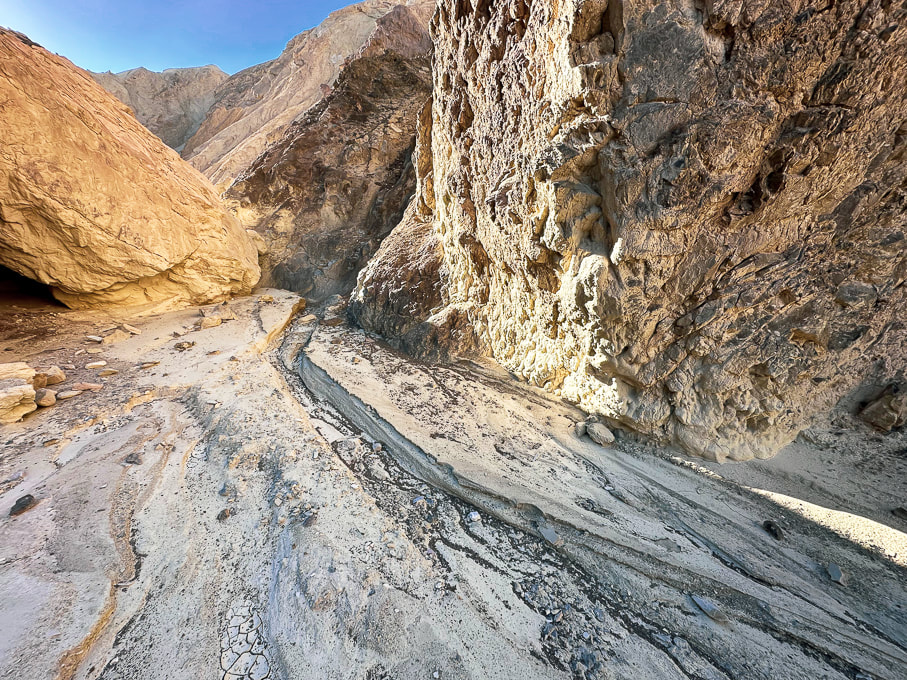 The canyon floor had signs of a recent wash-out. Twenty Mule Team Canyon 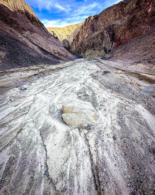 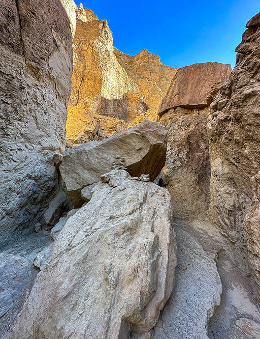 Toward the top of Twenty Mule Team Canyon - we were able to ascend this narrow, wobbly stack of rocks to hoist over this boulder but then met up with Class 3+ moves after this that proved too intimidating. The obstacle in the above photo is where another Artist's Palette Peak hiker who recorded his trip on Peakbagger website turned around. Stav Basis, in his route description of this hike advises that if you are hiking Twenty Mule Team Canyon to ascend it rather than descend it to make sure you can maneuver the Class 3+ stuff and you don't get stuck. The next canyon we attempted to the northwest of Twenty Mule Team Canyon had footprints in it, possibly from a group of hikers we saw at the trailhead. We followed it, fun scrambling over easy walls, until we were diverted out of the canyon to see a steep and loose talus slope with no end in sight. It's frustrating to know that "obstacles" like this get in your way of seeing your intended peaks and knowing there was less-steep terrain above. But that's why off-trail route finding in Death Valley is so rewarding - you have really earned the view from the summit and the access to the peak register. There is no other place like Death Valley's terrain - mostly devoid of vegetation. Rocks and sky predominate, but sometimes you get a remarkable surprise, like the blood red and magenta Desert five-spot flower growing in the gravel (photo below). 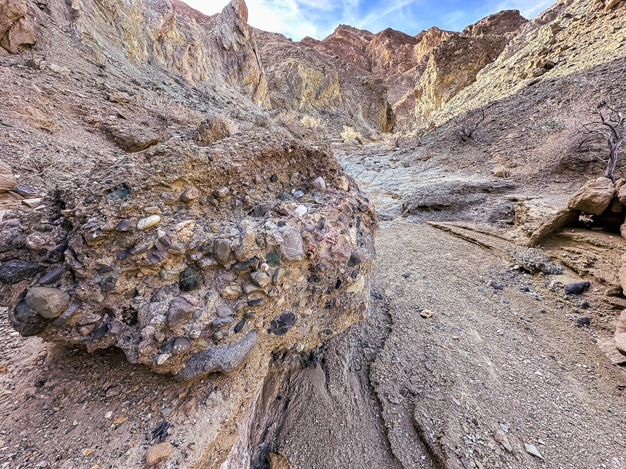 Conglomerate boulder containing mostly rounded cobbles from long-ago streams. 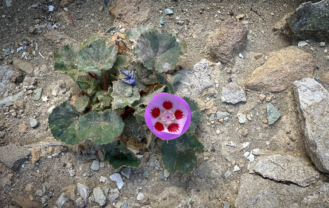 Desert five-spot Eremalche rotundifolia 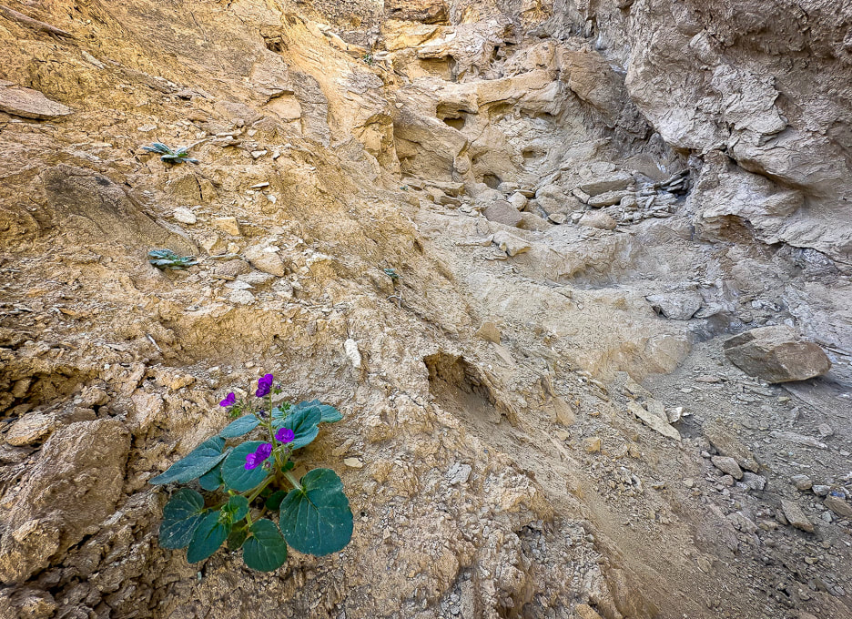 Route up canyon on the right - fun scrambling. 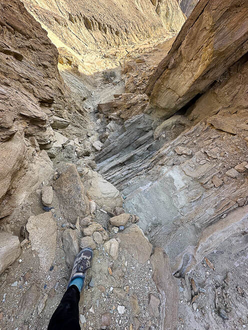 Looking down a "rock ladder" we climbed from the canyon floor. Shortly after this we came to the steep and long loose talus slope and decided to turn back. Sheephead Mountain (13 ascents on Peakbagger - A Sierra Club Desert Peaks Section Peak) I had been looking forward to hiking in the Ibex Wilderness, so the next day when we hiked to Sheephead Mountain, we were remote and alone, except for the occasional motorist on Highway 178, which begins at Shoshone, then heads west through two passes to turn north as it becomes Badwater Road, hugging the east side of Death Valley. We parked in a pull-out at Salsberry Pass, about 12 miles from Shoshone. The faint trail that headed southeast toward Sheephead soon became non-existent, so the approach was a maze of red washes and rubbly hills. We located our daunting-looking mountain to the south. We ascended a rotten, slippery and steep ridge of yellow scree too soon. Once we got on top of this yellow high point, we realized it would have been easier to ascend the red ridge just to the south, leading more directly to the saddle on the final ridge to Sheephead, which looked like a tower with more loose scree slopes flanking its sides. We didn't have the motivation in us to attempt the rock piles. From the saddle we found an easier way down over a ridge and then dropping into a wash. We instead walked back to the highway, crossing it and wandering on a ridge toward Salsberry Peak, seeing occasional bighorn sheep signs. Wrap-Up of 2023 hiking - The Year of Grudge Peaks This year we did more remote desert route-planning and finding on unmarked terrain with no trails in Utah's Zion Wilderness and San Rafael Swell, Nevada and Death Valley. Occasionally we see cairns that let us know some other hardy souls had stood in the same place. Walking without a trail takes more time. As a result, we had more "grudge peaks" this year - ones where we did not make the summit. Mummy Mountain was the most frustrating; we were within 200 feet of the summit and ran into a deep and steep snow-filled gully with no great footing to get out of it to a narrow shelf to the top. Scott, Fred and I will hopefully try this summit again but from the more-used trail on other side of the mountain. Other "grudges" this year were Hepworth in Zion, and Bearing Peak in Lake Mead National Park. Moapa's knife's edge we're not sure we would attempt again. Successful summits included Shelly Baldy in the Tushars, Mt. Kimball in Tucson, Jackson Peak near Boise, and Burger Peak in Pine Valley Mountains. And, the summit of Angels Landing was sweet because we got to hike it with my sis and bro-in-law. One of my favorite authors, Willa Cather famously said, "The road is all, the end is nothing." As far as reaching summits, I would have to respectfully disagree. The way to the summit is a great experience, but to stand on the summit after you've worked hard to climb it is even sweeter. So, is it our age or the pursuit of more technically challenging hikes that are preventing us from reaching our goals? I like to think it's a little of the first and mostly the last of those two reasons. Should we focus less on goals and more on appreciating just "being out there?" - not to always define "success" as achieving a summit? Of course, I love being out there in our American West, but my goal-driven trait wants more. At any rate, it's been fun to try something different and work on navigation skills in more remote country. I count myself as one of the lucky ones who gets to even consider this conundrum in the first place. Keep On Exploring! 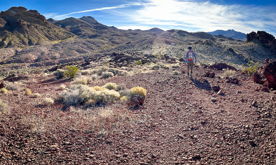 Walking southeast toward Sheephead Mountain (with notch on horizon 1/3 in from left). 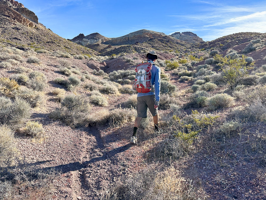 Sheephead Mountain on horizon to the right. 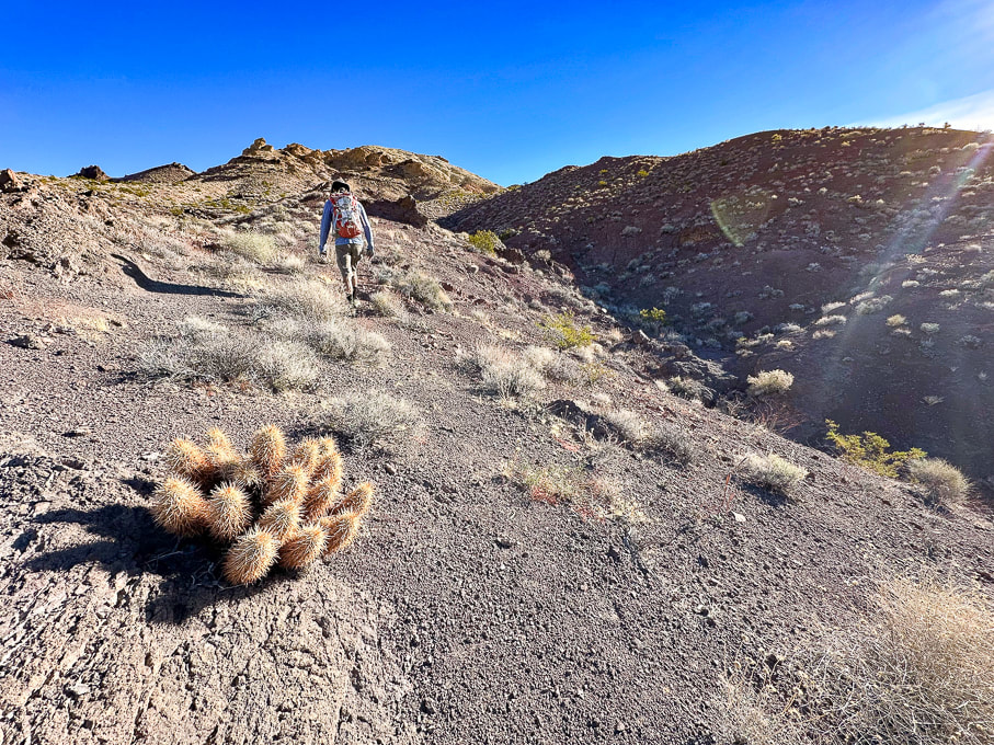 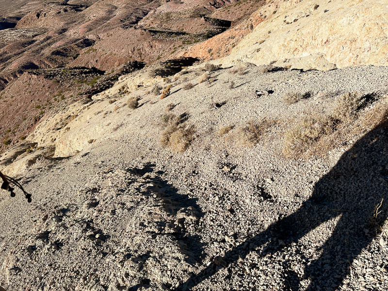 The loose and steep yellow scree slope we ascended, but didn't descend. 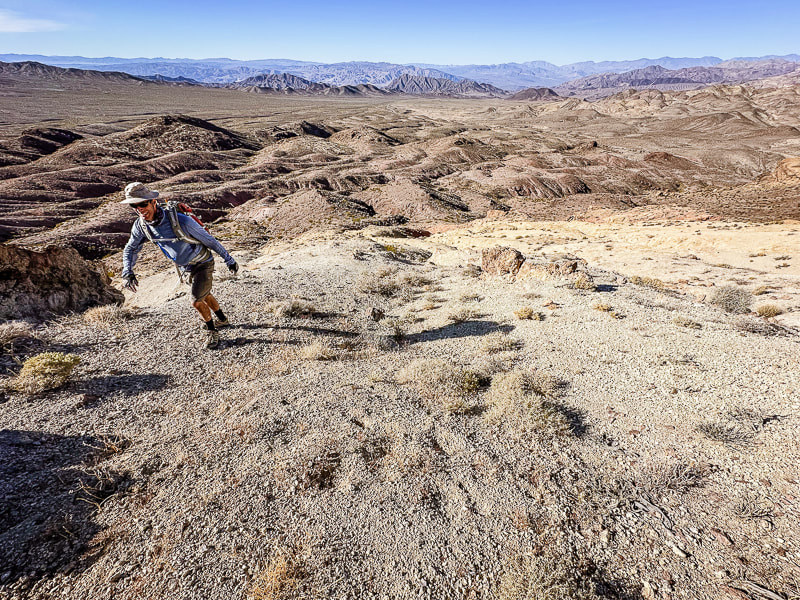 Reaching the top of the yellow scree slope and the ridge leading to Sheephead Mountain. 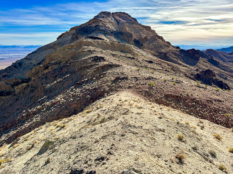 Ridge leading to Sheephead Mountain. We descended down the red slope to the right. 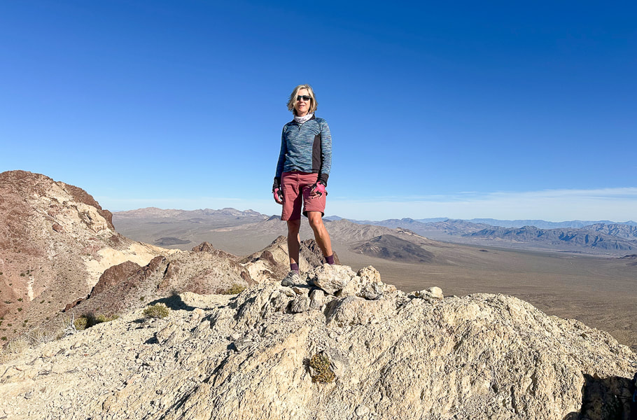 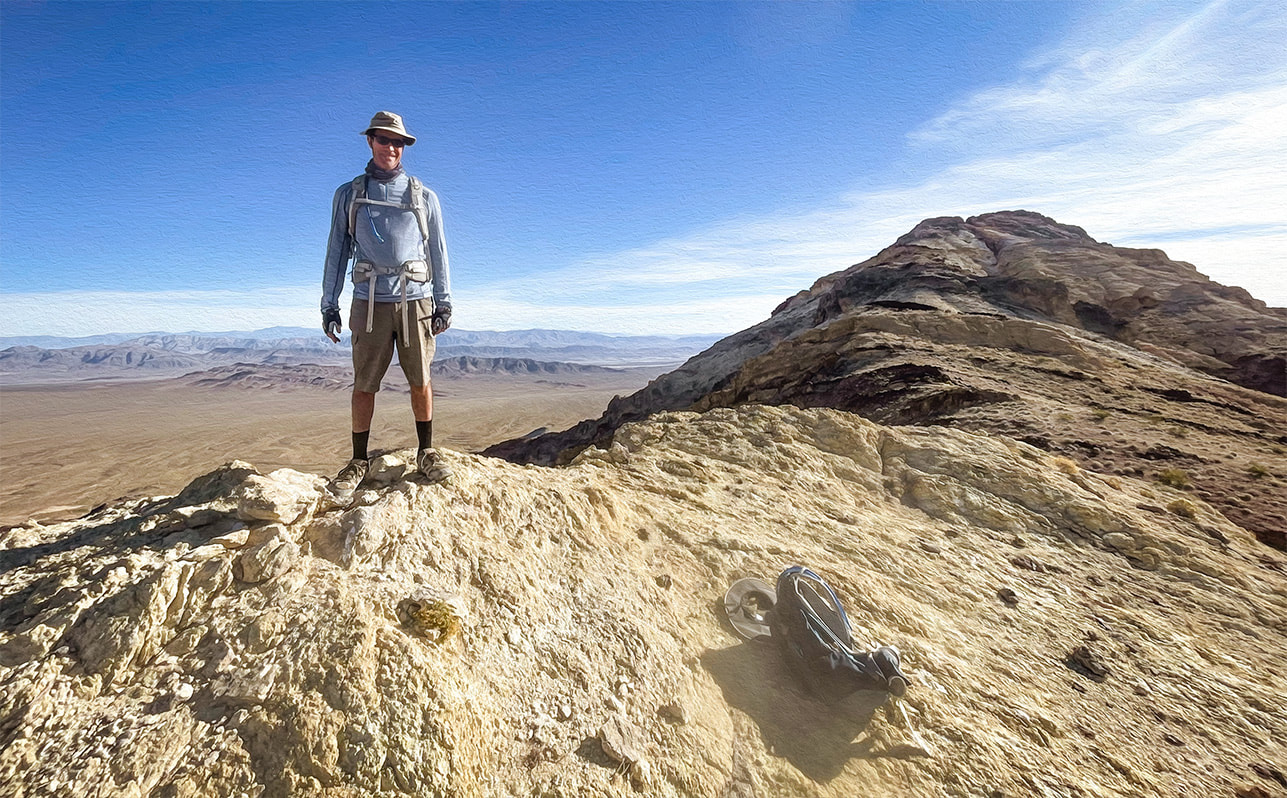 Fred at top of yellow ridge. Sheephead on horizon! 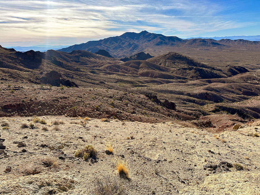 Looking southwest toward Talc Hills and Black Mountains. 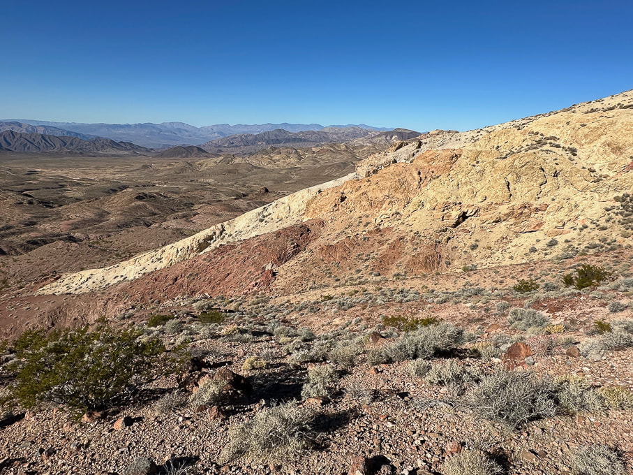 On our descent over red rocks - looking at our ascent over the not-so-fun loose yellow rock. Looking toward the northwest. 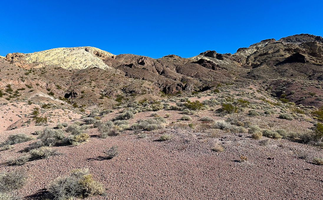 Parting shot - the ascent (Sheephead on the right) looks manageable from here!  Bright cobblestone lichen? A few more images near Zabriskie Point in northeast Death Valley National Park...    References
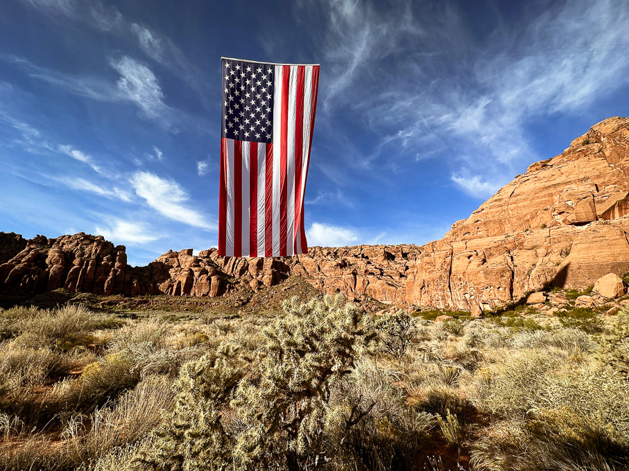
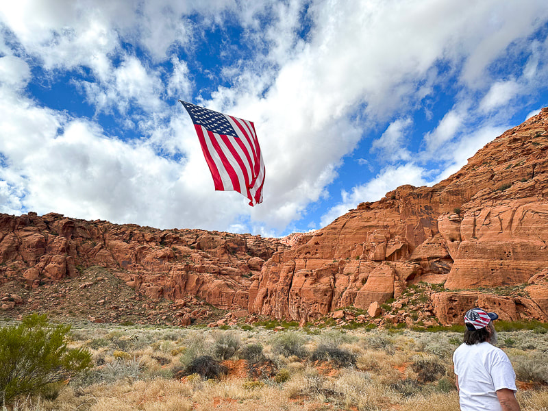
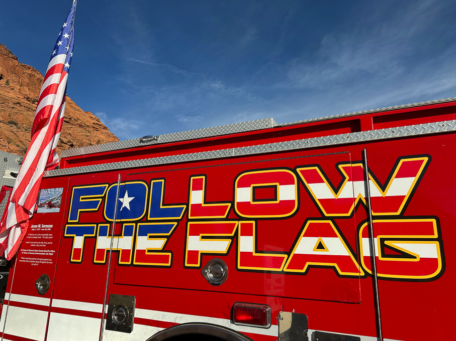
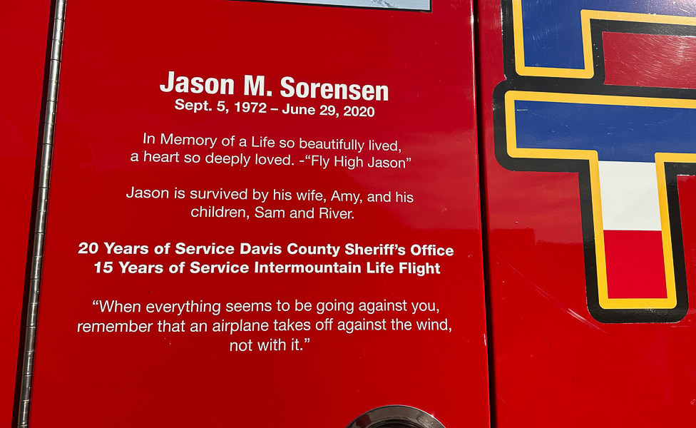
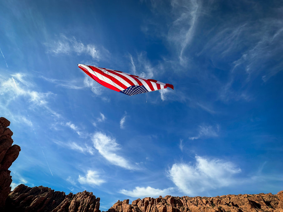
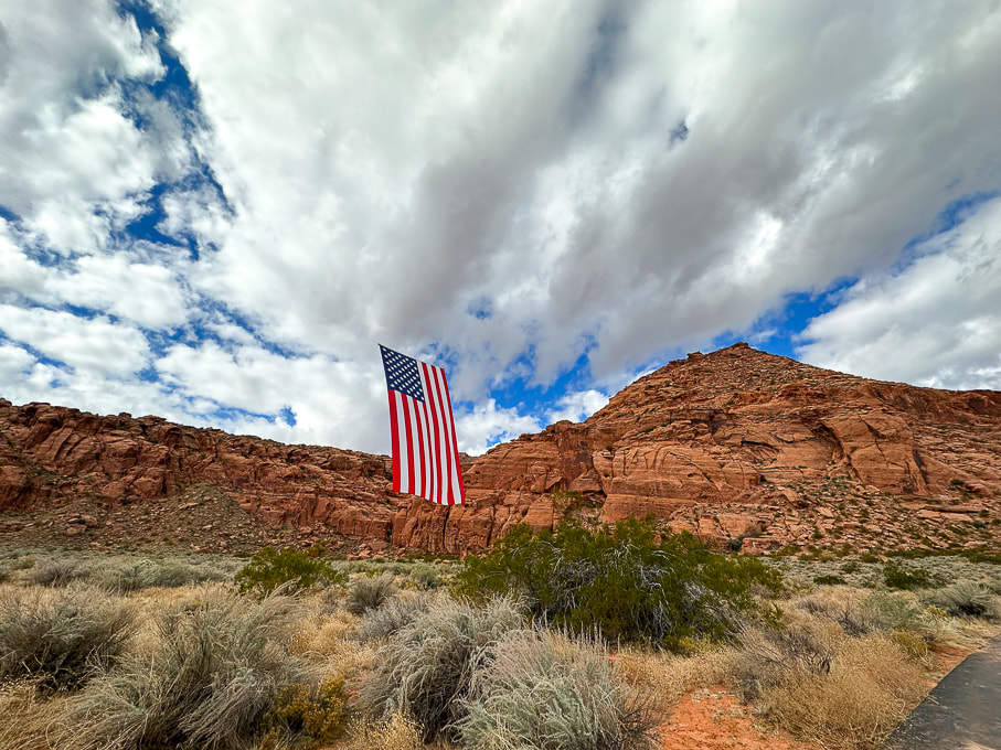
Fish, N. From Indiana University. https://sierra.sitehost.iu.edu/papers/2008/fish.html Doermann, L. NASA Earth Observatory. Floodwaters Fill Badwater Basin. Hunt, C.B., et al. 1966. Hydrologic Basin Death Valley California. Geological Survey Professional Paper 494-B. A stunning sight on Veteran's Day: the largest American flag juxtaposed with the soaring cliffs of Snow Canyon State Park. 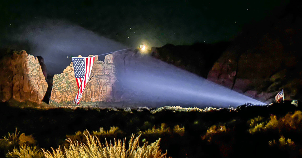 Lady Liberty, displayed by Follow the Flag organization, at night in Snow Canyon State Park, Utah. Photo by Ann Little Related pages in Explorumentary: Follow the Flag Organization Facts
Check out awesome drone footage in these great videos! Saville Creations: America's Largest American Flag in Snow Canyon St George News Founders: Kyle and Carrie Fox
Motivation: To strengthen Americans' patriotism, a simple idea of inspiring, strengthening and healing people by hanging one of their huge flags in a canyon produced "far more impact than ever anticipated." Other events:
Mission Statement
American Flag Etiquette
Click on video below for awe-inspiring drone video
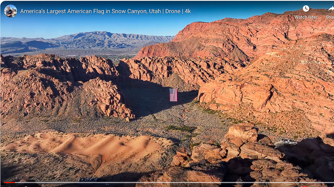
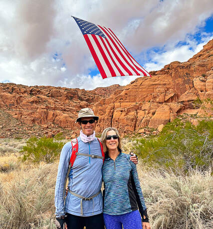
An unexpected sight greeted Fred and I on our favorite local loop-hike last month in Snow Canyon State Park. Just off Whiptail trail, suspended high in a gap between orange cliffs, hung an enormous American flag, seemingly out of place in in these walls of Navajo Sandstone. People were lined up, taking pictures of this spectacular sight. The flag, in the still air hung vertically, but billowed and rolled with occasional breezes, the bottom edge of it flying gracefully towards the sky. It was suspended in mid-air, with its hanging wires barely visible. I suppose you could ask what visitors were thinking about this huge flag in this gorgeous natural setting and you would probably get different answers, ranging from the emotion of national pride and patriotism to "Wow! That's pretty cool!" to "Why is it hanging here?" For me, my heart swelled because two things that I love were juxtaposed: a symbol of my country and the land of the American West.
Strength, unity, connection, freedom - these are what the American flag is intended to signify. The stripes represent the original 13 colonies that were seceding from the British. The blue canton contains the stars of our 50 states. Blue represents vigilance, perseverance, and justice. White signifies purity and innocence, and red signifies hardiness and valor. This proved to be a good exercise in brushing up on my flag facts, reading America's unique Declaration of Independence, and learning of the efforts going on to unify our country. Pew and Gallup polls show that a record high number of Americans perceive the nation as divided on the most important issues. Maybe Follow the Flag and other organizations can help us see the positive and help us remember the ideals of our country's origin. "...if there’s one impression I carry with me after the privilege of holding for five and a half years the office held by Adams and Jefferson and Lincoln, it is this: that the things that unite us — America’s past of which we’re so proud, our hopes and aspirations for the future of the world and this much-loved country — these things far outweigh what little divides us. And so tonight we reaffirm that Jew and gentile, we are one nation under God; that black and white, we are one nation indivisible; that Republican and Democrat, we are all Americans. Tonight, with heart and hand, through whatever trial and travail, we pledge ourselves to each other and to the cause of human freedom, the cause that has given light to this land and hope to the world." - President Ronald Reagan's Independence Day Speech aboard the USS John F. Kennedy, July 4, 1986. 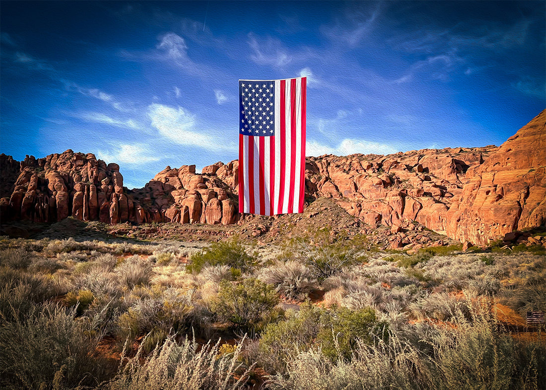 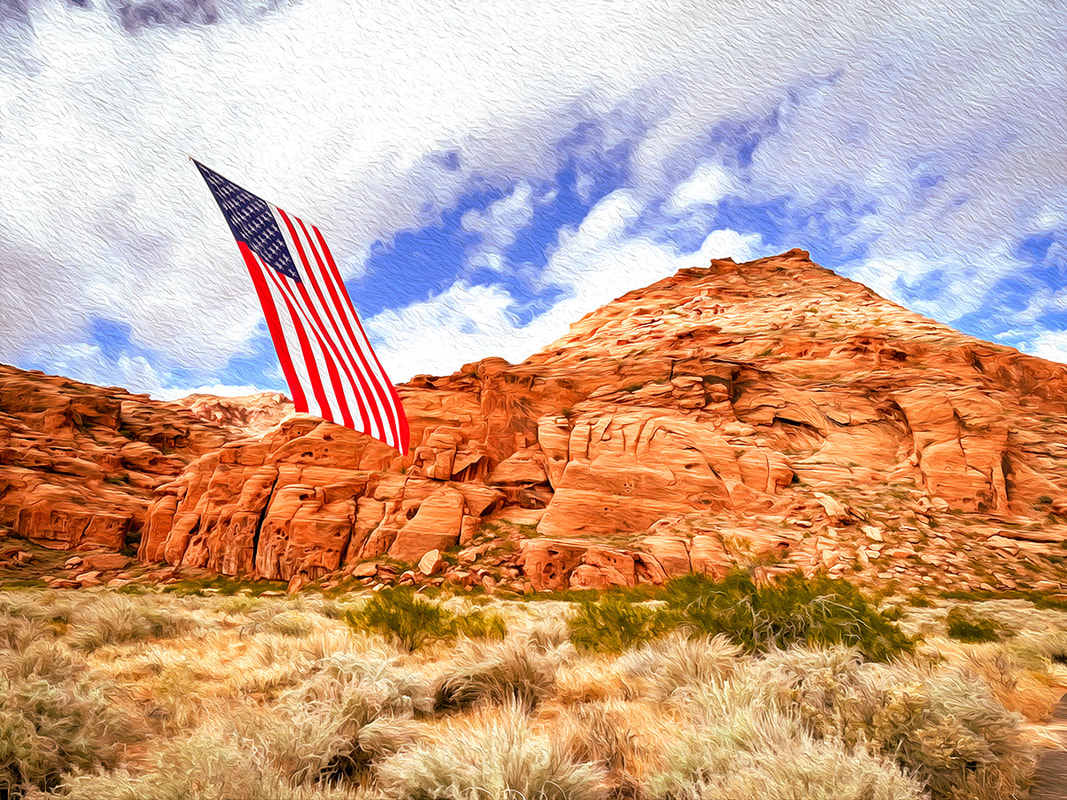 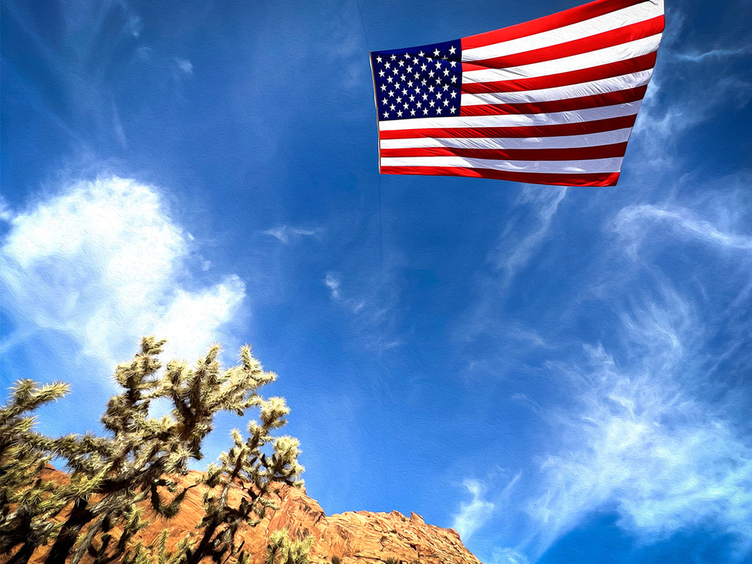 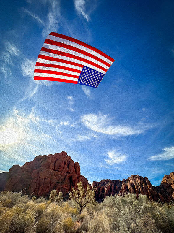
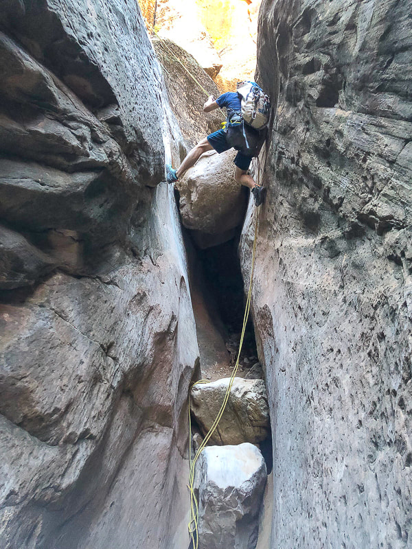
        A drop into the stained and polished Navajo Sandstone slot in this picturesque "beginner" canyon. 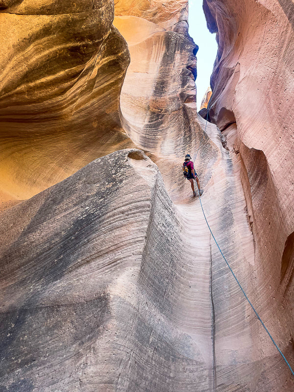 Sue entering Yankee Doodle on first and longest rappel, ~ 75 feet. photo by Fred Birnbaum Trip Stats Location: Dixie National Forest - Pine Valley Ranger District - ~ 1 hour drive northeast of St. George, Utah, near Leeds. Date: October 15, 2023 Canyon Rating: 3A/B1 (Technical, Dry and Pools, short time). Distance: ~ 2 miles roundtrip (~ 0.8 miles in canyon). Access: from FR031, a 25-mile dirt road connecting St. George and Leeds: best traveled with a 4 WD with moderate clearance vehicle, as this road can get rutted and rough after a rain. The canyoneering portion is just south of this forest road. Start: 37.2361, -113.4528 Links: Paragon Adventure/Canyoneering/Yankee Doodle Hollow Rope Wiki Geology:
Related Posts 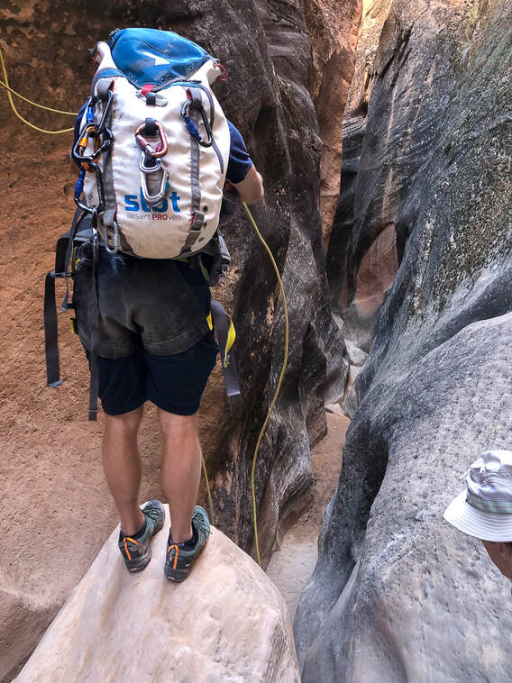 Brian gets the ropes ready on the next rappel anchor. Our Trip This time Fred and I decided to "leap" out of our comfort hiking zone and try something more challenging: canyoneering! Although Yankee Doodle Hollow is rated as a "beginner" canyoneering hike, rappelling - especially the first drop into the canyon - was a challenge for us. This brief foray into these beautifully-polished and sinuous narrows rated as one of our favorites for 2023. Also on my list of favorites is the "Subway" - Left Fork of North Creek in spectacular Zion National Park, another journey into rock carved by water. My friend Brian from CrossFit Dixie has been canyoneering in this area of southern Utah, including Zion. He invited me on previous canyoneering trips but I was always too intimidated to go. He guided us on this short foray, setting up the ropes on the rappel anchors and instructing us on how to control the rope in our rappel device. He got us all set up with our harnesses and locking carabiners. Brian's friend Jorey, who had never rappelled before, joined us. The joy on his face when he completed the first long rappel into the canyon and overcame his fear of heights was priceless. He was so afraid to take the initial "leap" into the void. Fred and I had learned climbing techniques on a guided Grand Teton hike, but I was still pretty nervous. Canyon Origins Not sure how this canyon got its name. Was it named by miners in the area, or Mormon Leeds settlers? Yankee Doodle Hollow Creek originates from the highlands under the cliffs of the Pine Valley Mountains. This area of southwestern Utah is complicated geologically-speaking, with uplifts, gravity slides, compressional structures (uplift), extensional structures (faults), and more. One look at the Geologic Map of St. George area and you might agree. So many rock units from Permian time (300 million years ago) until present. Although a shorter and shallower canyon compared to legendary Zion canyons, Yankee Doodle Hollow still has the pretty curved and smooth cross-bedded walls of spectacular Navajo Sandstone - one of nature's works of art. You don't have to get a permit or arrange for shuttles between canyon entry and exit points, like you have to do in Zion. After we had completed all of the down-climbs we did a Class 3 steep slick rock scramble out of the canyon, slightly rubber-stained from many climbing shoes, as it opened up to the left. The Class 2 path up to the rim was discernible. If you keep going past this exit point, you continue walking down Yankee Doodle Hollow, you intersect with Heath Wash, where you would take a left (north) onto Heath Trail, which takes you back to FR031. Fun stuff! Glad Brian finally got me out there. Hopefully we can do more canyoneering....but Fred and I always default to the above-ground adventures! Thank-you Brian for getting us out of our Comfort Zone! Push the envelope - Keep on Exploring! 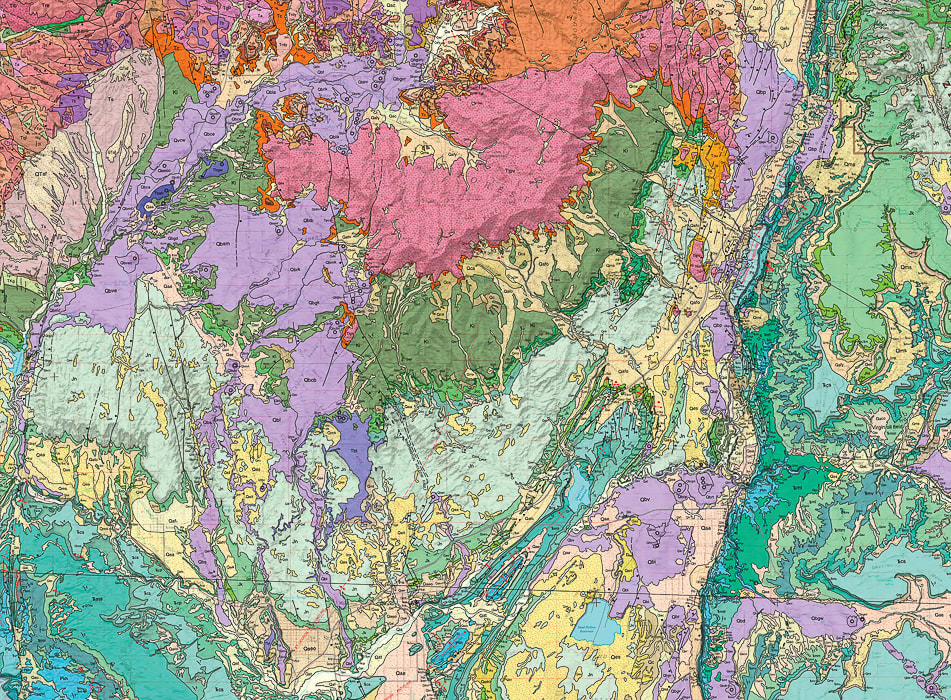 A portion of the GEOLOGIC MAP OF THE ST. GEORGE AND EAST PART OF THE CLOVER MOUNTAINS 30' X 60' QUADRANGLES, WASHINGTON AND IRON COUNTIES, UTAH by Biek, R.F., et al. The pink rock unit at top-center of photo is Pine Valley Mountains (quartz monzonite laccolith). The Jurassic Navajo Sandstone is the light-green unit that presents as a kind of semi-circle around the base of Pine Valley Mountains, a much older unit, that is the main rock seen in Zion National Park. The City of St. George is located at the bottom of the map. 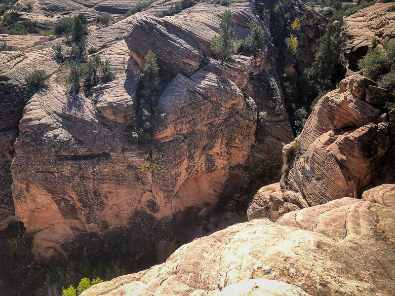 We are going to be down there soon - WOW! 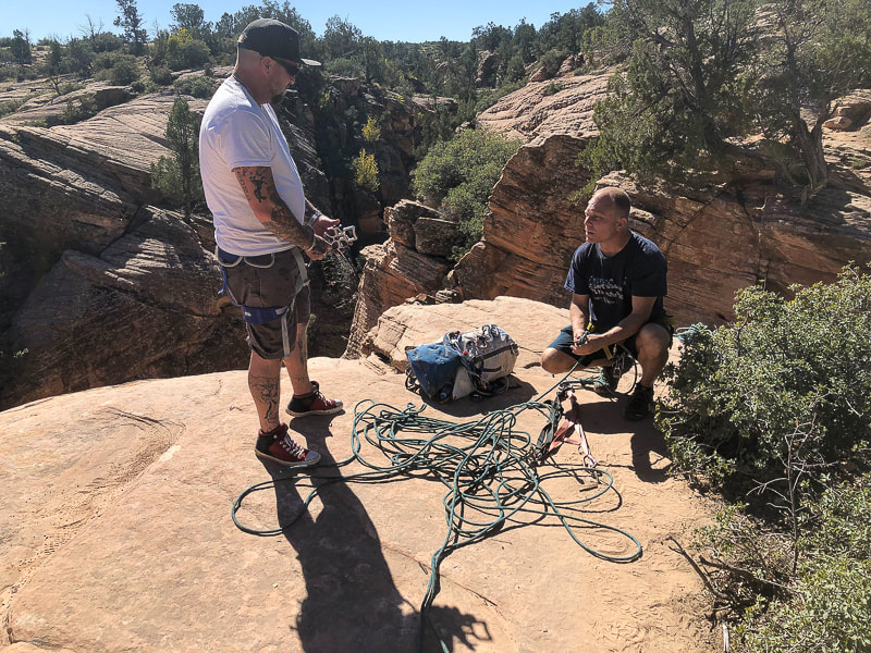 Jorey (canyoneering newbie) left, and Brian on the right, getting us all set up. 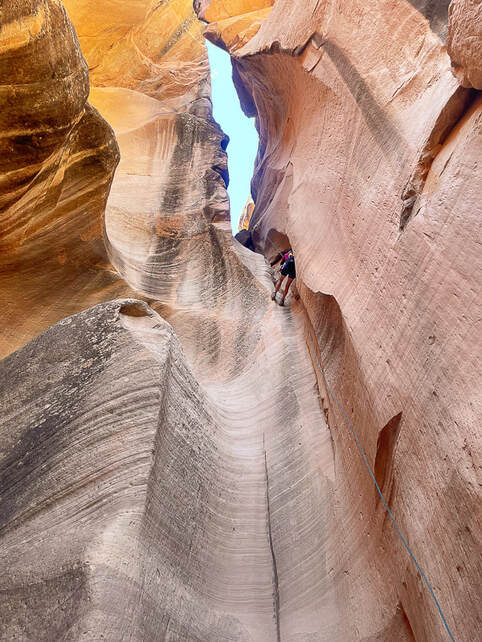 The first (and only) long rappel into the canyon, ~ 75', with two anchors. Photo by Fred Birnbaum 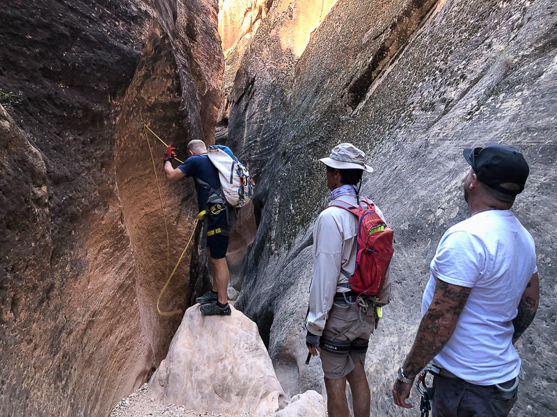 Brian getting next down climb ready. 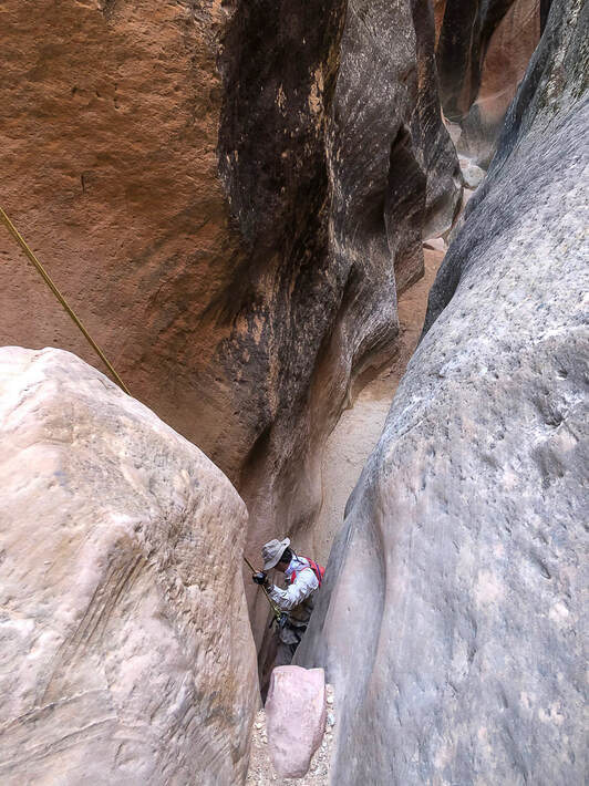 Fred on a short rappel.
 Canyon exit: steep smooth sand stone on the left, fractured rock falls on the right. 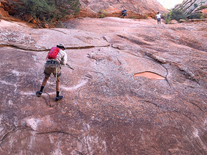 Pretty steep slick rock on the exit.  Wandering around afterwards in Brian's RZR side-by side ATV.  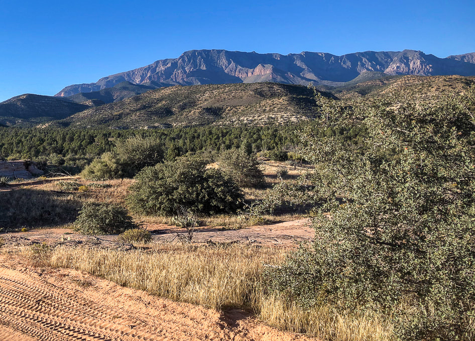 Pine Valley Mountains (monzonite porphyry laccolith) to the north. It's highest point is Signal Peak at 10,369'. Reference
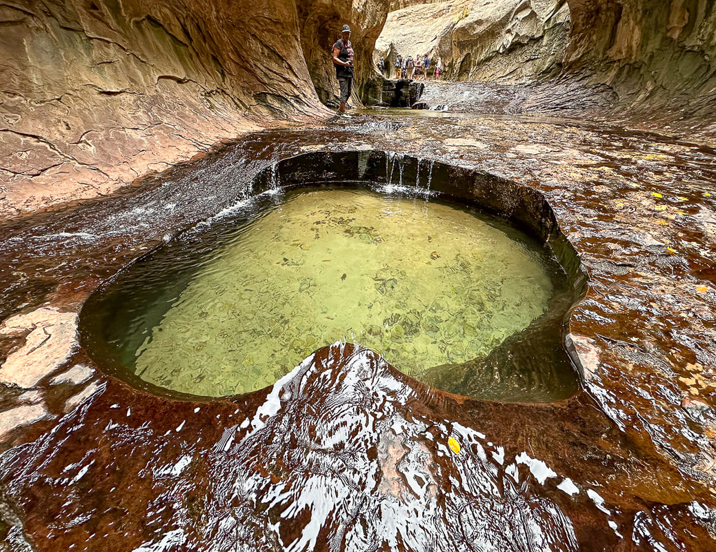
Biek, R.F. 2010. Geologic Map of the St. George and East Part of the Clover Mountains 30' x 60' quadrangles, Washington and Iron Counties, Utah. Utah Geological Survey. Explore one of southern Utah's famous and extraordinary places - the enchanting "Subway" and its beautiful waterfalls. 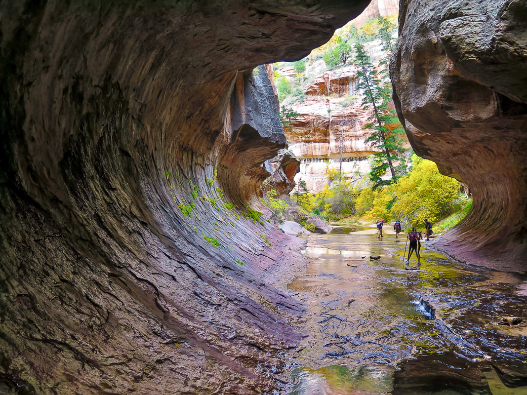 Walking into the "Subway", one of Zion National Park's iconic places. Trip Stats for bottom-up (non-technical hike)
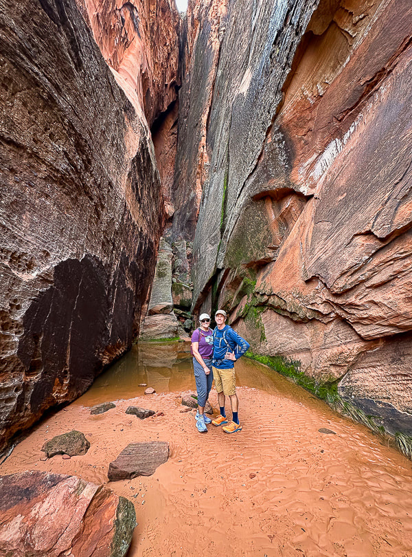
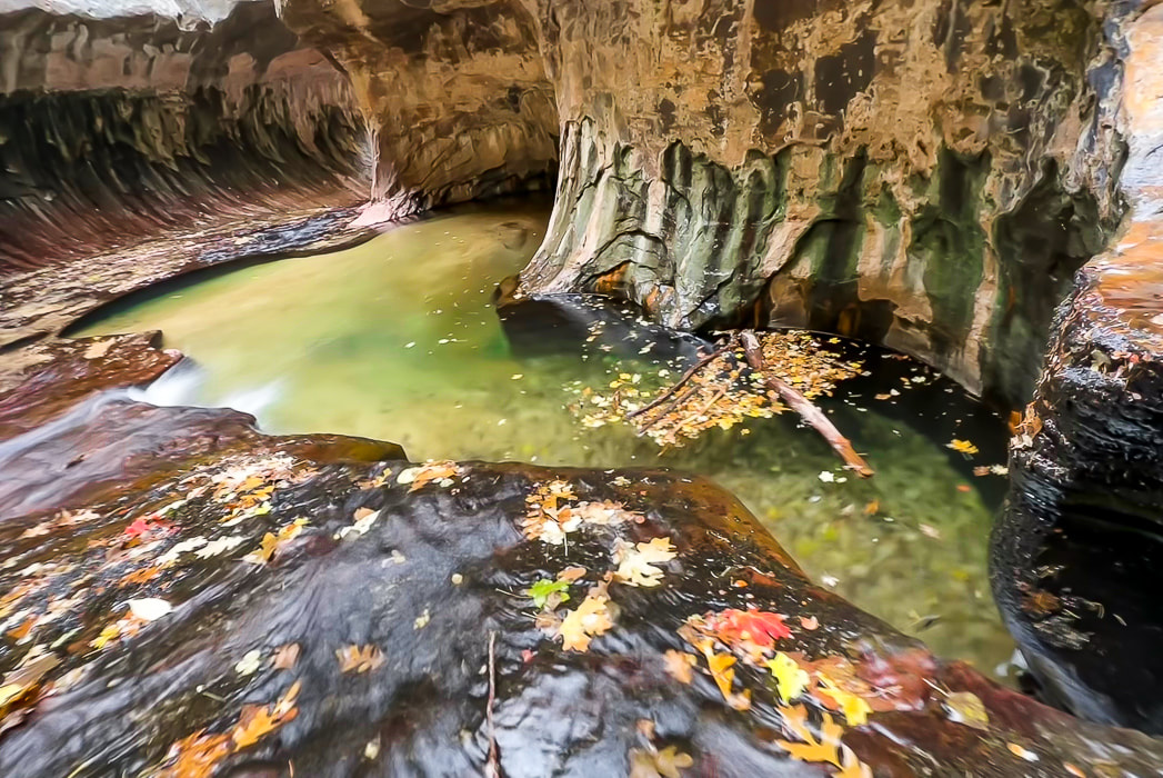
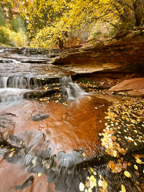
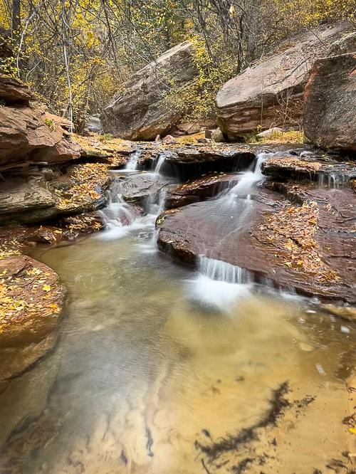
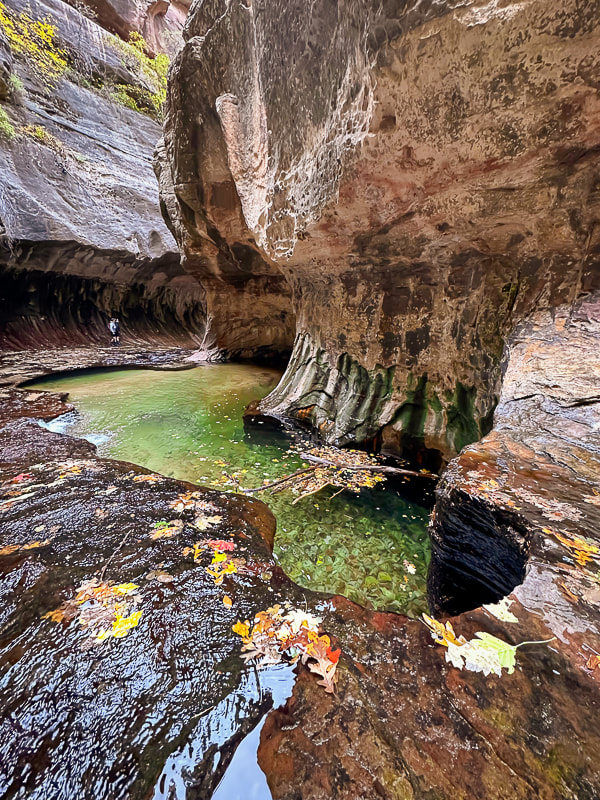
Location: Zion National Park - Kolob Terrace - Left Fork of North Creek Distance: ~ 8 miles out and back Difficulty: Moderate - strenuous boulder-hopping, stream wading and walking on slippery/uneven surfaces. Permit: permit required for all Left Fork/Subway hikes. Zion Wilderness Permits for Left Fork Subway. Date Hiked: November 5, 2023. Maps/Apps: AllTrails, Topo Maps U.S., USGS The Guardian Angels 7.5 min Topo Map Photo Advice: Summer: best light is mid-morning or mid-afternoon (pools are in full sun at mid-day). Autumn: mid-day is best light. Geology: Volcanic flow < 500,000 years from vent located north of trailhead: descend into Kayenta Formation (sandstone and mudstone). Navajo Sandstone towers overhead. Considerations: * Do not hike this canyon if there is a threat of rain/thunderstorms. * Make sure to take a waypoint of the canyon entry/exit and look at where you descended from the rim to get a good mental picture so you don't miss the exit point on the way back. There are signs but they may be easy to miss. Related Posts  "The Subway" at the end of a four-mile hike from the Left Fork Trailhead. Waters over the millennia have carved out tube through this sandstone. This ultra-popular journey through Zion National Park's Left Fork of North Creek to the "Subway" and all of its gorgeous and calming water cascades - one after the other - exceeded my expectations and turned out to be a favorite hike for 2023. Having scored a permit only two weeks before, we were able to park in the Left Fork Trailhead parking lot (you have to put a permit tag on your dashboard), descend from Kolob Terrace to travel this stream to a magical world of green pools, red waterfalls and a tunnel of fern-covered sandstone walls. It takes about three miles of boulder-hopping and clear stream wading to get to the spectacular stuff, but it's so well worth it. I went with three friends who knew the route, and other friends who were seeing Subway for the first time also. The pathway up the Left Fork is pretty straight forward: it heads up-canyon, and around a major waterfall in about 3.5 miles from the trailhead. Much time is spent walking in the crystal-clear water. Less-Traveled Kolob Terrace: Beautiful Forests, Wondrous Canyons and Colorful Sandstone Peaks Compared to Zion Canyon, which received a record number of visitors - five million in 2021 - Kolob Terrace, Zion's west section, is a much-less visited area of Zion National Park. It's accessed via Kolob Terrace Road that ultimately ends at the Kolob Reservoir at an elevation of 8,100 feet - a marvelous place to see in autumn with the blue water and yellow cottonwood trees. A good list of adventures is posted in Joe Braun's Hikes in the Kolob Terrace. Kolob Terrace is also a great place for star-gazing and astrophotography. Zion NP became certified as an International Dark Sky Park in 2021. Das Boot is another classic Zion canyon on Kolob Terrace. It involves dark, convoluted narrows and long swims. If you prefer to be above the land instead of below, there are knolls named Spendlove, Cave and Tinaja to climb. Peak time on the Subway hike for fall color is late October/early November to capture the bright red and yellow leaves that fall in the round potholes and decorate the deep red sandstone cascades. Looking down into the Left Fork from the rim, yellow cottonwood trees line the bottom water course. The hike begins in a volcanic rock flow for ~ 0.5 miles from trailhead to rim, and in fact, it's important to note these black volcanic rocks on the rim when you get down into the creek, so you have a mental picture of the place you came down, and you don't pass it up on the way back out of the water. The 400' descent from the rim is steep and slippery in a few places. As you hike upstream, negotiating many pools, boulders and rocks, you occasionally catch glimpses of the magnificent Navajo Sandstone formations on the plateau above. We didn't pause too long because we had four miles of relatively slow hiking and the day was short. Amazing Place! And then you reach the almost supernatural world of the "Subway". Hanging ferns thrive on the dripping curved walls and round-sculpted lime green pools appear with water continuously pouring in and out. How did this stream sculpt this almost perfect tunnel? Crimson sandstone, polished by continuous water flow is slippery, I saw a few other hikers take minor tumbles. A few in our party waded through the cold deeper pools at the end of this section to a small waterfall. A few climbers with full wetsuits were descending from the Subway top down route which involves rappelling and deep water swims - the canyoneering route that begins further upstream. Sounds like a worthy goal for a future hike! Finding the point at which the trail leaves the canyon to ascend steeply to the rim was not difficult. I had the waypoint recorded on my GPS, so I knew we were getting close. Signs mark the way out of the stream, but it's best to remember the scene you memorized on the way in: the black volcanic rocks next to the orange sandstone on the rim. Grateful to be hiking in the American West - Keep Exploring! 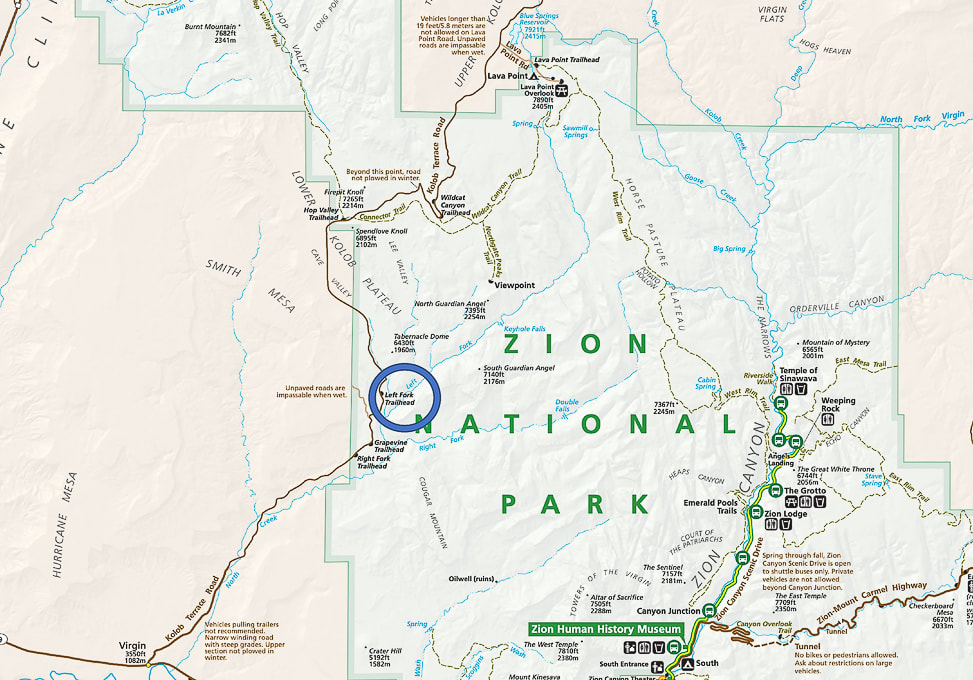 The Subway (Left Fork) hike is located west of the main Zion Canyon in the Lower Kolob Plateau. Left Fork Trailhead (blue circle) is 8 miles up Kolob Terrace Road. 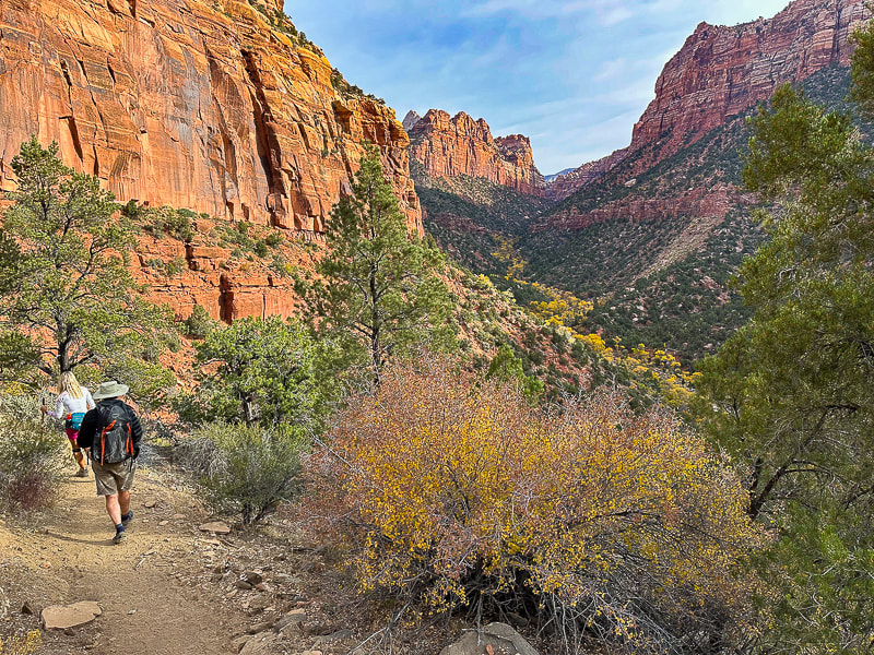 Beginning the descent into the Left Fork - looking forward to getting closer to those yellow cottonwood trees! 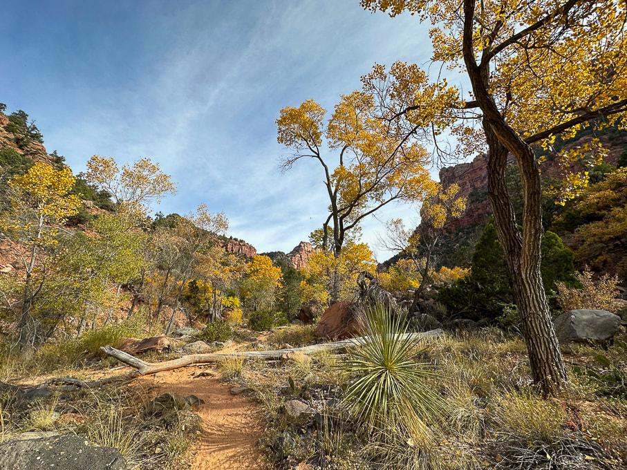 Once into the canyon, the autumn colors are beautiful and the sandy trail is easy to follow. 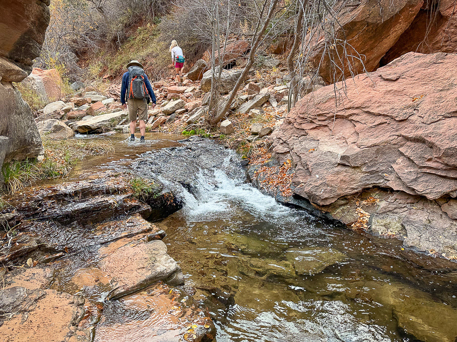 The canyon begins to narrow after ~ 1 mile and you get to walk by/through many pools past waterfalls.
 The shade, constant water flow, ferns and green pools create cool and calm. 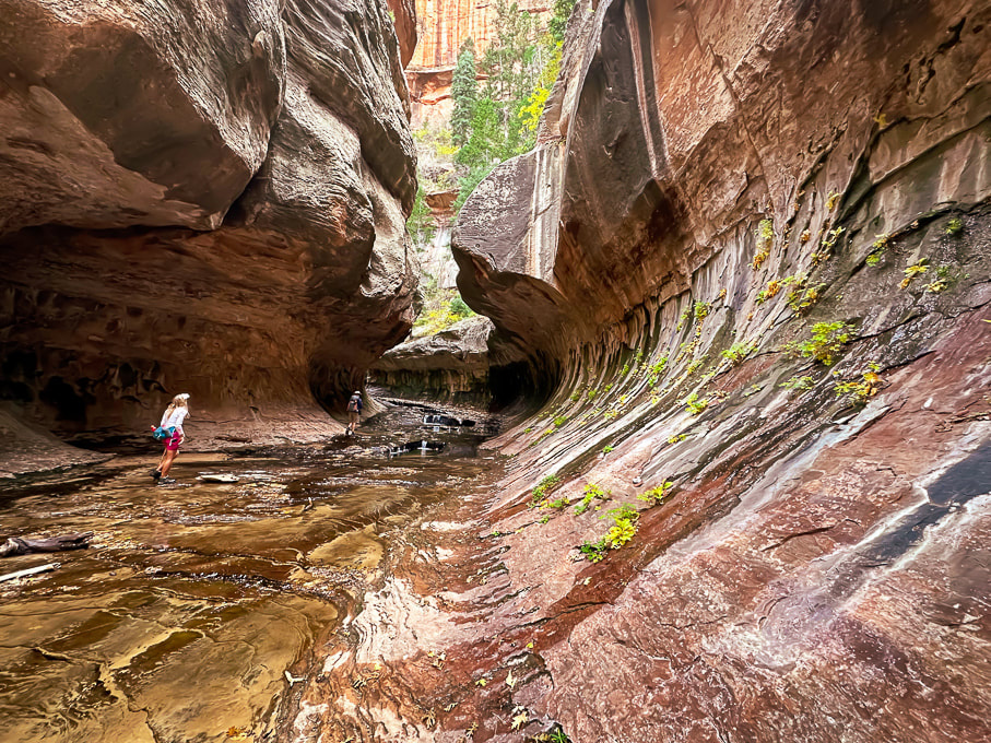 Lydia and Colin walking through the Subway. 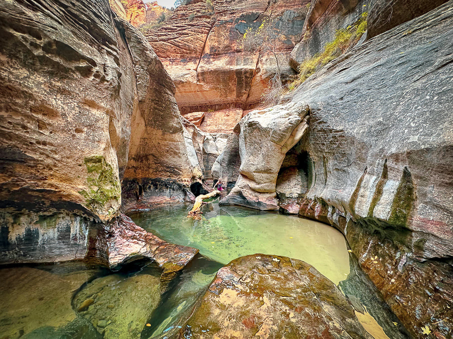 The end of the Subway hike from lower trailhead. You can walk in those gorgeous pools to a small waterfall. If you look at the middle of this photo closely , Lydia is wading in the cold pools! 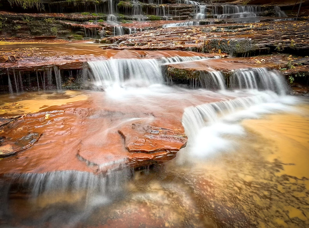 Archangel Falls 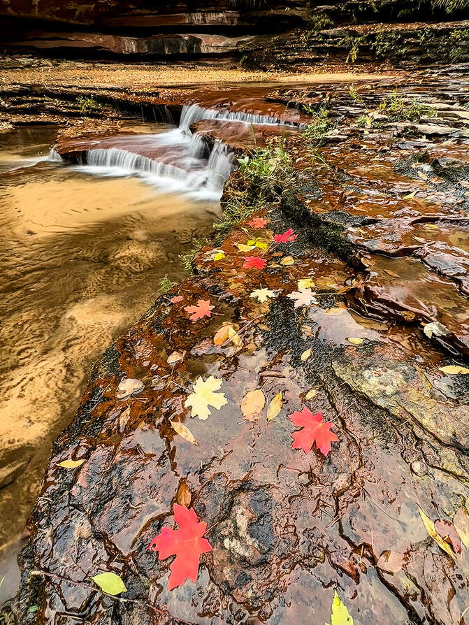 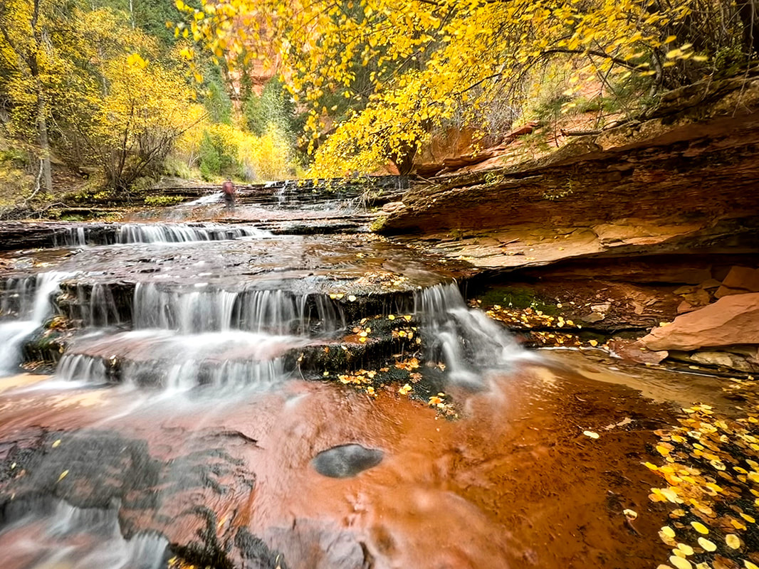 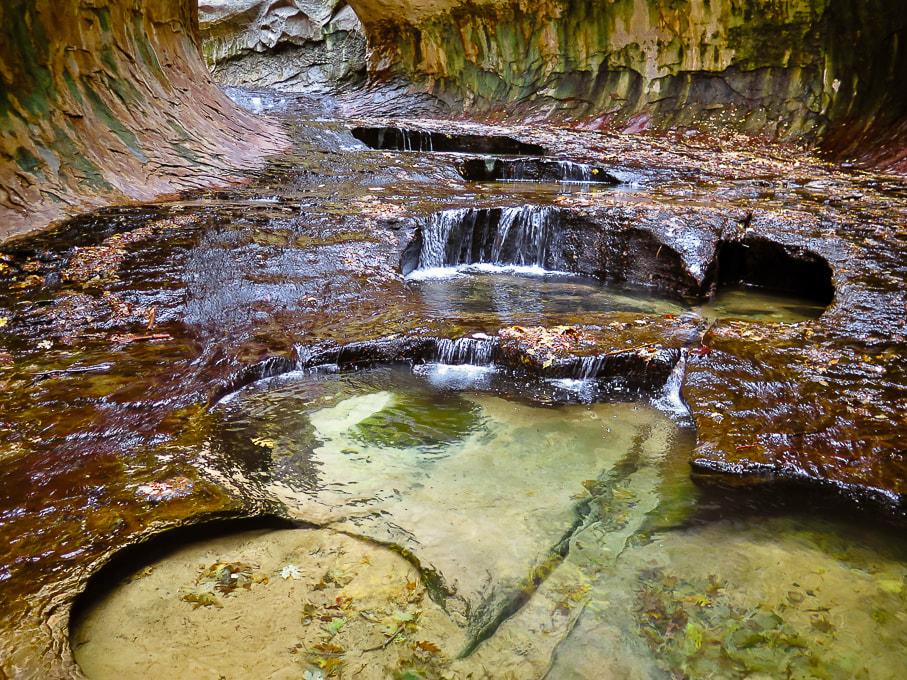 The beautiful emerald pools in the Subway. 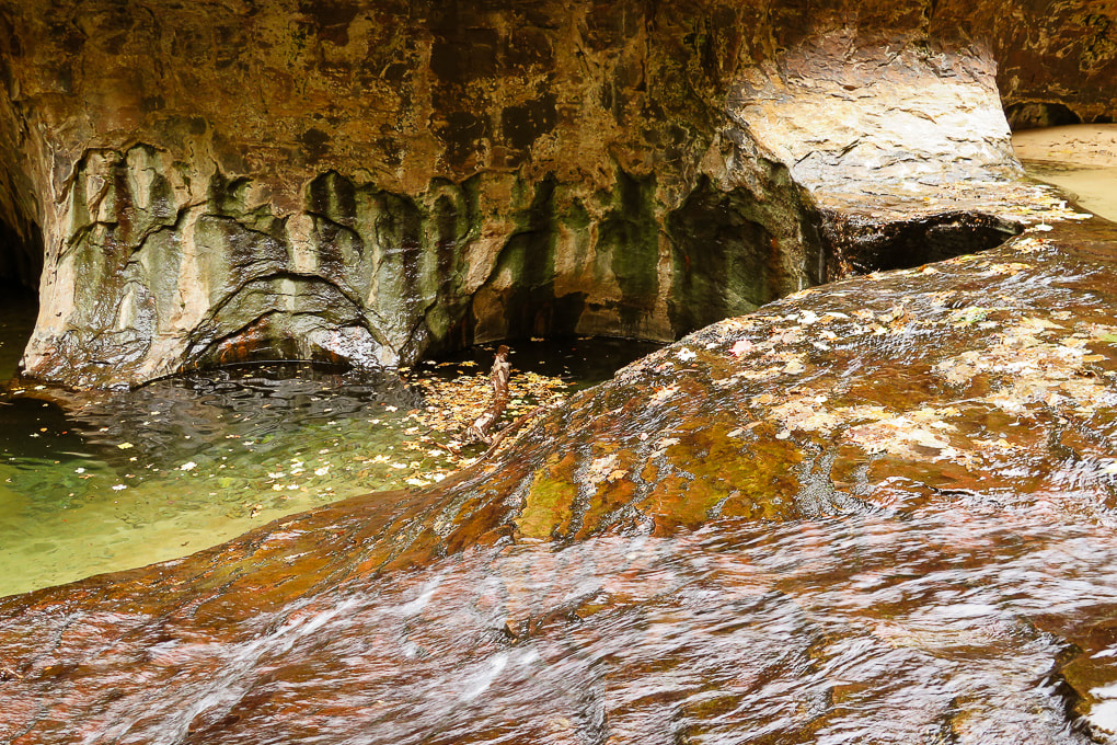 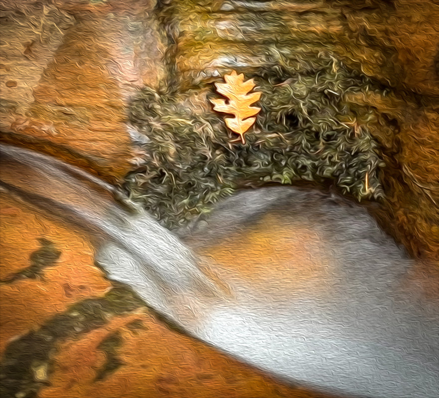 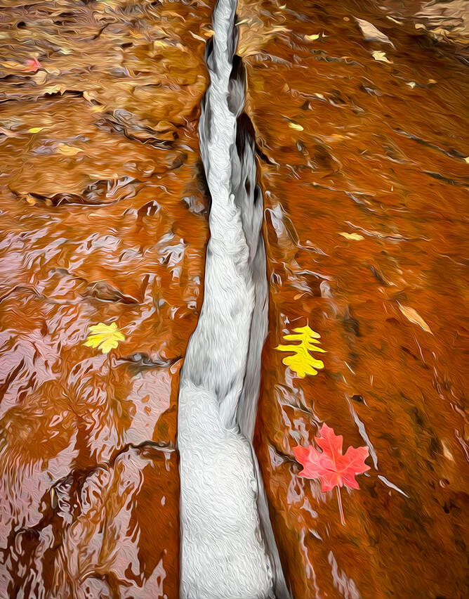 Both images above: having fun with Photoshop oil paint filter. 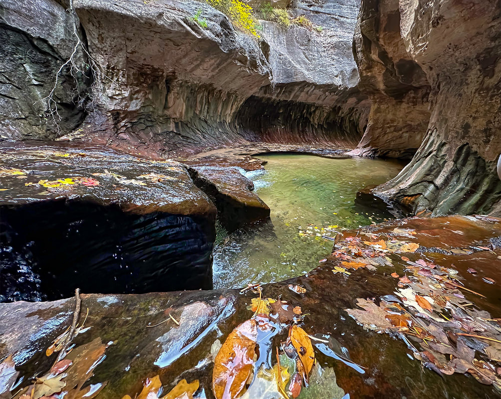 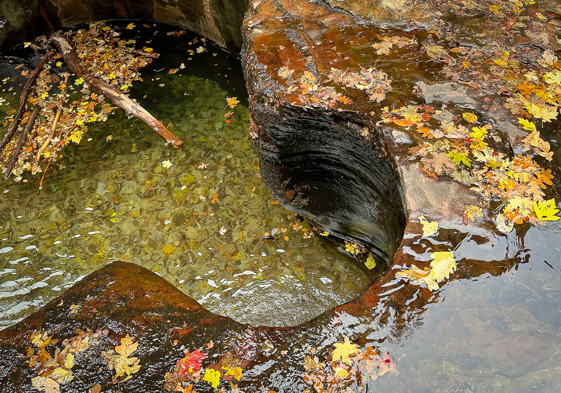 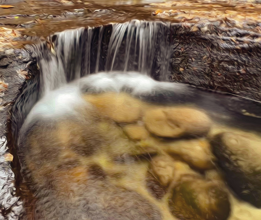 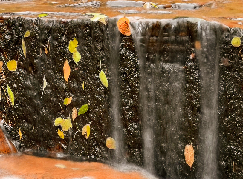 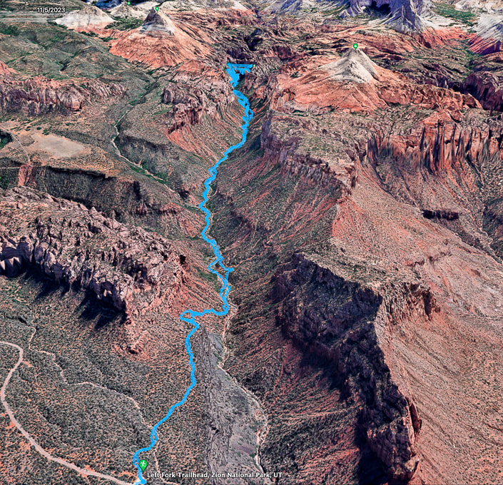 Google Earth map of my GPS tracks, beginning at Left Fork Trailhead, descending into canyon, and reaching the "Subway" after four miles. You pass under the North Guardian Angel and the South Guardian Angel (two peaks at end of this hike). 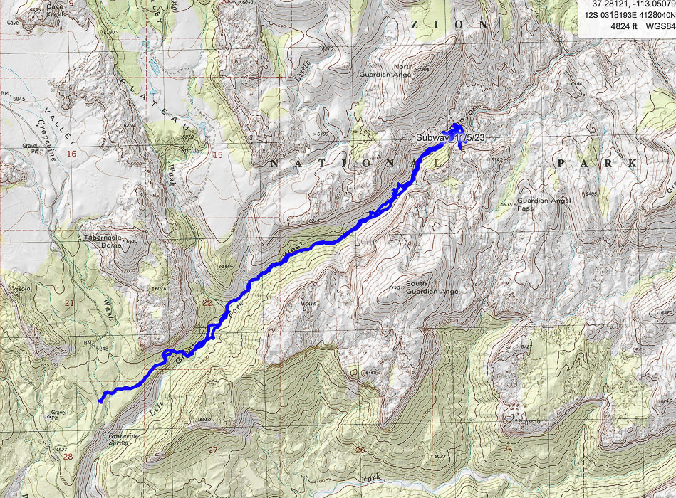 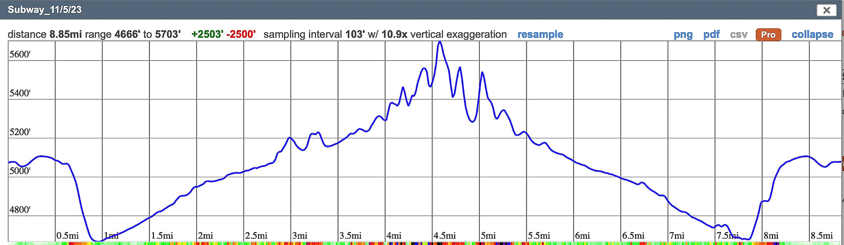 My GPS tracks and elevation profile on CalTopo Maps.
Note that the inaccuracy of GPS (extra-long lines that deviate away from actual hike course) occurs in a deep canyon because the GPS device cannot connect to all the satellites that are required to give an accurate position. This overestimates the hike distance. Walk across Egypt bench and wade through Escalante River in Glen Canyon National Recreation Area to a glowing grotto at the end of a luminous Wingate Sandstone canyon. 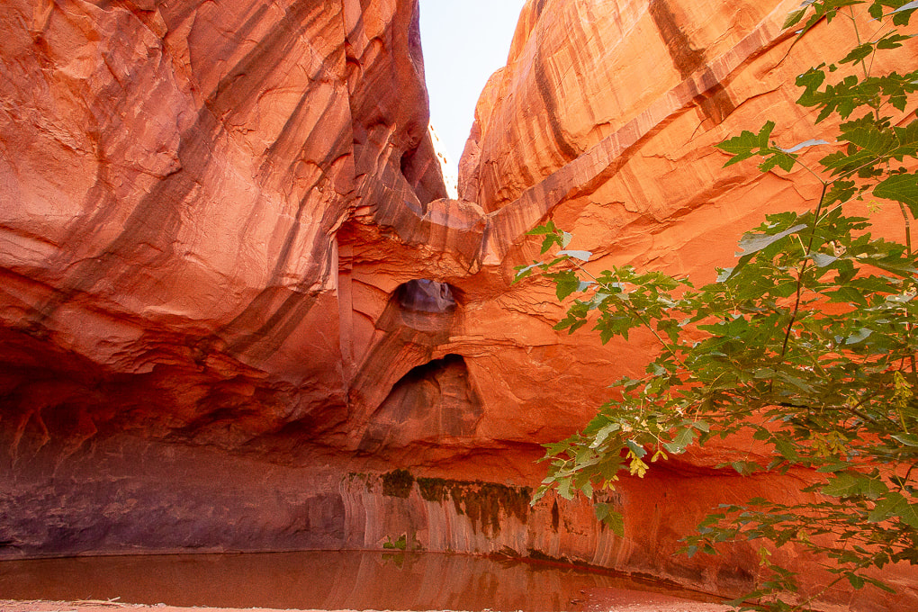 Stunning Golden Cathedral at the end of Neon Canyon Erosion of Wingate Sandstone (Jurrasic, ~ 150-200 million years ago) over the millennia has created three skylights in this glowing grotto.  Photographer Mish at Golden Cathedral. MishMoments.com photography website.  Walking out through the overhanging walls of Neon Canyon. Trip Stats
Location: Southeast of Escalante, Utah in Glen Canyon National Recreation Area. Distance/Elevation gain: 10 miles out and back/~1,200' of gain. Mileage will vary slightly depending on if you take the standard route to Fence Canyon or the "Beeline" route. Difficulty: Moderate effort across pockets of sand; navigation off-trail moderately challenging. Coordinates: Trailhead: 37.59448 -111.22040. Neon Canyon opening: 37.60668 -111.16798. Trailhead: Traveling east on Highway 12 from Escalante, Utah, turn right onto the gravel Hole in the Rock Road a few miles out of town. Drive 16.7 miles, turn left (heading east) at the sign for "Egypt, 10 mi." Zero-out your trip odometer. Stay straight on main road. At 3.5 miles, cross Twentyfive Mile Wash. At 9 miles, a culvert identifies the Egypt 3 slot. At 9.5 miles, turn right at intersection. In ten miles park in large lot. It took us 1:40 from Escalante. Date Hiked: 9/26/23 Maps/Apps: Trails Illustrated Canyons of the Escalante #710, Alltrails, Topo Maps U.S., USGS 7.5 quad topo, Egypt, UT. Considerations: Do not attempt Neon Canyon if there is a chance of rain, and/or flash flood. Driving on road to trailhead requires moderate-clearance 4WD. Beeline Trail crosses Escalante River once. Too hot in summer months. Bring adequate water. Photo advice: Best time to photograph Golden Cathedral is between 11 am and 2 pm depending on the season. Most desirable to have the entire grotto in shade. Light from upper Neon Canyon reflects into the grotto creates glow on walls. At mid-day, light beams shine onto the dark green water on the floor. Links: Escalante Interagency Visitor Center (BLM) Earthline's blog post on this hike Escalante Petrified Forest SP Related Posts
Beeline Route Out and Back
Now I can see how Neon Canyon got its name. The colors are intense. Canyoneers rappel through the opening, getting access from a trail on its west rim. Stav is Lost website has a good canyoneering trip description of Neon Canyon. Fred and I got close to this remote marvel a few weeks before, but we heard thunder and saw clouds building when we got near Neon's opening, so we nixed the plan of going up this narrow canyon and headed back to the trailhead via Beeline Trail. On that hike, we checked out the huge petroglyph panel along the Escalante River, approaching from the Fence Canyon route. From the trailhead, identify Point 5270, a round dome to the east. That is your landmark to hike toward, as Neon Canyon is just to its left. The terrain that spreads before you is "Egypt," an elevated bench above the Escalante River, which flows right in front of Point 5270. The "Standard" Golden Cathedral Trail aims toward and travels along the north rim of Fence Canyon on the left in image below. The Beeline Trail goes in a more or less straight line toward Point 5270. A map of our GPS tracks hiking the Standard/Beeline loop is on my last post Neon Canyon/Escalante River Petroglyphs Hiking Directions. 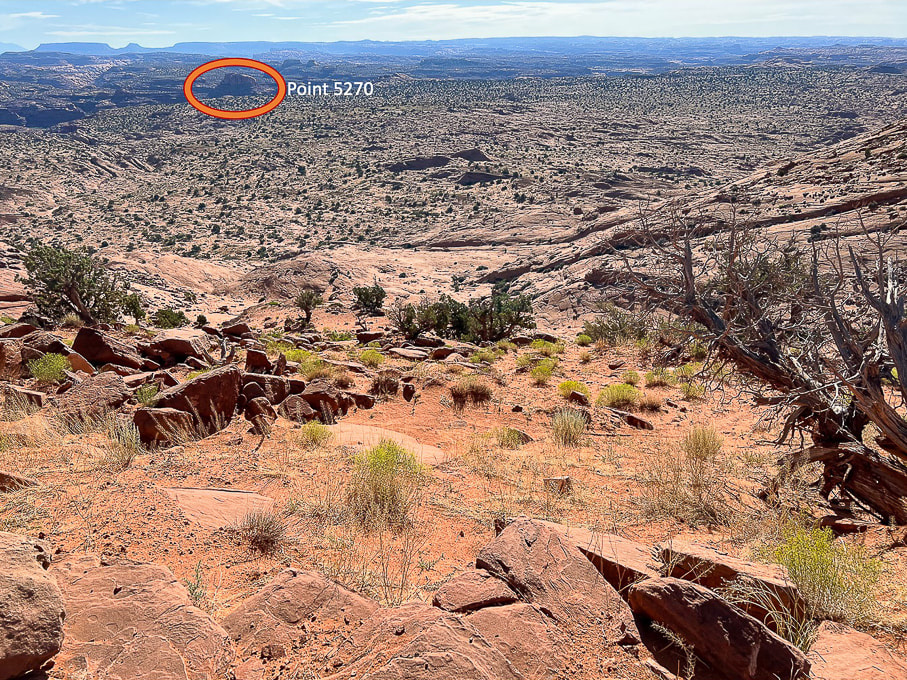 Looking east from Egypt Trailhead: Descend down through bowl onto Egypt Bench and make a Beeline toward Point 5270, the landmark just east of the opening to Neon Canyon. The alternate "Standard" trail heads to the left of Fence Canyon, seen at left in image.
 Looking back up at Egypt Trailhead. The dark brown boulders are the landmark to look for when returning from Neon Canyon. They are from the Carmel Formation and made mostly of limestone. The underlying rock strata is Navajo Sandstone. 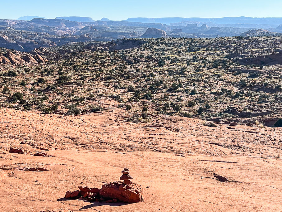 Approaching the base of the Navajo Sandstone bowl and getting closer to the dome. This cairn marks the Beeline route. Cairns are few and far between and easily missed. 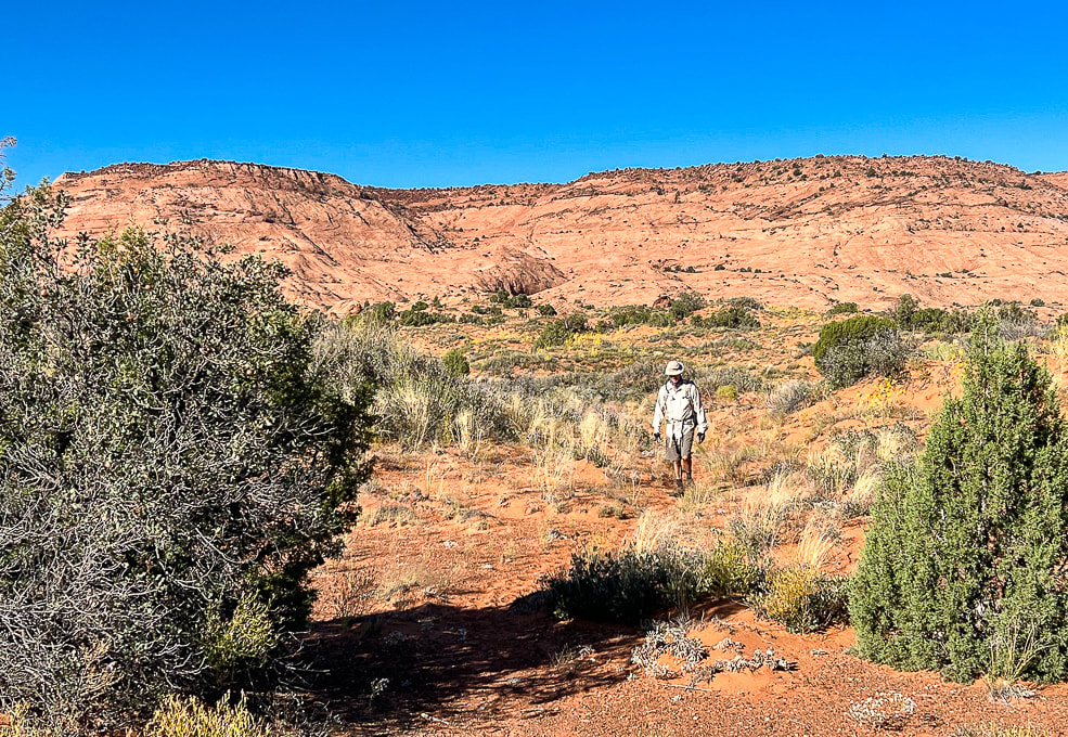 Heading across Egypt Bench on trail that is discernible here and there. We saw footprints on the sandy Beeline Trail. The cleft with the large brown boulders on the plateau's rim is the landmark for the return hike. In September, abundant wildflowers speckled the hummocks and sand dunes. 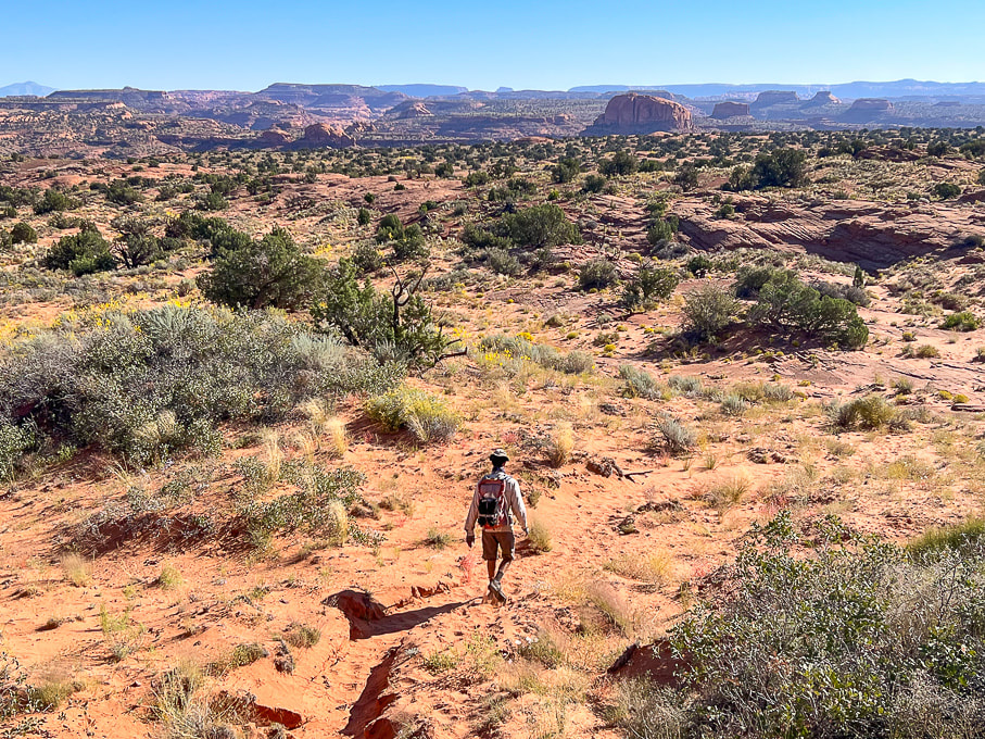 A definite trail through the sand. 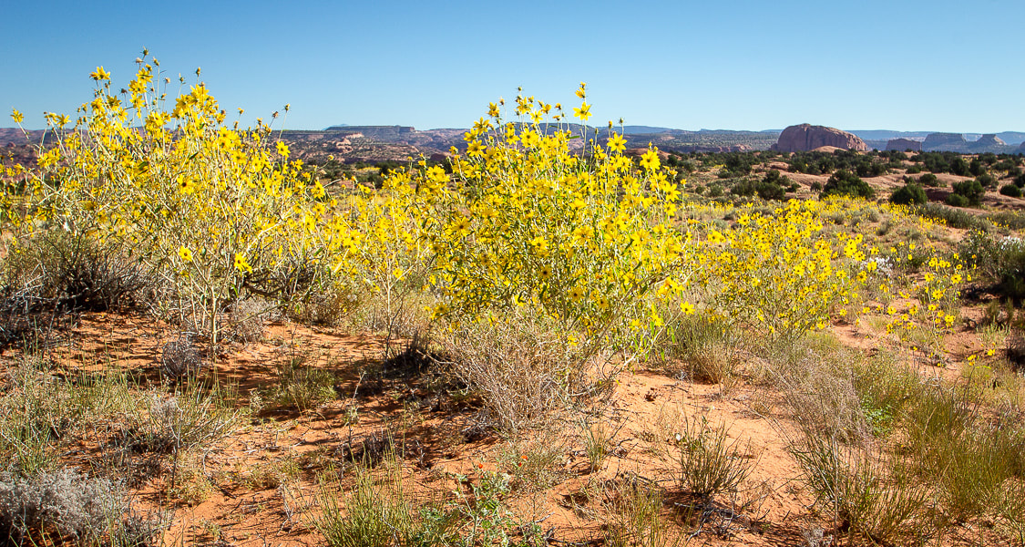 Longleaf false goldeneye? 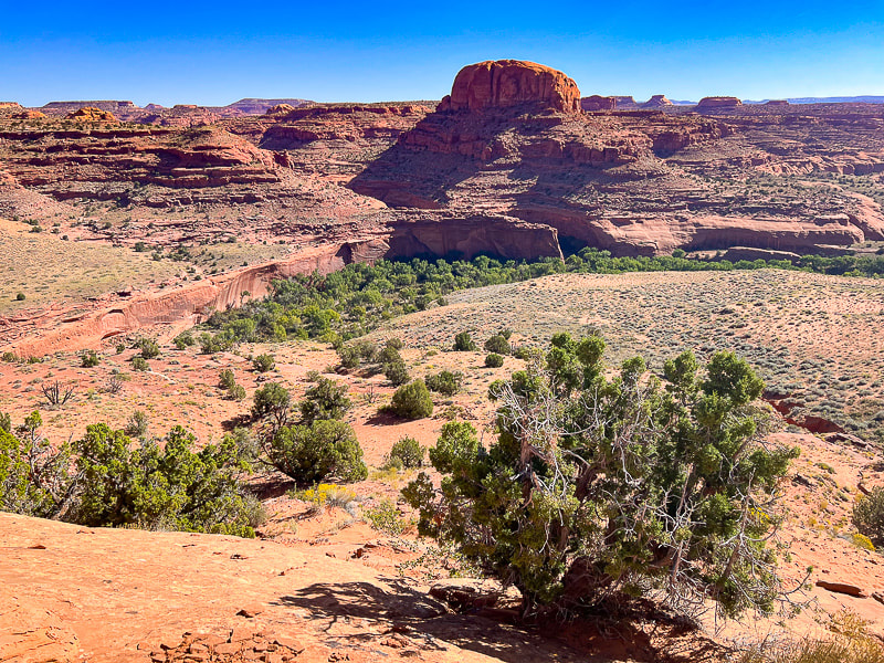 The beginning of the descent off the main Egypt Bench: stepping off of firm slabs of sandstone onto the soft deep sands of a lower bench or terrace just above the Escalante River. First really good view of the Point 5270 dome. Cottonwood trees fill the river bed. Neon Canyon opening is the notch under the dome. 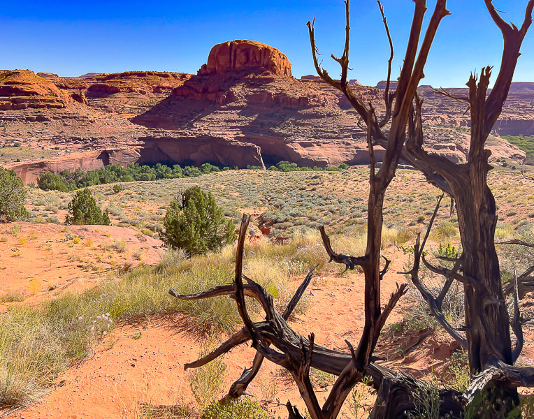 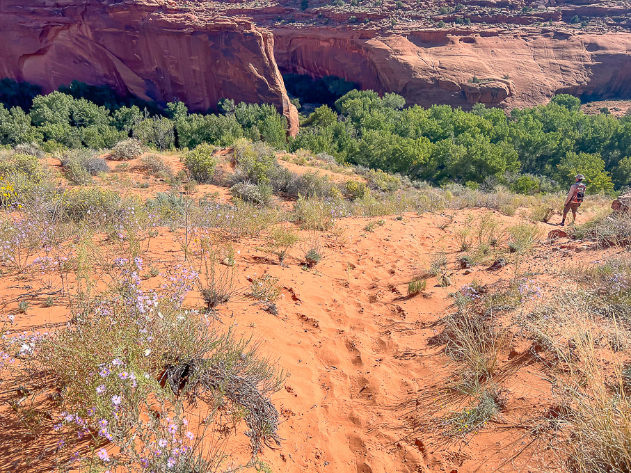 Not a problem descending this deep sand on the way to the river, but a pain to walk up it on the way back! Now we can see the opening of beautiful Neon Canyon. 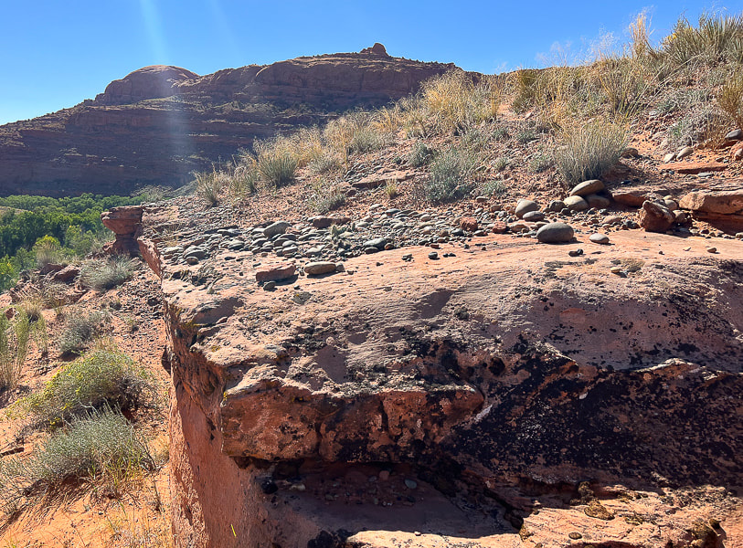 Just above the river bottom: the rounded rocks are a sign that the river probably once ran on this terrace. 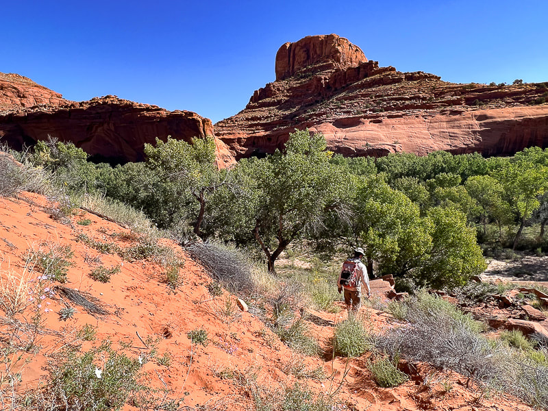 Nearing the cottonwood trees of the Escalante River bottom - would be great to see these when the leaves turn yellow! 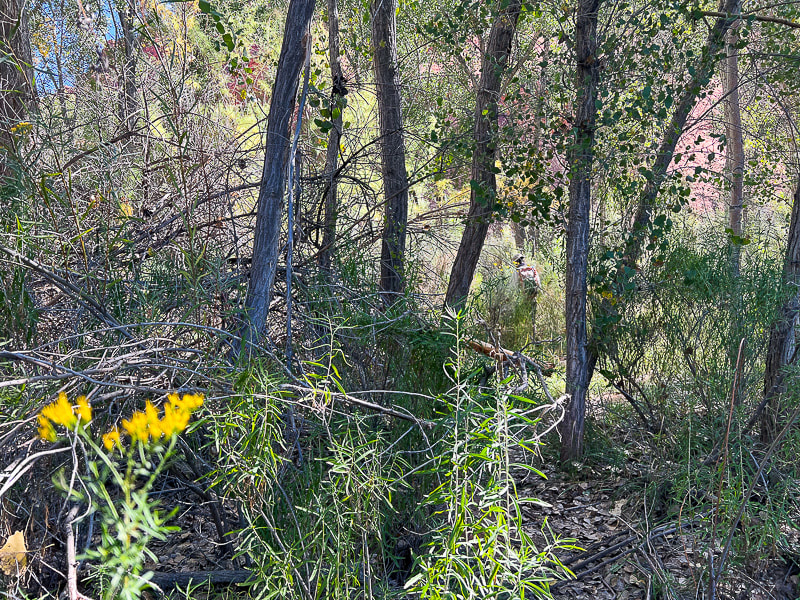 Weaving through brush and trees to the river. 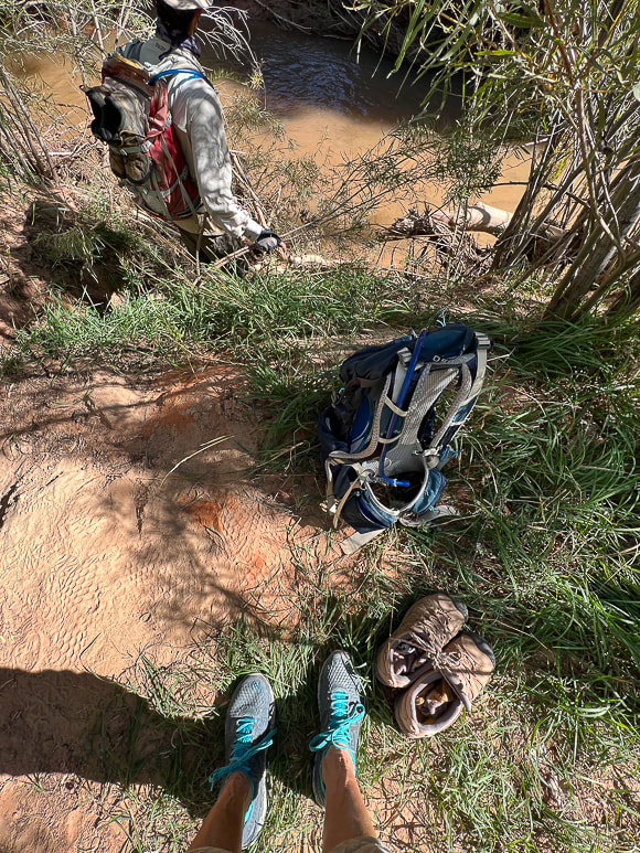 On the bank of the Escalante: switching from boots to trail running shoes. Only two short river crossings both ways, might as well keep boots dry for the hike. The canyon walls at Neon's opening and all the way through are stunning; trees growing against them seem small in scale. A path leads through a garden of wildflowers in September. A trail on the left side of the first bend in the canyon takes you above Neon's west rim and to the beginning of the canyoneering route. After a walk in the cool shade of Neon, reach Golden Cathedral in a little over a mile. We saw evidence of a recent flash flood in the fresh carved sand on the stream banks. The pool reflects the three skylights above. We stayed for awhile, appreciating the serenity, until the sun started to fill the canyon, shining on part of the grotto. The best time to photograph Golden Cathedral is before the sun hits it, so you don't get too much contrast. The reflected light from the upper Neon through the skylights is what gives the glow to these beautiful walls. With every Escalante visit, our to-do list grows exponentially in this land of remarkable personality. There's so much out there to explore! 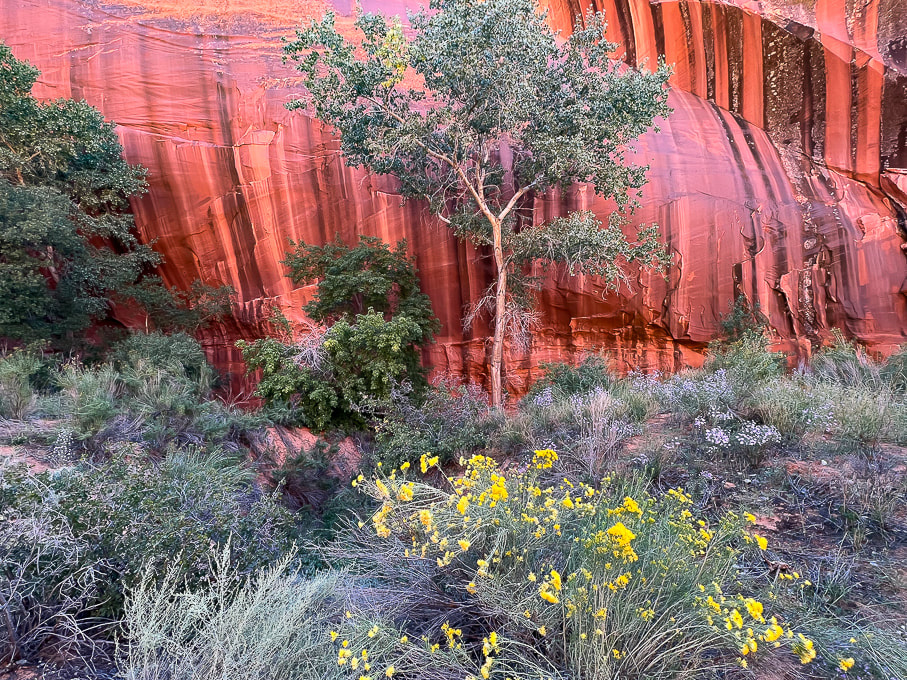 Intense colors near Neon's opening. 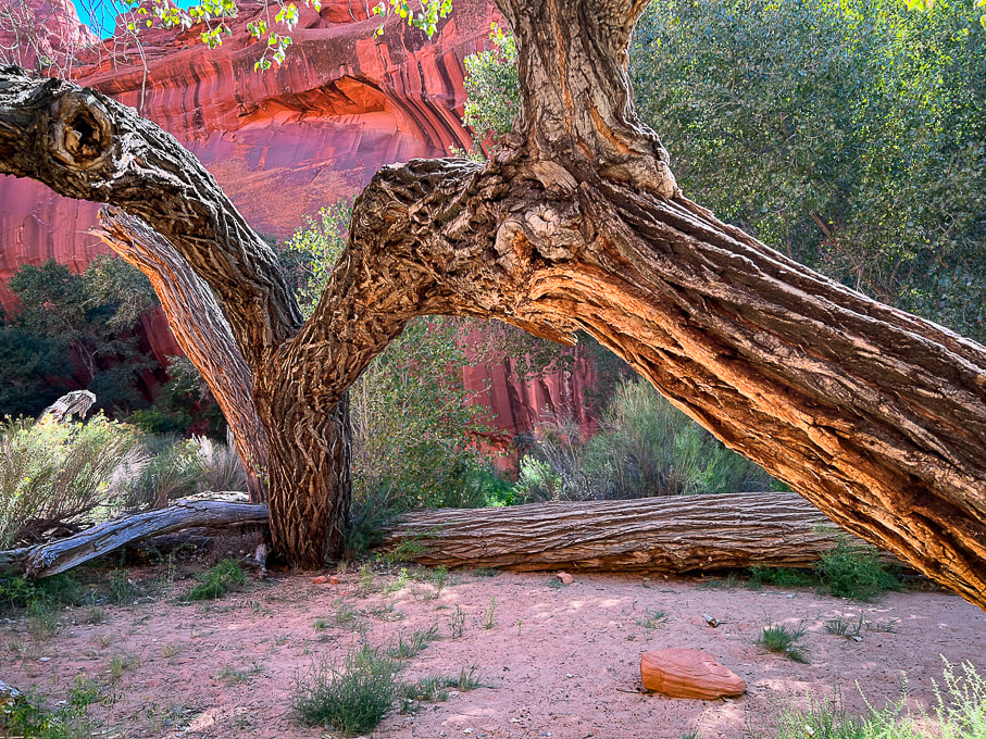 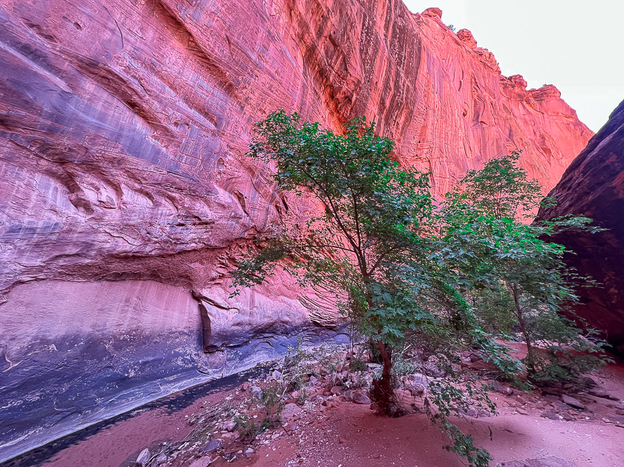  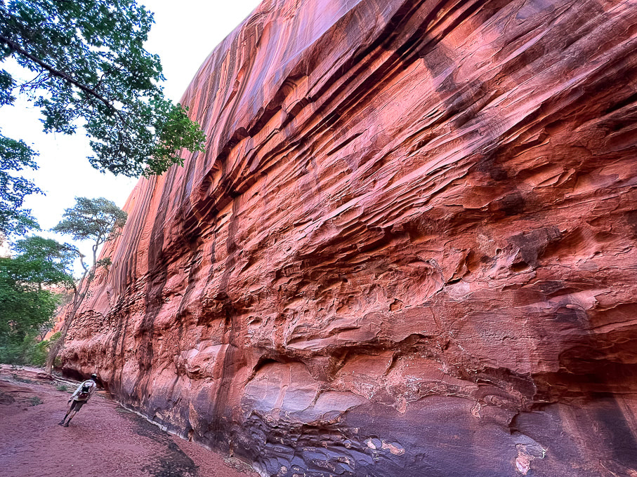 A wide-angle shot of Neon walls. 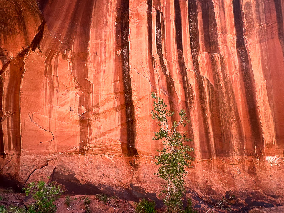
 Fred walking out. 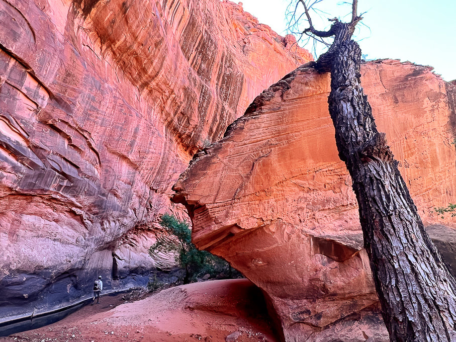 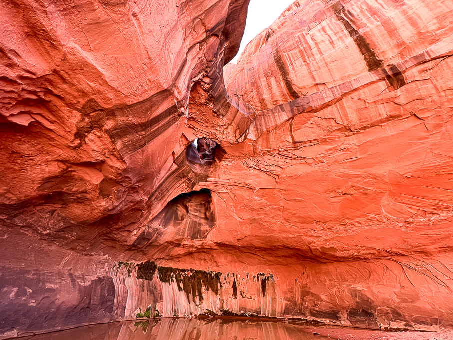 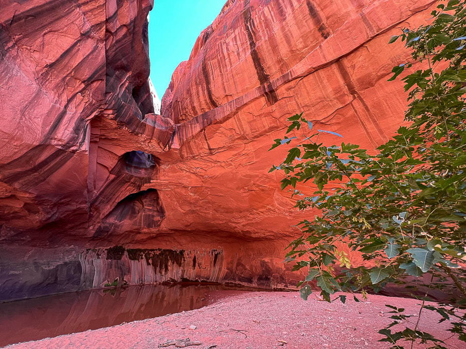 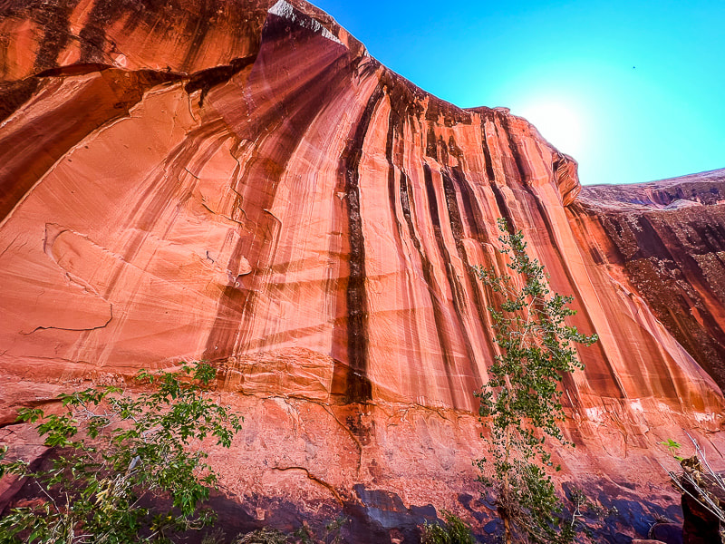 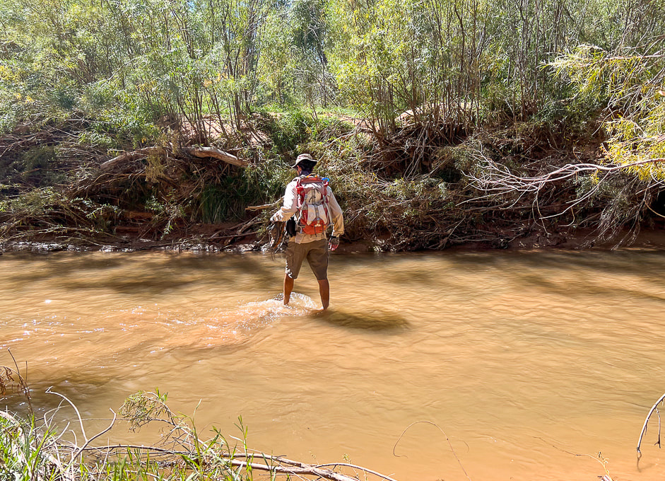 Crossing through Escalante River back to Beeline Route.
Carmel Formation (deposited ~ 170 million years ago) boulders strewn over Navajo Sandstone. Note the difference in textures: the limestone in the Carmel makes the rock more sharp and rough.  Scenes from Escalante Petrified Forest State Park, where we stayed with our trailer.
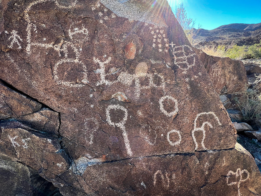
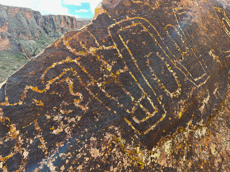
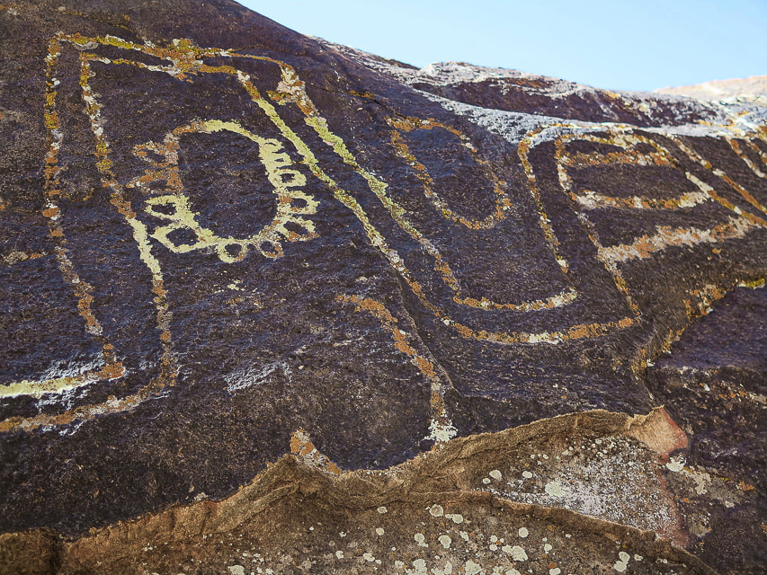
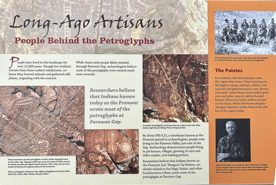
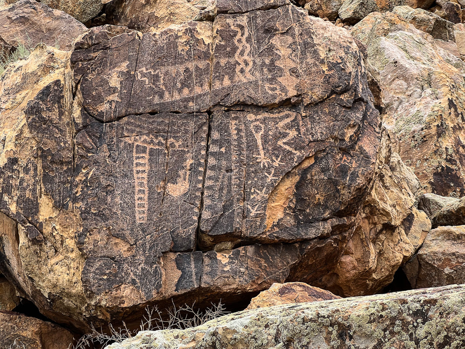
This prominent gap in the Red Hills has one of the most abundant collections of American West petroglyphs, including the most unusual of all - the Zipper Glyph.
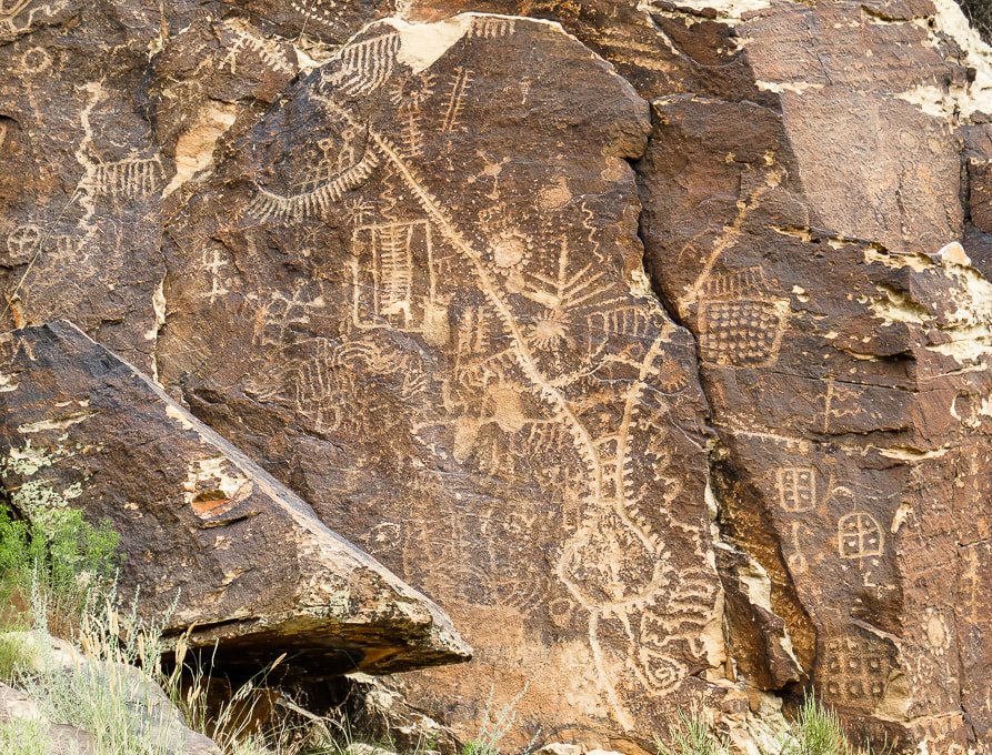
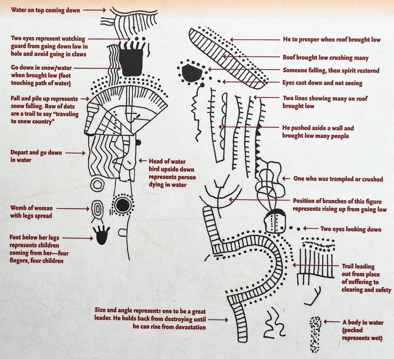
Iconic Parowan - the "Zipper Glyph"
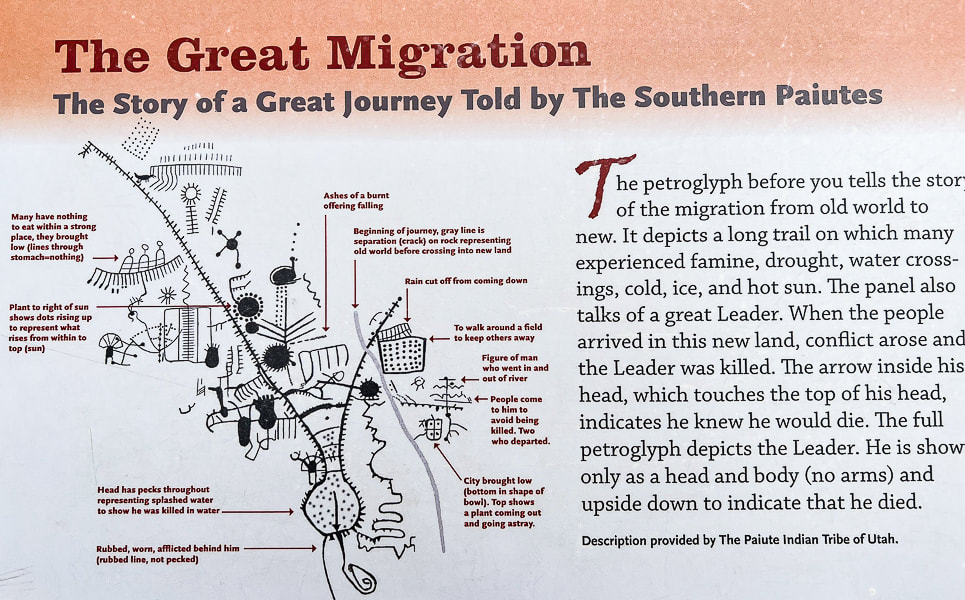
Interpretations of this petroglyph include a solar calendar because it has 180 notches coinciding with the 180 days it takes for the sun to move between summer and winter solstices. The Paiute Indian Tribe of Utah interprets this as the story of a great Leader during a migration where many people experienced famine, drought, water crossings, cold and ice.
Trip Stats
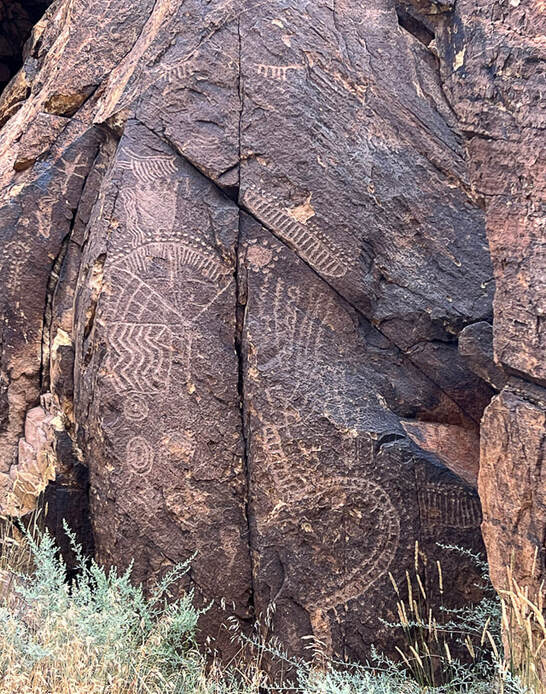
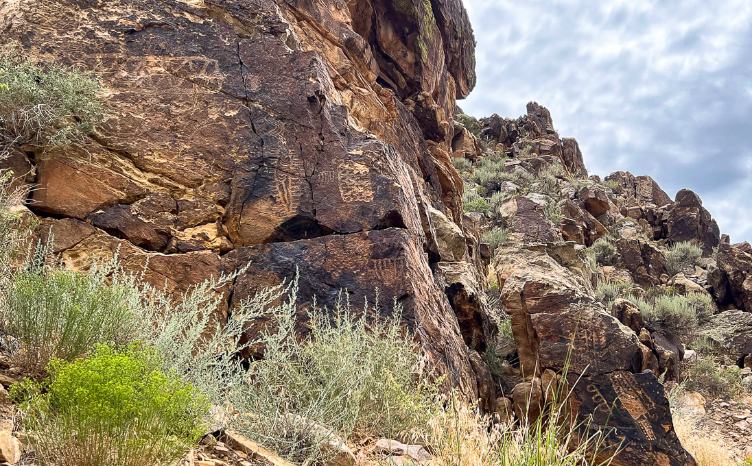
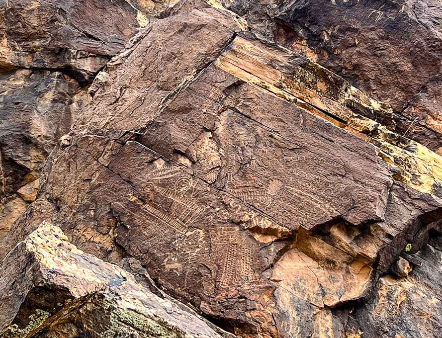
Overview: At the western edge of the Parowan Gap, in the "Narrows", over 1,500 petroglyphs made by different indigenous cultures are carved in the Navajo sandstone. Location: Parowan, Utah, just north of Cedar City, in the Red Hills west of Little Salt Lake. Petroglyphs are in the notch at the west end of Parowan Gap. Managed by Bureau of Land Management. Petroglyph Coordinates: 37.909722 112.985556 Native Americans: Fremont culture, Paiute, Hopi. Recognition: Listed on National Register of Historic Places. Geology: the petroglyphs are pecked into Jurassic Navajo sandstone, deposited 190 million years ago.
Related Posts:
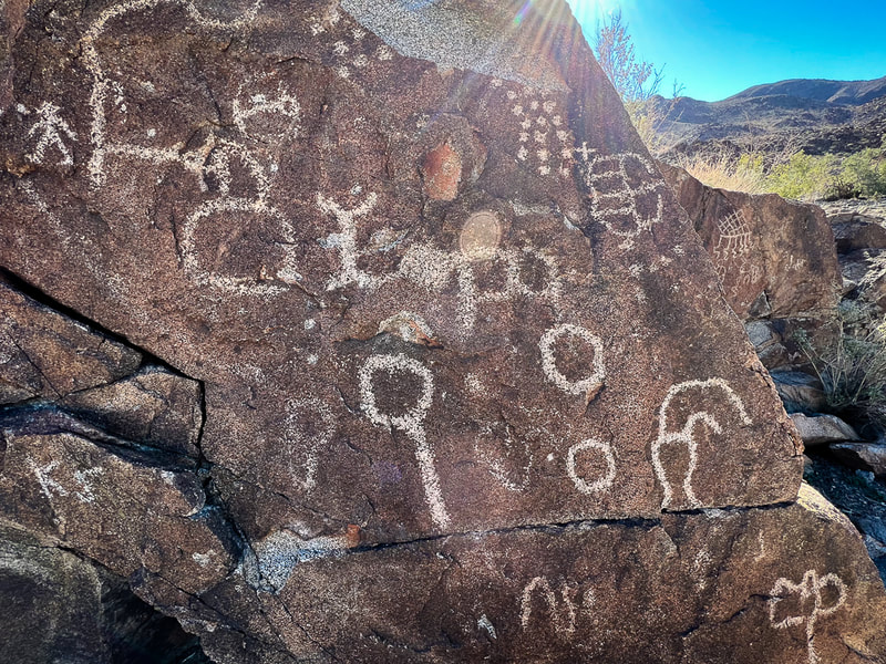
Petroglyph "Heaven"
To rock art aficionados, Parowan Gap must be petroglyph heaven, not only because of its famous "Zipper Glyph", but also the amazing quality and number of petroglyphs there - rock after rock, panel after panel (90 of them!). Some believe that this site has the most concentrated petroglyph assemblage of any in the American west. Some of the rock carvings may be as old as 5,000 years, the majority of them made by the people of the Fremont culture. To today's Paiute and Hopi tribes, this is a spiritual site. The Parowan Gap is a stream-cut valley and narrows through the Red Hills, just west of Little Salt Lake, north of Cedar City, and 10 miles northwest of Parowan, Utah. The petroglyphs are located in a dramatic V-shaped notch at the western edge of this gap, a great place for indigenous peoples to carve their petroglyphs during their migrations. I was looking forward to seeing the Zipper Glyph in person. With two "arms" and 180 notches, people who believe in the astroarchaeological (AKA archaeoastronomy) interpretation see this mysterious petroglyph as a solar calendar. If you look closely at the Zipper Glyph, it resembles the notch in the Parowan Gap. It is believed that this glyph is a map with relating equinoxes and solstices. However, the modern Paiute Tribe of Utah had a different interpretation: a migration of the old world to the new. The Paiutes say that the Zipper Glyph represents a long trail of hardship in which their great Leader was killed. The two "arms" in this case are the Leader's body shown upside down with his head at the bottom. 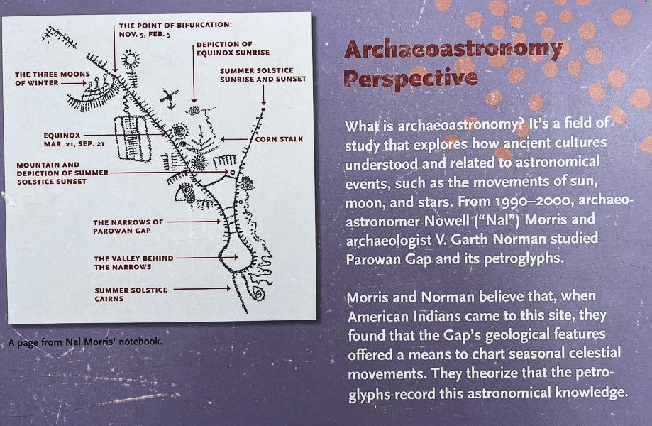
An interpretive sign illustrating the belief that the "Zipper Glyph" was used to chart celestial movements.
Interpretive sign that describes the Utah Paiute Tribe's interpretation of the Zipper Glyph.
Parowan is nicknamed "the Mother Town of the Southwest." It's a city that has gone through a lot of changes since it first began mining iron in the 1800's. Now its main industries are tourism and recreation, including Brian Head, a year-round resort where we like to go skiing. It was first called "City of Little Salt Lake," because of its proximity to Little Salt Lake, a now salty playa to its west. It was renamed "Parowan," a native American word meaning "evil water." This lake is a key geographic feature relating to the formation of the Parowan Gap.
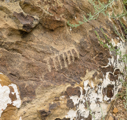
Fred and I had just hiked the astonishing Cosmic Ashtray in Grand Staircase-Escalante the day before, so we were on our way home. I had to talk him into seeing Parowan Gap; he doesn't normally want to go too far out of the way to see petroglyphs but with these he was pretty darn impressed. On the same Grand Staircase trip, we also hiked to a huge petroglyph panel along the Escalante River in Grand Staircase-Escalante National Monument, near the opening to Neon Canyon. Bear paws march up out of sight on this tall rock face, a rattlesnake slithers, and Fremont-culture warriors stand as just a few petroglyph examples. If you don't mind slogging through four miles of sand and slick rock, wading, and navigating, you can find these remote glyphs. It's believed that the Fremont culture made most of the Parowan Gap rock carvings 700-1,500 years ago, although the area has been inhabited for thousands of years before that. Typically the designs are abstract and geometric, although there are some lizards, snakes, and mountain sheep pecked into the Jurassic Navajo sandstone. Many petroglyphs are located very high, out of reach on the hillside. Check it out - you won't be disappointed! The interpretive signs make this a nice site. A great place to go afterwards if you are hungry is Centro Woodfired Pizzeria in downtown Cedar City.
Keep on Exploring!
For the Geo-curious: Creation of a Unique Land Feature
So, what created this peculiar notch in the hills — so noteworthy that ancient peoples over hundreds of years decided to engrave hundreds of petroglyphs as they migrated through the area? Two clues — the gap's rock orientation and Little Salt Lake help geologists to make sense of its creation. The ancient stream that for millions of years carved this gap through the Red Hills on its westward journey to the Great Basin became blocked by the rising Red Hills fault block. Its flow then accumulated to form Little Salt Lake, just east of the Parowan Gap. Either the fault block rose too quickly for the stream to keep incising through the rocks, or the region became drier and the stream had less volume, or both. Clues that faulting occurred are seen in the rock layers. North-south trending faults through the Red Hills caused east-dipping and west-dipping beds; some were left in their original horizontal position. The rocks here — Claron Formation (dominant Bryce Canyon rock), Navajo Sandstone (Zion's main rock), Carmel Formation, Iron Springs and Grand Castle formations first underwent mountain-building during the Sevier Orogeny 45-100 million years ago, when the Pacific tectonic plate collided and slid under the North American plate. The stream through Parowan Gap then carved a passage through the Red Hills. More recently, beginning 20 million years ago, Basin and Range extension (stretching of Earth's crust) began, which caused the Red Hills fault block to rise, blocking off the Parowan Gap stream's passage. Water collected to form Little Salt Lake, now a playa (a dried-up lake). 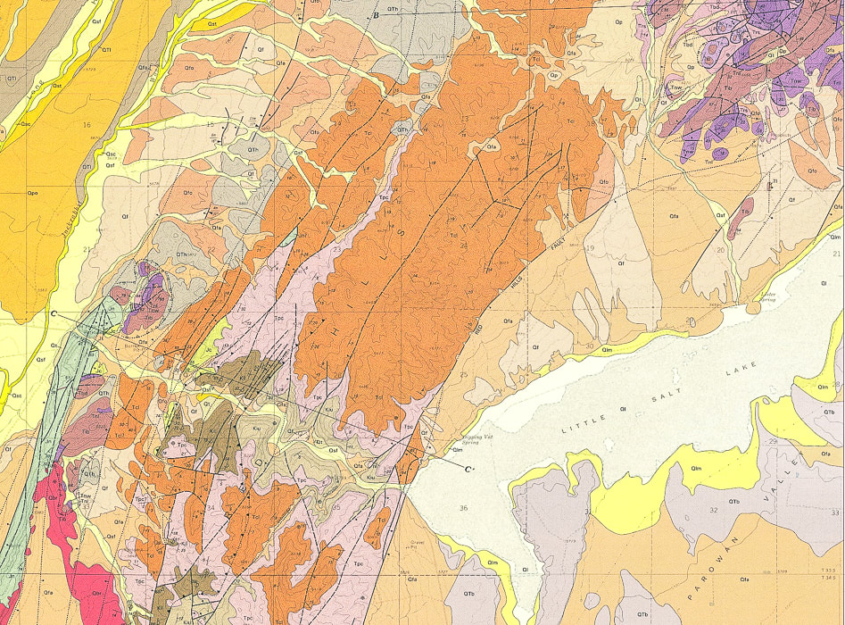
Geologic Map of Parowan Gap Quadrangle (USGS).
Little Salt Lake (lower right) was formed when the westbound stream that created the Parowan Gap (larger yellow, curving line (lower left) became blocked by the rising Red Hills. Note the parallel dark lines (faults) running mostly north-south and the long line extending from middle bottom to top right (Red Hills Fault), raising that fault block and providing a barrier to stream flow westward . 
The "narrows" at the west end of the Parowan Gap. Ancient waters carved this opening in the Red Hills.
Extensive abstract petroglyphs on both sides of Gap Road, which passes through the Parowan Gap.
Interpretation of the panel above by Paiute Indian Tribe of Utah, from interpretive signs at the site.
Another Parowan Gap interpretive sign.
References:
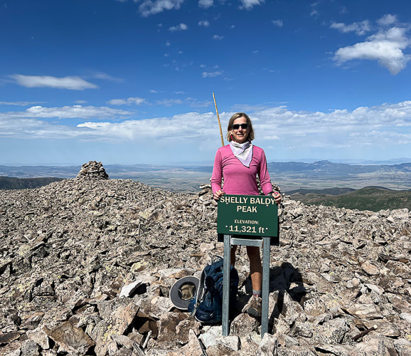
Maldonado, F., et al. Geologic Map of the Parowan Gap Quadrangle, Iron County, Utah. U.S. Geological Survey. Wilkerson, C. 2018. Geosights: Parowan Gap, Iron County. Orndorff, R.L., et al. Geology Underfoot in Southern Utah. 2020. Mountain Press Publishing Company. Parowan City Corportation website. Wadsworth, Rueben. 2019. Parowan Gap day; Interpretations and Mysteries of a Petroglyph Heaven. Cedar City News Archives. Hike a gorgeous and high Utah mountain range that relatively few know about. 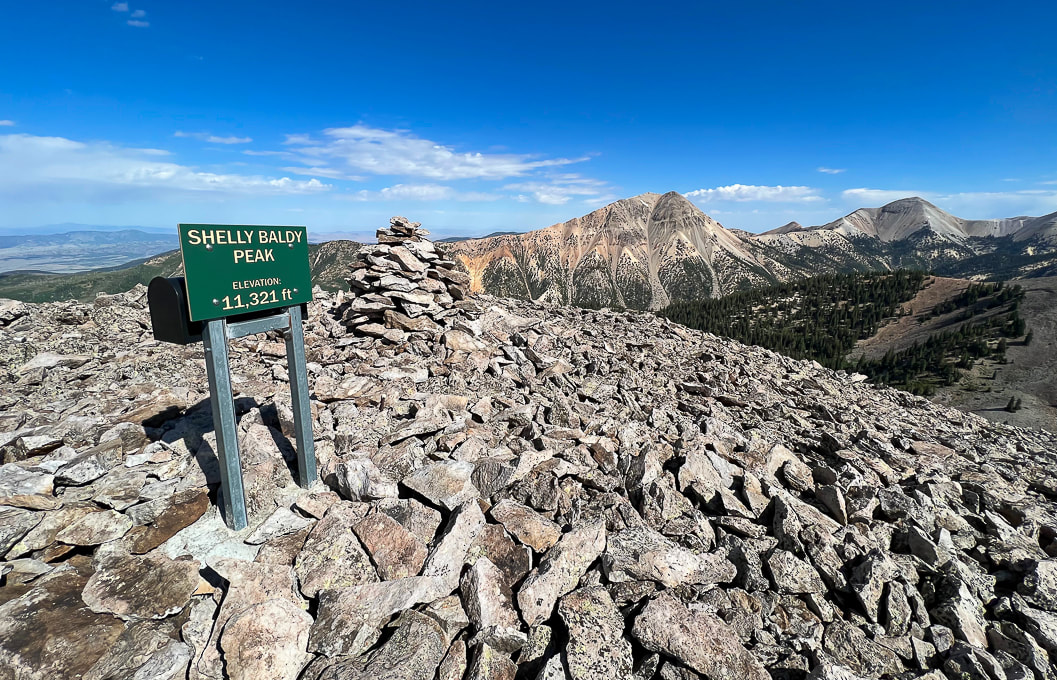 On Shelly Baldy's summit looking at Mount Baldy (left) and Mount Belknap (right), the Tushar Mountain's second highest peak after Delano Peak. Trip Stats Location: Southern Utah - Fishlake National Forest out of Beaver. Quick Summary (from Skyline/ Big John Flat trailhead on Forest Road #123, head northwest, ascend northeast ridge).
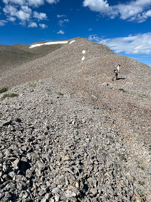
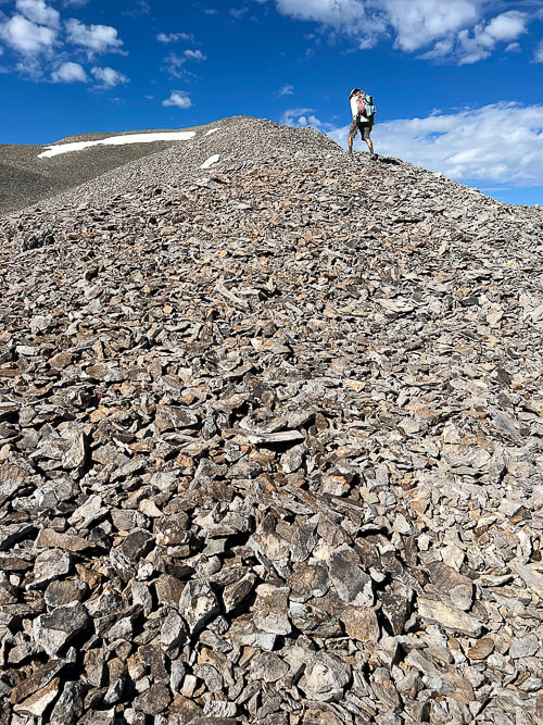
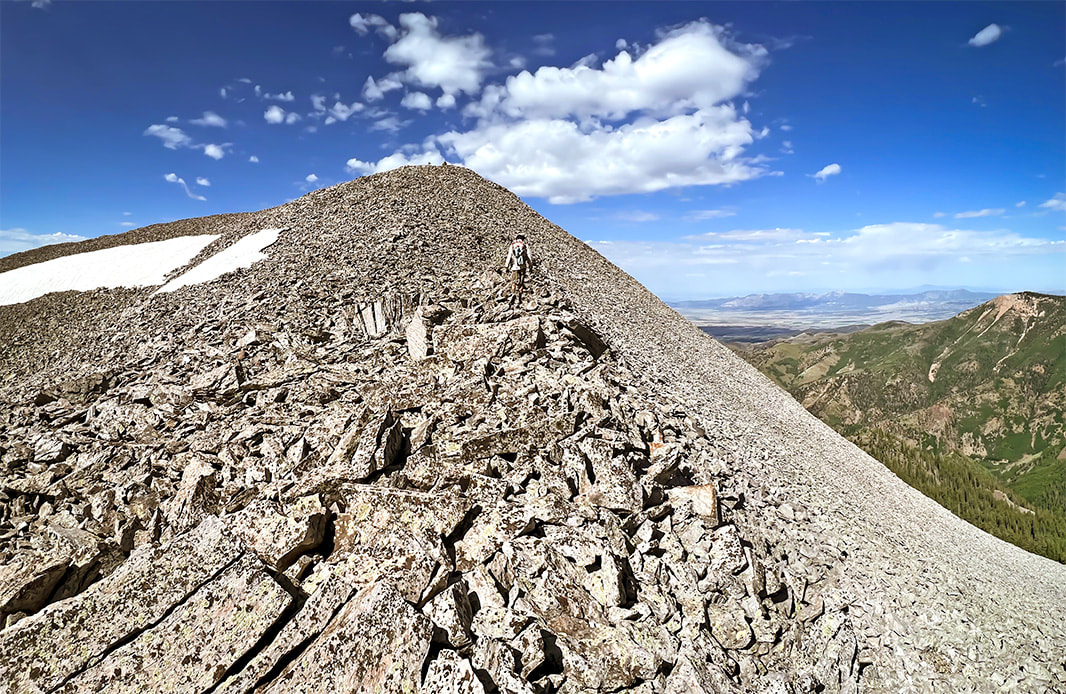
Difficulty: Easy - moderate Class 1, then moderate Class 2 scramble on stable talus ridge. Coordinates: Trailhead = 38.35910 -112.39317. Summit = 38.36911 -112.42528 Trailhead location: The Skyline-Big John Flat Trailhead is located 21 miles east of Beaver, Utah. From Beaver travel east on UT-153 road for approximately 16.2 miles. Turn left onto the FR123 (Sunset Drive) for 0.3 miles. Keep left on FR123 and travel another 4.5 miles to the Trailhead. Forest Service Interactive Map Maps/Apps: Fishlake National Forest - Beaver and Fillmore Ranger Districts map. Date hiked: July 26, 2023 Geology: Shelly Baldy summit is Mount Baldy Rhyolite, an extrusive igneous fine-grained silica-rich rock. Links: Mountain Forecast (weather) Fishlake National Forest Related Posts:
Descending Shelly Baldy's talus ridge looking toward the east and Delano Peak. 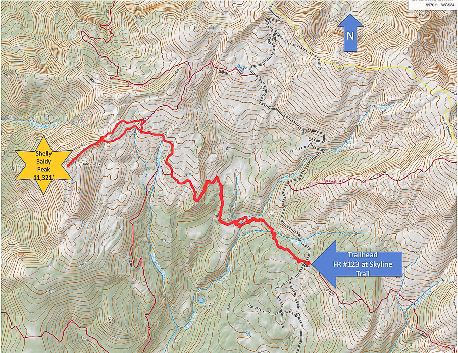 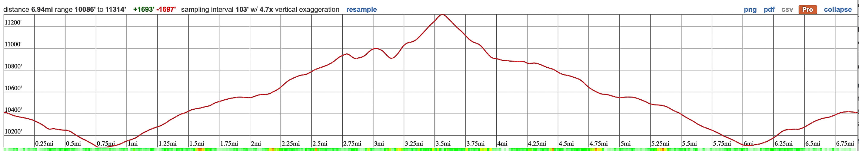 Topo Map and profile for Shelly Baldy Peak accessed from Big John Flat/Skyline Trail trailhead. (Thank-you Caltopo). The Tushars: Ouiet, High, and Beautiful We keep returning to the less-traveled Tushars because of the forest, wildflowers, the variety of peaks to hike and the spectacular ridge scenery. And it's so green! We previously hiked Delano Peak, and a loop including Delano and Mt. Holly where we shared the mountain with the mountain goats. Copper Belt Peak was our original plan this trip, accessed along a beautiful ridgeline in the central Tushars, but we were blocked by a gate on the access road. We found out from a guy doing trail maintenance after finishing Shelly Baldy that there was still a snow slide blocking the road. Last winter (2022-23) saw record-breaking snowfalls in southern Utah. It's believed that Tushar came from the Southern Paiute word "T-shar", meaning "white". Mt. Belknap and Mt. Baldy, two of its highest volcanic-rock summits gleam white from a distance. Shelly Baldy is a fun peak and a not-too-difficult way to get stunning views of Belknap, Baldy and Delano. The hike is a combination of high-country creeks and waterfalls, meadows and forest, tundra and talus, and many wildflowers this July. The route is straightforward: you hike the Blue Lake Trail to its closest point near Shelly Baldy's northeast ridge and jump off to head cross-country towards it, having to negotiate a large talus field before embarking on a straight-up route on its ridge. It's a short climb on stable talus - not exposed - to the summit cairn, sign and mailbox that acts as a summit register. That night we stayed in the Mahogany Cove Campground, camping out of the back of our truck. We had driven up Forest Road 123 toward the trailhead the day before, but found all of the camping areas filled with RV's. The 275-mile Paiute ATV Trail, a network of trails and dirt roads runs through the Tushars. It ties together historic mining and native American sites, Mormon heritage sites, state parks and National Forests. Copper Belt Peak is still on our list. If we can't access it from Beaver, we can hopefully get to it from Marysvale, to the east. Comfort Kills In my Crossfit "box" (term affectionately used by Crossfitters to describe their gym which contains barbells, racks, rowers, jump ropes, kettlebells, etc.), a photo shows two athletes wearing shirts with the words "Comfort Kills." Intrigued, I read up on this "attitude." Forceful words, but they are true. We must go beyond our limits, our comfort zone. Going beyond what we think we can withstand, taking on risks in order to grow. "Our goal should not be to constantly remain in a sheltered place. Rather, in all circumstances have the ability to find solace." --Savage Gentleman website. I will keep on reminding myself. Growth and change happens in the extremes - Never Stop Climbing Mountains! 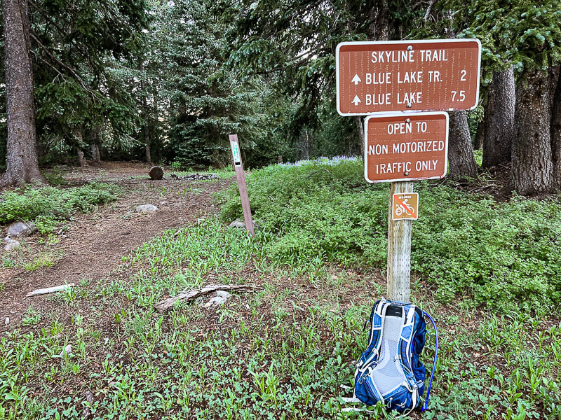 Skyline/Big John Flat Trailhead just on FR 123. Some cool stuff on the trail. 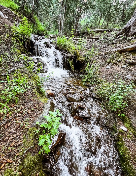 Griffith Creek near trailhead. 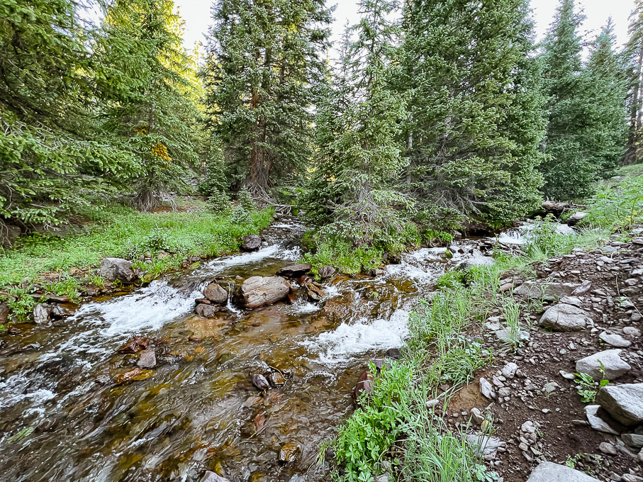 Poison Creek - cold water and a bit tricky to cross!  On the Skyline Trail walking out of the forest into higher meadows. 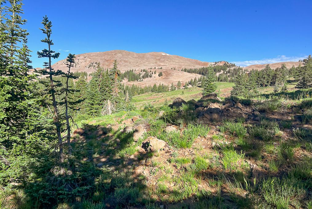 Still on Skyline: first view of Shelly Baldy Peak with the two small snow patches near its summit. 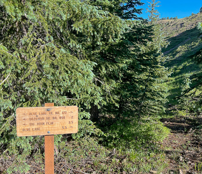 Intersection of Skyline Trail with Blue Lake Trail. From here we headed north (right) onto Blue Lake Trail. 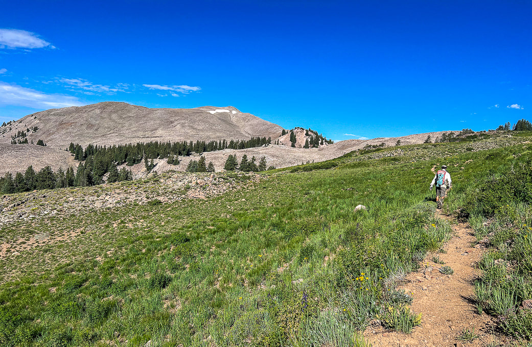 Blue Lake Trail: finding a point closest to Shelly Baldy's (peak with snow on it) ridge on the right. 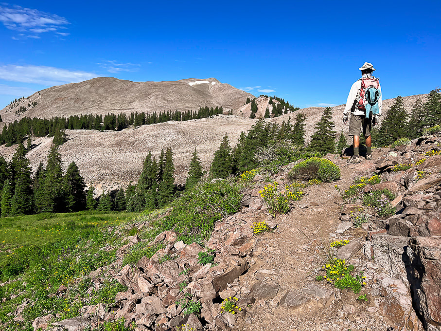 Looking for the best cut-off point from Blue Lake Trail. 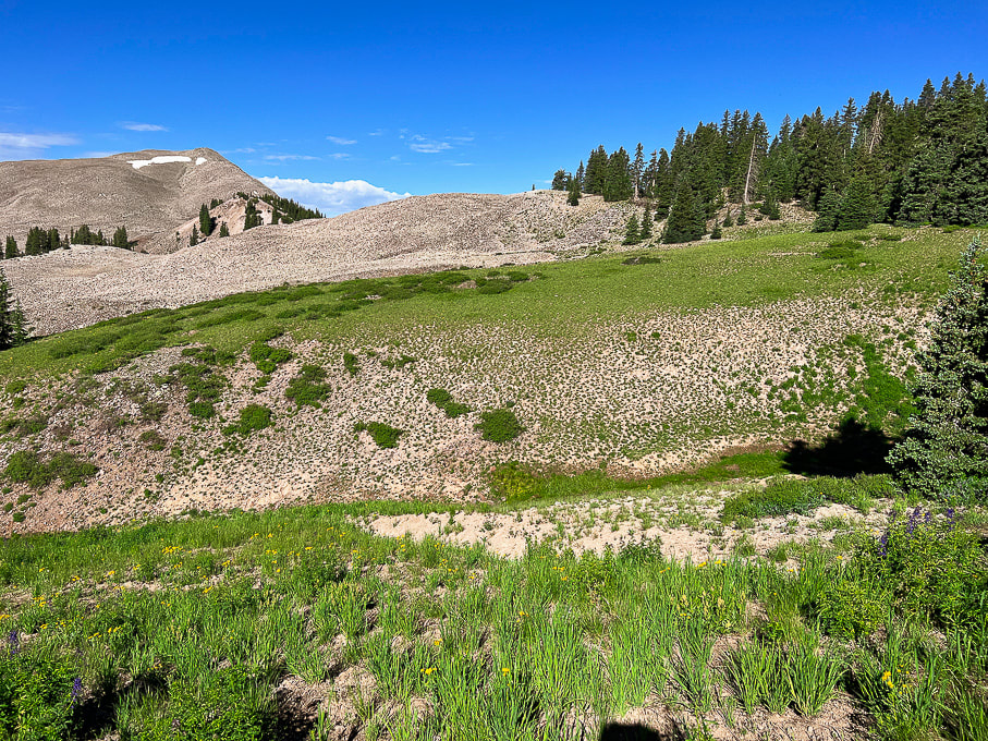 Looks like we found it. There's that big mound of talus to get over before heading up Shelly Baldy's northeast ridge. I think you could continue ascending Blue Lake Trail a little further and get off the trail to walk through the forest on the right and avoid so much of the talus. 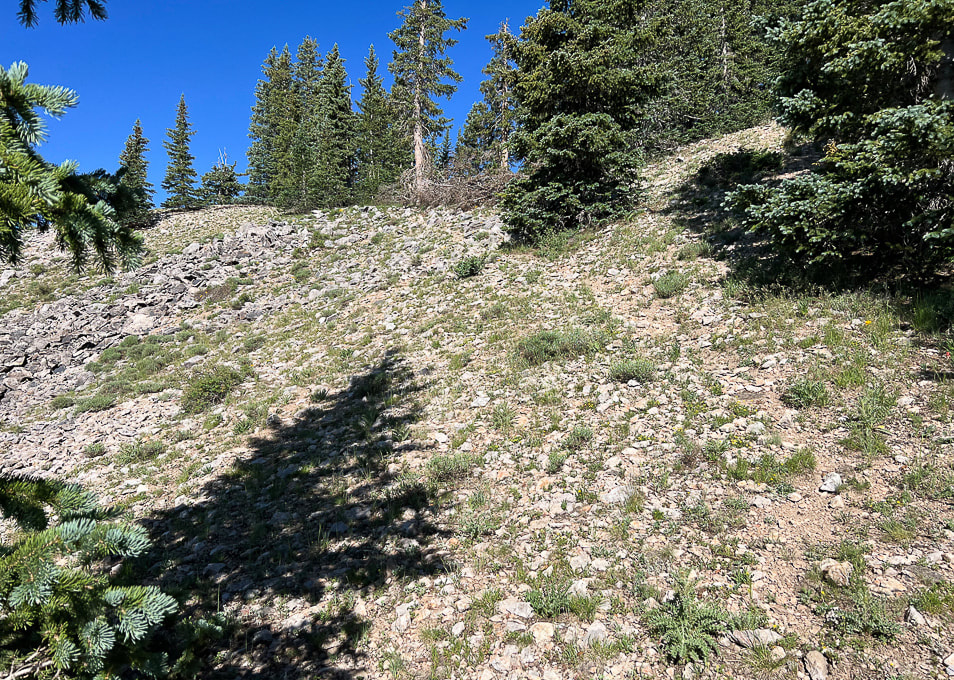 Faint trail through edge of forest. 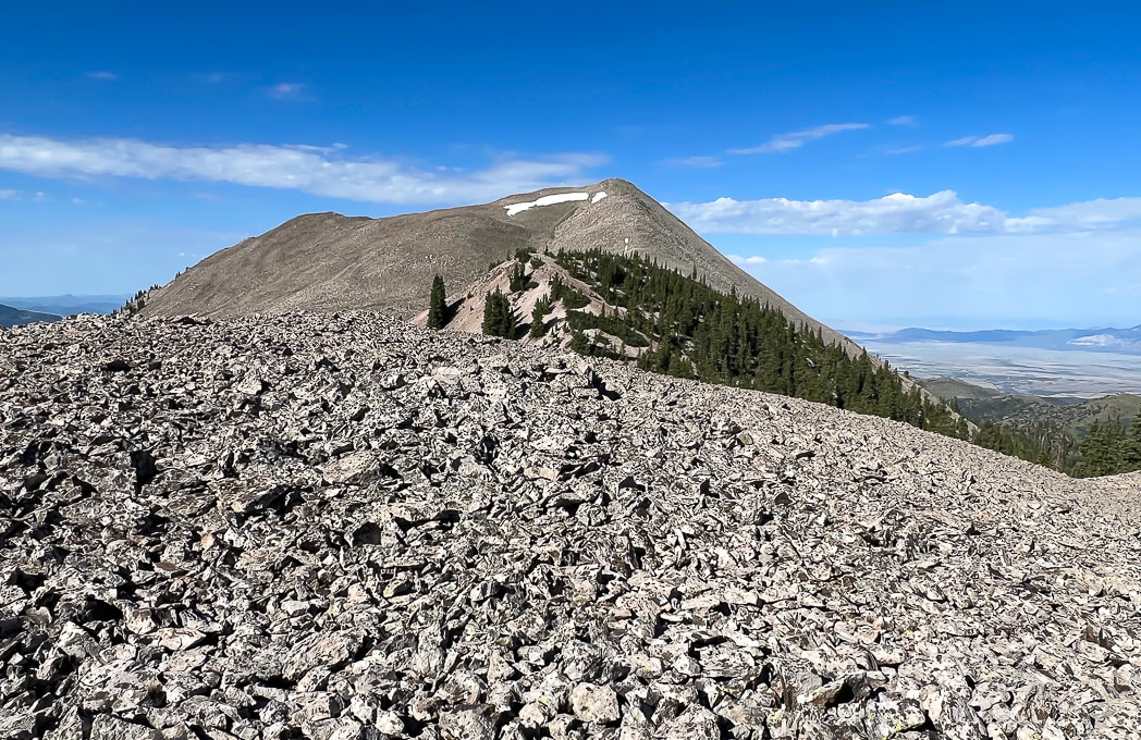 Hill of talus before reaching ridge.  Wow! Pink!!  Finally on steep, slippery ridge. Fred upper center. 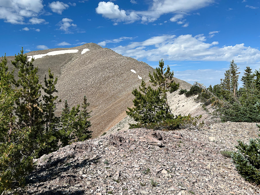 Pretty straightforward!! 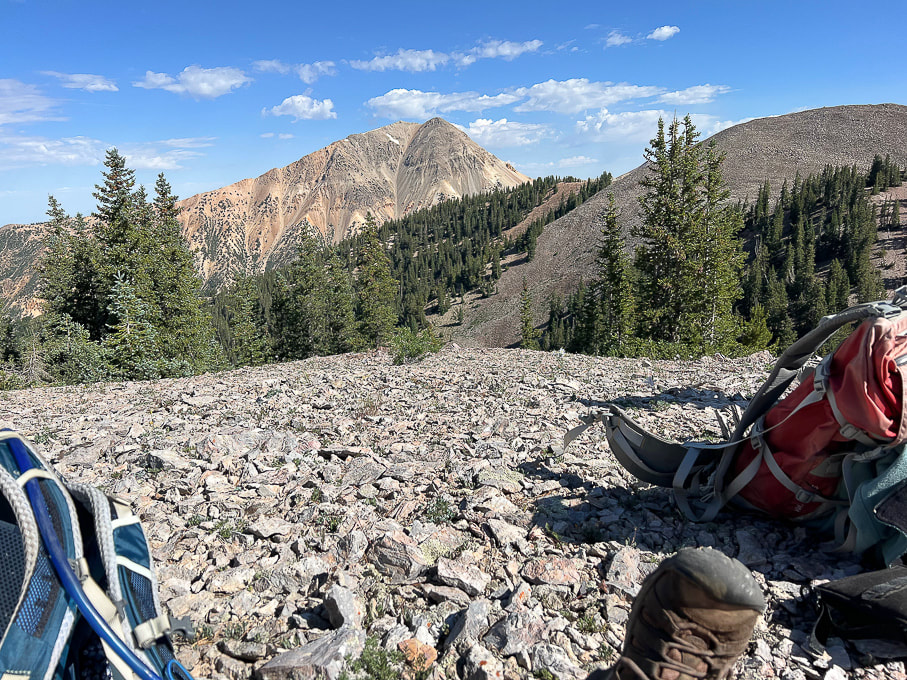 Mid-way up ridge looking at Mount Baldy, Tushar's third highest peak at 12,122'.
 At Shelly Baldy summit. Piece of cake! 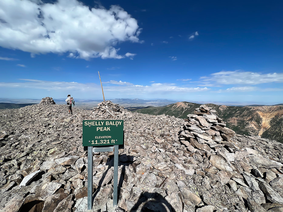 Looking west toward Mineral Mountains north of Beaver, Utah. 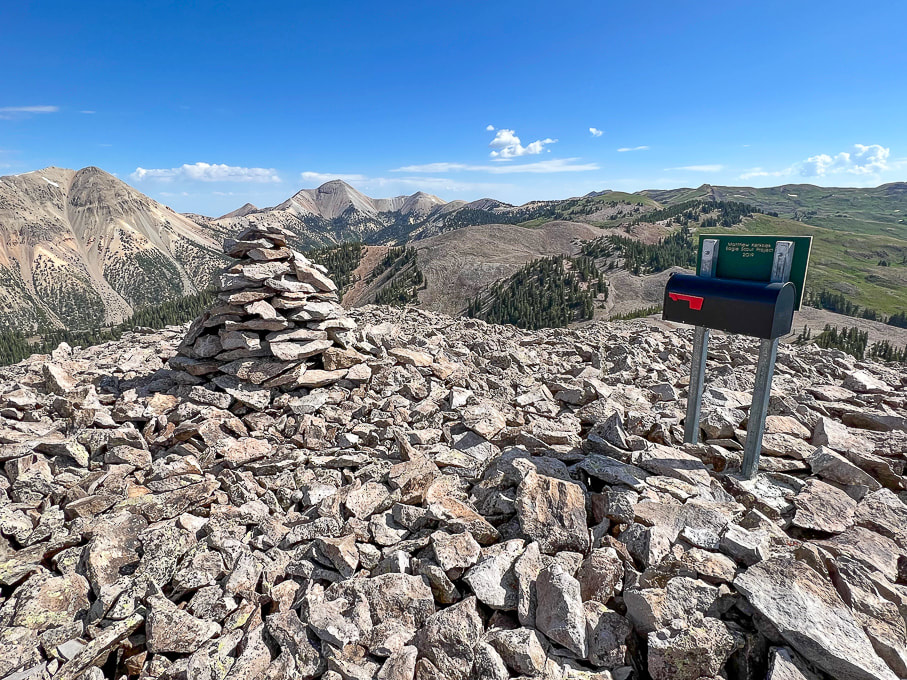 On summit: Mount Baldy (left) and Mount Belknap (right). You can see why "Tushar" may have come from "T-shar," the Southern Paiutes' word for "white." 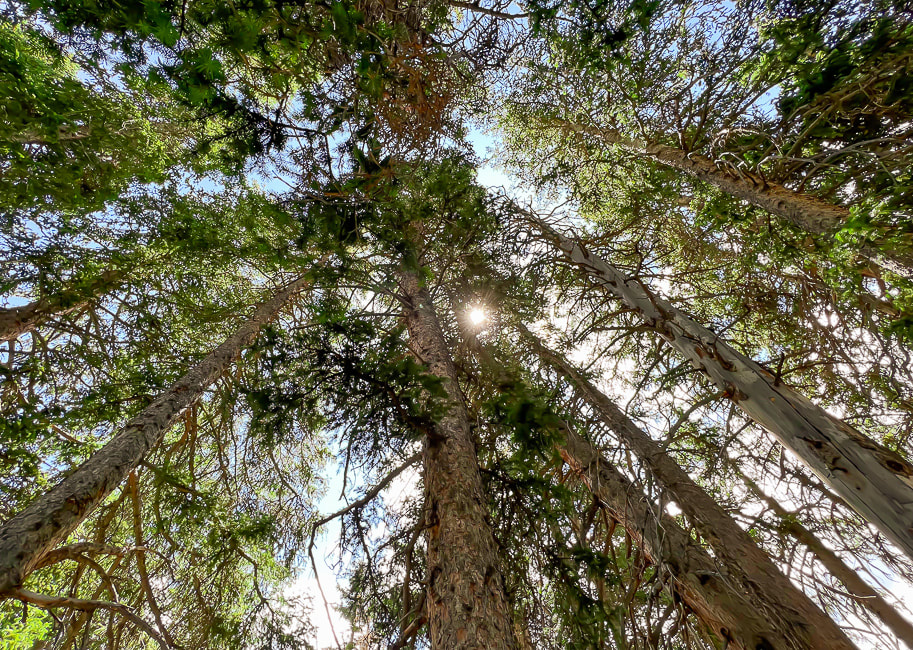  Never tire of this beautiful forest. Reference
Cunningham, C.G, et. al. 1983. Geologic map of the Tushar Mountains and adjoining areas, Marysvale volcanic field, Utah. |
Categories
All
Sue and Fred
About this blogExploration documentaries – "explorumentaries" list trip stats and highlights of each hike or bike ride, often with some interesting history or geology. Years ago, I wrote these for friends and family to let them know what my husband, Fred and I were up to on weekends, and also to showcase the incredible land of the west.
To Subscribe to Explorumentary adventure blog and receive new posts by email: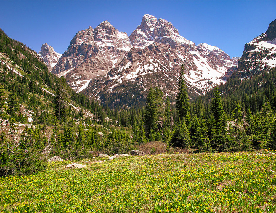
Happy Spring!
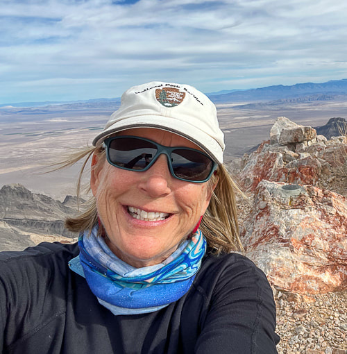
About the Author
|